Products
Explore market-ready mobility solutions across diverse needs and areas. Discover innovations proven to positively impact global smart cities.

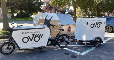
CautCurier
A same-day B2B urban logistics platform that enables companies to…
Find out more...about CautCurier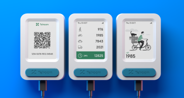
Telraam
A citizen-deployed IoT traffic monitoring solution: window-mounted…
Find out more...about Telraam
Bikekey: Circular Bike Registry
Digital bike registry for insurers and cities that enables verified…
Find out more...about Bikekey: Circular Bike Registry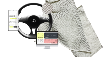
FabenodeIoT: Stress & Drowsiness Detection
FabenodeIoT is a smart-textile steering wheel cover that monitors…
Find out more...about FabenodeIoT: Stress & Drowsiness Detection
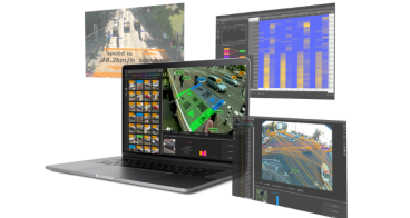
AI-powered traffic monitoring solution via Drones
An innovative approach that enables the simultaneous observation of…
Find out more...about AI-powered traffic monitoring solution via Drones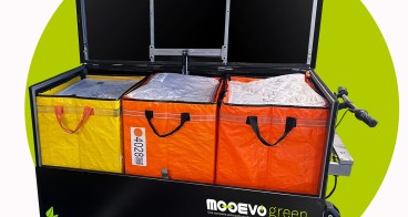
Mooevo e-Walker
Flexible electric transport and delivery cart designed for…
Find out more...about Mooevo e-Walker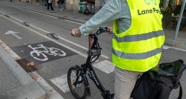
Lane Patrol
A state-of-the-art tool enhancing urban mobility through innovative…
Find out more...about Lane Patrol
SCADA-Hypervision
All-in-one digital solution to maximise the economic viability of…
Find out more...about SCADA-Hypervision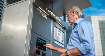
ELLA CombiStation
The solution enables on-demand battery swapping for LEVs and parcel…
Find out more...about ELLA CombiStation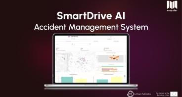
SmartDrive AI
A digital solution that streamlines accident reporting and analysis…
Find out more...about SmartDrive AI
SurplusMap - Planning EV charging infrastructure
SurplusMap helps you find the best place to build EV charging…
Find out more...about SurplusMap - Planning EV charging infrastructure
STACK: The next generation (MaaS) solution
All-in-one white-label Mobility as a Service (MaaS) app enables…
Find out more...about STACK: The next generation (MaaS) solution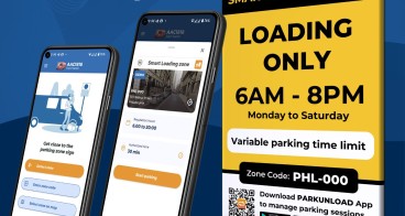
Parkunload: Smart Loading Zones
Parkunload enables the digital transformation of loading and delivery…
Find out more...about Parkunload: Smart Loading Zones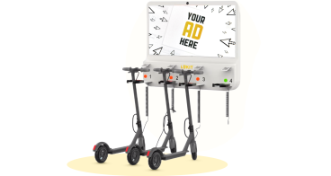
Lokit Wallbox: Micro-mobility docking station
Unlock urban mobility with Lokit Wallbox – the smart, sustainable…
Find out more...about Lokit Wallbox: Micro-mobility docking station
Nommon Mobility Insights: Origin-destination data collection
Nommon Mobility Insights provides accurate, up-to-date and complete…
Find out more...about Nommon Mobility Insights: Origin-destination data collection
NielsenConcept's all inclusive, individual and collective bike selection
Fleets of electric bikes designed to meet all the needs and everyday…
Find out more...about NielsenConcept's all inclusive, individual and collective bike selection
MIOO: Ready to ride assembly service for bike e-commerce
Online bike resellers can partner up with MIOO and offer a…
Find out more...about MIOO: Ready to ride assembly service for bike e-commerce
EVIO: Electric Vehicle Ecosystem Management Platform
EVIO is addressing not attended needs in the market through enabling…
Find out more...about EVIO: Electric Vehicle Ecosystem Management Platform
BUDDY Service: urban support & accessible travel services
A One-stop-shop that facilitates information and booking of required…
Find out more...about BUDDY Service: urban support & accessible travel services
Bia Optimised EV Charging
The Bia platform can easily connect to all types of charging…
Find out more...about Bia Optimised EV Charging
MOSA Intelligent Cycle Parking Hubs and Management Solutions
MOSA's smart solution is 70% cheaper, saves space owners time by…
Find out more...about MOSA Intelligent Cycle Parking Hubs and Management Solutions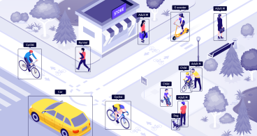
FYMA: Unlock data from your video feeds
Costumers can unlock the full potential of their commercial real…
Find out more...about FYMA: Unlock data from your video feeds
Scootable: Micromobility platform for scooters, e-bikes, e-cars
Do not worry about complexity of software and mobile apps, just focus…
Find out more...about Scootable: Micromobility platform for scooters, e-bikes, e-cars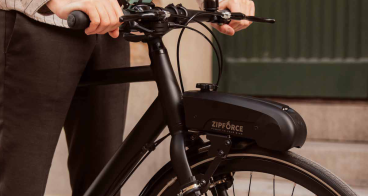
Zipforce Slim - eBike kit
Zipforce is a portable and light, easy-to-assemble electric motor…
Find out more...about Zipforce Slim - eBike kit
Zipforce Distance - eBike kit
Zipforce is a portable and light, easy-to-assemble electric motor…
Find out more...about Zipforce Distance - eBike kit
Smart Nudges Mobility
A cost-efficient tool that uses timely nudges, grounded in…
Find out more...about Smart Nudges Mobility
Elonroad: Electric road system
Electric roads extend driving range and reduce the need of large and…
Find out more...about Elonroad: Electric road system
Nemi: demand-responsive transport
Nemi makes public transport in low-density areas feasible by…
Find out more...about Nemi: demand-responsive transport
Asistobe PROGNOSIS: AI/ML algorithms to predict the future transport demand
Get AI-based automated predictions about the next period’s ridership…
Find out more...about Asistobe PROGNOSIS: AI/ML algorithms to predict the future transport demand
geoFluxus: Transparency platform for urban goods and waste flows
geoFluxus helps costumers to find better alternatives for their…
Find out more...about geoFluxus: Transparency platform for urban goods and waste flows
ModelMe3D: Immersive Co-Design of Public Spaces
ModelMe3D is the only co-design platform in the world where costumers…
Find out more...about ModelMe3D: Immersive Co-Design of Public Spaces
Greenroads
AI traffic video analytics tool for liveable and smart cities…
Find out more...about Greenroads
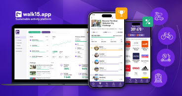
Walk15.app: Sustainable activity platform
Walk15.app Sustainable Activity Platform and Step Wallet helps…
Find out more...about Walk15.app: Sustainable activity platform
SEADS Blue Barriers: Collect & Upcycle river plastic waste
SEADS Blue Barriers - Cleaning rivers, protecting oceans!
Find out more...about SEADS Blue Barriers: Collect & Upcycle river plastic waste
VePa: Vertical Parking
VePa provides the most space-efficient and sustainable parking…
Find out more...about VePa: Vertical Parking
VEOMO: Mobility Monitor
With real time data of local mobility options highlighted and easily…
Find out more...about VEOMO: Mobility Monitor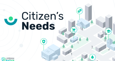
Citizen's Needs by Urban Radar
Proximity based urban planning and 15-min city to meet citizen's…
Find out more...about Citizen's Needs by Urban Radar
Data Flow by fluctuo
Visibility for shared mobility operators, simplicity for MaaS…
Find out more...about Data Flow by fluctuo
Everimpact: Carbon emissions measurement and reporting platform
Everimpact helps cities measure, reduce and monetise their carbon…
Find out more...about Everimpact: Carbon emissions measurement and reporting platform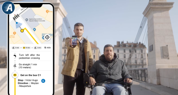
ANDYAMO: Multimodal route planner adapted to people with reduced mobility
Andyamo helps users develop alternative solutions to private cars,…
Find out more...about ANDYAMO: Multimodal route planner adapted to people with reduced mobility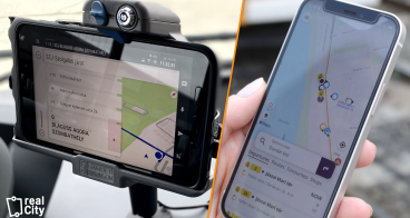
realCity
Cloud-based, intelligent traffic systems for drivers, dispatchers and…
Find out more...about realCity
Mosaic: Mobile Street Mapping Service
Mosaic’s Mobile Street Mapping Service gathers large amounts of…
Find out more...about Mosaic: Mobile Street Mapping Service
BRUNTOR
The small electric vehicle that transforms urban deliveries and…
Find out more...about BRUNTOR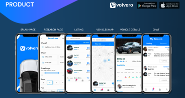
Volvero: Vehicle sharing platform
Volvero creates a system in which whoever has a car, motorcycle or…
Find out more...about Volvero: Vehicle sharing platform
Parkly: Modular urban furniture
Parkly's multifunctional and modular urban furniture helps to…
Find out more...about Parkly: Modular urban furniture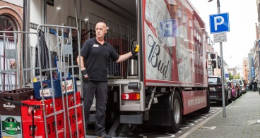
Smart Zones: Digital and bookable curbside spaces
Coding the Curbs provide cities with "Smart Zones" –…
Find out more...about Smart Zones: Digital and bookable curbside spaces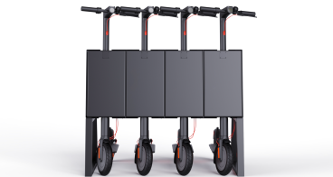
Trap: Urban parking docks for scooters
Trap is a parking station with an electric charging system - designed…
Find out more...about Trap: Urban parking docks for scooters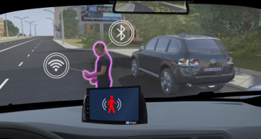
SpotBeam: V2X for Safer Mobility
To improve pedestrian's safety and traffic control by leveraging…
Find out more...about SpotBeam: V2X for Safer Mobility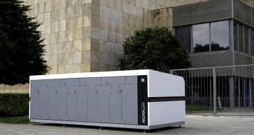
NOVALITY: Smart parking solutions
Secure parking stations for bicycles and scooters responding to the…
Find out more...about NOVALITY: Smart parking solutions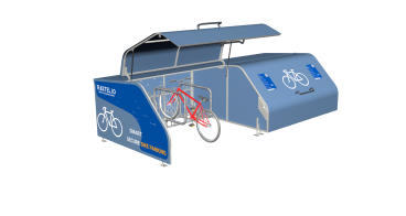
Rastel.io
A modular, smart and secure bike shelter, accessible through a mobile…
Find out more...about Rastel.io
HOPU: Environmental data analysis & visualisation
Hopu’s SaaS is an evidence-based air quality solution with high…
Find out more...about HOPU: Environmental data analysis & visualisation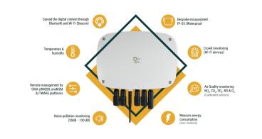
Smart Spot
IoT device for environmental parameter sensoring. The inclusion of…
Find out more...about Smart Spot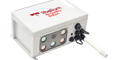
Libelium Air Quality Station
The Air Quality Station will allow your city to monitor key pollution…
Find out more...about Libelium Air Quality Station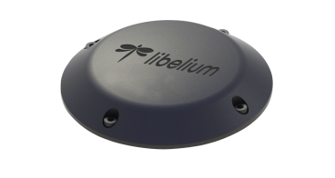
Libelium Smart Parking Sensor
Dual detection technology for 99% accuracy in identifying parking…
Find out more...about Libelium Smart Parking Sensor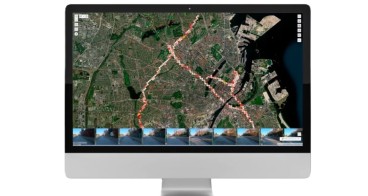
ROAD System
The solution combines AI and human-driven data collection to…
Find out more...about ROAD System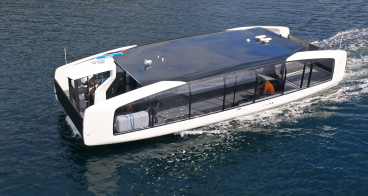
Hyke: Smart City Shuttle
Hyke’s mission is to provide cities with a mobility and…
Find out more...about Hyke: Smart City Shuttle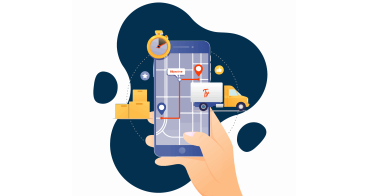
Tymap: A real-time delivery and fleet tracking platform
The delivery solution that saves money and time.
Find out more...about Tymap: A real-time delivery and fleet tracking platform
Bikademy: rewarding cycling mobility and tourism
Bikademy encourages people to cycle every day, to visit cultural and…
Find out more...about Bikademy: rewarding cycling mobility and tourism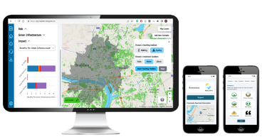
BGI Builder for climate resilient cities
For urban risk managers, BitaGreen provides data, models and…
Find out more...about BGI Builder for climate resilient cities
Mapalyse: Public Participation GIS Tool
Increase citizen engagement by collecting public opinions to…
Find out more...about Mapalyse: Public Participation GIS Tool
MaaS Solution
Meep is an urban mobility platform that integrates all modes of…
Find out more...about MaaS Solution
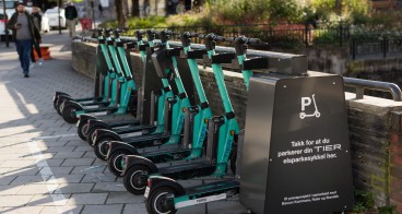
Luna: safer micromobility
Provides irrefutable visual proof of real-time location of e-scooters…
Find out more...about Luna: safer micromobility
Bicihangar Rocket: Secure bike & scooter parking
Bicihangar Rocket is a unique solution to accelerate the change…
Find out more...about Bicihangar Rocket: Secure bike & scooter parking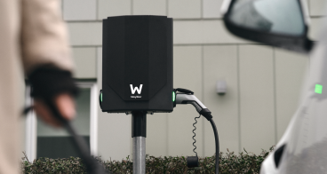
Waybler Charging Solution
More EV car charging on the same power.
Find out more...about Waybler Charging Solution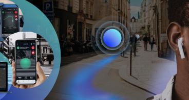
waveOut audio navigation
The platform for audio augmented reality navigation, waveOut brings a…
Find out more...about waveOut audio navigation
IPA2X - Intelligent pedestrian assistant
IPA2X is built to help children, the elderly, and people with…
Find out more...about IPA2X - Intelligent pedestrian assistant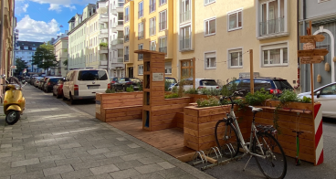
SET: Street Experiments Tool
SET helps to implement street experiments (quick and low-cost…
Find out more...about SET: Street Experiments Tool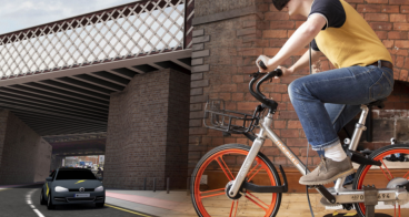
RAPID: 3D Prototyping
Early prototyping of mobility infrastructure changes, along with…
Find out more...about RAPID: 3D Prototyping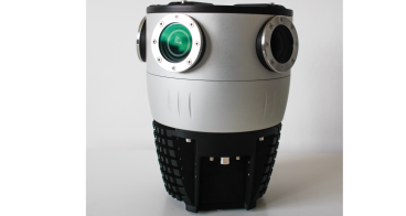
Mosaic X: 360º camera for 3D modelling and mapping
Mosaic X is a purposely-built, top quality mapping camera that allows…
Find out more...about Mosaic X: 360º camera for 3D modelling and mapping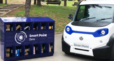
Smart Point: Reducing delivery vans in cities.
Smart Point designs zero emission delivery networks for smart cities…
Find out more...about Smart Point: Reducing delivery vans in cities.
NIMBEE: Mobile Charging Stations
Nimbee’s vision? More electric cars in the city with less charging…
Find out more...about NIMBEE: Mobile Charging Stations
Remote Sensing Device
The most advanced, widely used and verified sensor in the world to…
Find out more...about Remote Sensing Device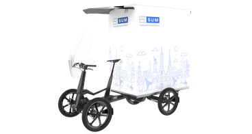
SUM-X: Cargo eBike
SUM-X is ONE LESS VAN's solution for sustainable last mile…
Find out more...about SUM-X: Cargo eBike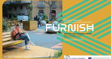
FURNISH
By enabling efficient and effective transformations of outdoor urban…
Find out more...about FURNISH
Replan.City
Cloud-based SaaS platform that creates a digital twin of a city'…
Find out more...about Replan.City
PANTOhealth Monitoring
AI-powered SaaS platform with onboard sensors and video that detects…
Find out more...about PANTOhealth Monitoring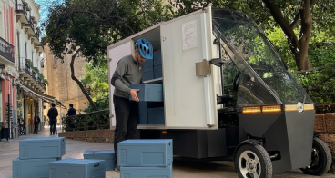
Greenø
Qualified thermal system for 100% traceable reverse logistics. Ideal…
Find out more...about Greenø
Chat&Go with MARIA
An end-to-end solution that combines WhatsApp ticketing (Chat&Go®…
Find out more...about Chat&Go with MARIA
StreetNav
Inclusive navigation app that provides accessible routes tailored to…
Find out more...about StreetNav
StreetCo
Crowd and professional field reporting app that captures and…
Find out more...about StreetCo
Autonomous last-mile delivery with drone
More efficient, environmentally sustainable, and cheaper than current…
Find out more...about Autonomous last-mile delivery with drone
LoRaWAN parking sensors
A solution for parking and a dedicated Web App for parking officers…
Find out more...about LoRaWAN parking sensors
APIB Tictactrip
All-in-one rail and multimodal API booking for Online Travel Agencies…
Find out more...about APIB Tictactrip
HaulAI
The dispatching agent for waste collection fleets: automates tour…
Find out more...about HaulAI
Mobility Impact Module
Healthy Cities' Mobility Impact Module: an evidence-based online…
Find out more...about Mobility Impact Module
HYBA Battery pack
Modular, weldless battery system for light electric mobility,…
Find out more...about HYBA Battery pack
V-Locker Bike Tower
The modular solution for modern bicycle parking
Find out more...about V-Locker Bike Tower
eTRAC: Rail Cleanliness Intelligence
eTRAC is an AI-powered platform for real-time external train…
Find out more...about eTRAC: Rail Cleanliness Intelligence
Curbsync
Road permit smart management platform. Save 70% of the time spent to…
Find out more...about Curbsync
Traffic Inventory, Lines, Defects Detection, Mapping & Analysis
An AI-driven road inspection and digital mapping platform that…
Find out more...about Traffic Inventory, Lines, Defects Detection, Mapping & Analysis
Transcality: OPERATE
Web-based tool for real-time monitoring, forecasting and incident…
Find out more...about Transcality: OPERATE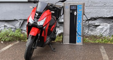
UltraChargers
Fleet-grade fast-charging nodes and OEM vehicle integration for light…
Find out more...about UltraChargers
EZlines
A turnkey e-scooter sharing platform that enables partners to launch,…
Find out more...about EZlines
Kale AI
AI-powered platform scaling cargo bike logistics operations across…
Find out more...about Kale AI
S’Harmony
Smart road safety at bus stops. Protects vulnerable users. Promotes…
Find out more...about S’Harmony
GreenRipple
Multimodal disruption tracker using AI to trace root causes of…
Find out more...about GreenRipple
NanoHubZone
Turnkey, modular nano-hub zones for urban logistics: secure…
Find out more...about NanoHubZone
Urban Radar: LogE-Hubs
LogE-Hubs is a web-based decision-support platform for cities that…
Find out more...about Urban Radar: LogE-Hubs
Vortex Air Quality Monitoring System
Vortex IoT provides smart sensing and data solutions that help cities…
Find out more...about Vortex Air Quality Monitoring System
Luxene
A fiber-optic road guidance lighting system integrated into road…
Find out more...about Luxene
Verdilo
Autonomous, privacy-by-design pedestrian and cyclist counting…
Find out more...about Verdilo
Routal Drivers
A mobile-first solution for delivery drivers that simplifies route…
Find out more...about Routal Drivers
CrowdFlowX
A plug-and-play hardware sensor for Public Transport that tracks real…
Find out more...about CrowdFlowX
Asistobe Public Transport Attractiveness Index
Cloud-based mobility analytics platform that replaces expensive…
Find out more...about Asistobe Public Transport Attractiveness Index

Bus Data Platform
AI bus operations platform using real-time GTFS/AVL and onboard…
Find out more...about Bus Data Platform
Holoscene
Mobile reality capture for cities. Make city infrastructure decisions…
Find out more...about Holoscene
ACTIA SOH Fleet
Independent SaaS for electric bus fleets providing real-time battery…
Find out more...about ACTIA SOH Fleet

Diana GreenConnect
An intelligent mobility concierge that builds trust by ensuring…
Find out more...about Diana GreenConnect

Commutifi
Global employers use - Commute Capital Management - software and…
Find out more...about Commutifi
Bikewave: bike rental app
A digital marketplace that connects travellers with professional bike…
Find out more...about Bikewave: bike rental app
SonoBeacon
SonoBeacon provides a privacy-compliant Motion Data Intelligence…
Find out more...about SonoBeacon
MIOO LifeCycle
A digital service that shows how technology and collaboration can…
Find out more...about MIOO LifeCycle
CiiM: Connected Intelligent Infrastructure Monitoring
A GDPR-compliant, 3D LiDAR and AI monitoring platform that measures…
Find out more...about CiiM: Connected Intelligent Infrastructure Monitoring
Illuminated Platform Edge
SIUT’s Illuminated Platform Edge combines smart lighting technology…
Find out more...about Illuminated Platform Edge
Digital Noon Reports: fleet analytics
A zero‑installation maritime analytics platform that converts routine…
Find out more...about Digital Noon Reports: fleet analytics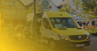
DIY Bus and Shuttle
Create and manage your own demand-responsive shuttle and bus services…
Find out more...about DIY Bus and Shuttle
Karos: Daily Carpooling App
Karos is a daily carpooling solution that connects employees for…
Find out more...about Karos: Daily Carpooling App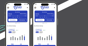
Liftshare for Work: carpooling app
Liftshare For Work is a product in the Mobilityways app and is the UK…
Find out more...about Liftshare for Work: carpooling app
Mobilityways App
The unified employee gateway to zero carbon commuting - a ground…
Find out more...about Mobilityways App
AIOne MapSmart
A smart route planning and fleet management platform that simplifies…
Find out more...about AIOne MapSmart
MDSI: Market Data Service International
Market intelligence software platform for the cycle industry
Find out more...about MDSI: Market Data Service International
Smart Information Totem
An AI-powered solar totem that monitors pedestrian, cyclist, and…
Find out more...about Smart Information Totem
BOB: Four-wheeled bike
A safer and more comfortable mode of transport designed for use semi…
Find out more...about BOB: Four-wheeled bike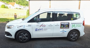
DIY On Demand
Match Rider’s on-demand mobility solution empowers communities with…
Find out more...about DIY On Demand
DIY Ridesharing
Match Rider’s DIY Ridesharing makes carpooling easy and reliable with…
Find out more...about DIY Ridesharing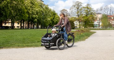
Livelo #2 family bike
The fast, safe and fun family cargo bike
Find out more...about Livelo #2 family bike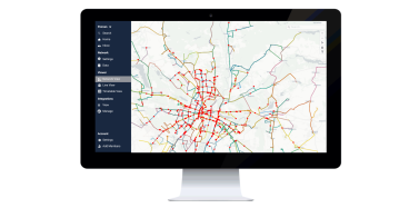
ReRoute
ReRoute empowers public transit agencies to detect disruptions…
Find out more...about ReRoute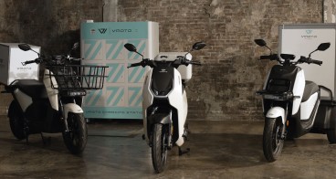
Vmoto: Fleet Solution
Comprehensive Electric Mobility Solution Vmoto offers a full-scale…
Find out more...about Vmoto: Fleet Solution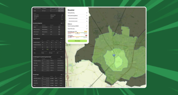
Parkyria AI: AI optimised parking and mobility planning
Data-driven parking policy optimisation for sustainable urban mobility
Find out more...about Parkyria AI: AI optimised parking and mobility planning
MUBE: Carpooling app
Shared short-distance rides for your daily commute
Find out more...about MUBE: Carpooling app
H2LLO Connect: green refuelling & recharging network
H2LLO Connect is accelerating the green transition in road transport…
Find out more...about H2LLO Connect: green refuelling & recharging network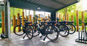
TILER wireless bike charging
With TILER, charging your e-bike is as simple as parking it. Our…
Find out more...about TILER wireless bike charging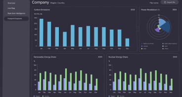
Emissium: SmartCharge Optimizer
SmartCharge Optimizer is a data-driven EV charging software that…
Find out more...about Emissium: SmartCharge Optimizer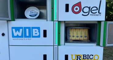
GEL Proximity: the Operating System for Out-Of-Home Logistics
A carrier-agnostic logistics orchestration platform coordinating…
Find out more...about GEL Proximity: the Operating System for Out-Of-Home Logistics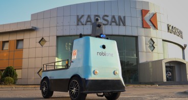
Robione: Smart autonomous logistics robots
Robione is built for seamless indoor and outdoor operations, with…
Find out more...about Robione: Smart autonomous logistics robots
Compass IoT
Connected vehicle data for improved, safe, and efficient mobility…
Find out more...about Compass IoT
STELION Powertrain
A clean, silent and autonomous hydrogen-powered cooling system for…
Find out more...about STELION Powertrain

Neutral Phase Protection Relay
A solution that safeguards electrical equipment from neutral line…
Find out more...about Neutral Phase Protection Relay
Phase Compensation Module (PCM)
A solution that ensures uninterrupted operation of single-phase…
Find out more...about Phase Compensation Module (PCM)

LendoCare
A seamless digital solution for accessing accessibility equipment.
Find out more...about LendoCare
Routal
A SaaS solution that optimises last-mile delivery with smart route…
Find out more...about Routal
FlexEV
An innovative energy flexibility platform that addresses the need for…
Find out more...about FlexEV
FLX: Smart Speed Reducer
The intelligent asphalt speed limiter FLX-SSR is a revolutionary…
Find out more...about FLX: Smart Speed Reducer
MoboKey
A tool that enables rental car companies to manage, secure, and share…
Find out more...about MoboKey
Velosafe: Track & Protect IoT module
An integrated e-bike security system combining IoT tracking…
Find out more...about Velosafe: Track & Protect IoT module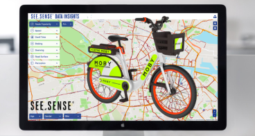
See.Sense AI Spinovation Dashboard
A tool that transforms cycling with intelligent, data-driven…
Find out more...about See.Sense AI Spinovation Dashboard
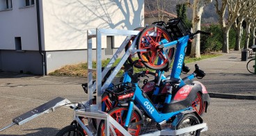
Micro Cargo RPV X5
The innovative bike trailer that easily transports up to 5 bikes with…
Find out more...about Micro Cargo RPV X5
Kentyou Mobility
A data-driven traffic monitoring system that empowers cities to…
Find out more...about Kentyou Mobility
STANDTRACK
A standard intermodal platform that allows the identification and…
Find out more...about STANDTRACK
METRUCKS DOER Cargo
A 4 wheeler, highly modular, adaptable cargo bike that is made to…
Find out more...about METRUCKS DOER Cargo
Transit Insights
The tool provides accurate, up-to-date indicators about public…
Find out more...about Transit Insights
Infrared City
AI-powered SaaS platform delivering rapid, high-accuracy…
Find out more...about Infrared City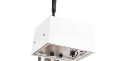
EMSOL Praxis Air Quality Monitor
An MCERTS-certified air quality monitoring device delivering high…
Find out more...about EMSOL Praxis Air Quality Monitor
Tyre wear capture device
Capturing tyre wear PM on commercial vans to improve air quality in…
Find out more...about Tyre wear capture device
Standab
A Charging-as-a-Service solution that improves operations and…
Find out more...about Standab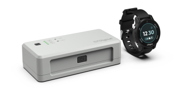
BaselineNC™: workplace fatigue monitoring wearable
The first real-time workplace fatigue monitoring wearable with 98%…
Find out more...about BaselineNC™: workplace fatigue monitoring wearable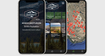
Konya Ekoturizm eco-mobility application
Application that allows calculating the carbon footprint produced by…
Find out more...about Konya Ekoturizm eco-mobility application
Roadscor
Roadscor is a risk-focused tool that enhances safety at intersections…
Find out more...about Roadscor
Persium Pod
Highly accurate IoT sensors specifically engineered for rail and…
Find out more...about Persium Pod
MOBIRE
Scalable, cost-effective battery repair and lifecycle tracking via…
Find out more...about MOBIRE
ParkCtrl
Parking management solution that uses real-time AI-powered cameras…
Find out more...about ParkCtrl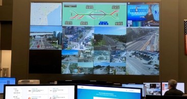
MOBITO Data Marketplace
A tool to access curated, best-in-class external mobility data across…
Find out more...about MOBITO Data Marketplace
MOBITO: anonymised vehicle data
It provides high-volume, high-quality, trajectory-level vehicle data…
Find out more...about MOBITO: anonymised vehicle data
All Aboard
Train ticket booking API. Grow your travel business with train…
Find out more...about All Aboard
MOVIS
A sustainable mobility system designed for pedestrians and cyclists,…
Find out more...about MOVIS
Eco Solutions Margherita
A compact, off-grid solar charging shelter designed for small urban…
Find out more...about Eco Solutions Margherita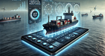
Remote Vibration Monitoring Kit
Gelectric’s Remote Vibration Monitoring Kit is an advanced solution…
Find out more...about Remote Vibration Monitoring Kit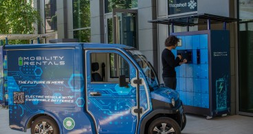
e-Mobility Rentals
Sustainable mobility solutions, delivering zero-emission electric…
Find out more...about e-Mobility Rentals
Smart Zone Enforcement Module
Data-driven enforcement of Smart Zones through real-time sensor…
Find out more...about Smart Zone Enforcement Module
Giravolta Mobility Platform
Unleash the power of shared and on-demand mobility for cities,…
Find out more...about Giravolta Mobility Platform
WOW! Urban Utopia: mobility and social hubs
WOW! transforms underutilised urban spaces into vibrant, sustainable,…
Find out more...about WOW! Urban Utopia: mobility and social hubs
LUCID
A platform that provides urban logistics and mobility operators with…
Find out more...about LUCID
Devonic former
The bike that evolves alongside your child from ages 2 to 6! It kicks…
Find out more...about Devonic former
Koiki
Sustainable and social transport with the primary goal to minimise…
Find out more...about Koiki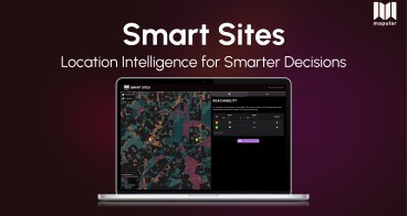
Smart Sites
A location intelligence platform that provides comprehensive insights…
Find out more...about Smart Sites
SeeingEye
SeeingEye: Empowering blind individuals to navigate freely with a…
Find out more...about SeeingEye
Tennders: the one-stop-solution for road freight transport
Costumers unlock their network potential and streamline freight…
Find out more...about Tennders: the one-stop-solution for road freight transport
Ecoplants
An eyecatching and highly efficient solar energy factory that follows…
Find out more...about Ecoplants
Bicycle, E-Bicycle, Kick e-scooter charging stations
Modern Bike and Kick E-Scooter docking stations used for safe parking…
Find out more...about Bicycle, E-Bicycle, Kick e-scooter charging stations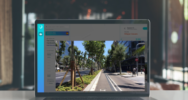
VeloVision
Boost cycling in cities through smart infrastructure assessment
Find out more...about VeloVision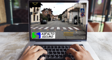
Asfalto Sicuro®
AI-driven monitoring system using GNSS, IMU and cameras to detect and…
Find out more...about Asfalto Sicuro®
Nivel Regulator - getting the best out of shared mobility
Nivel Regulator standardizes mobility services through digital…
Find out more...about Nivel Regulator - getting the best out of shared mobility
The Mobility Factory: Cooperative e-carsharing Platform
TMF offers modular e-carsharing for cooperatives, promoting…
Find out more...about The Mobility Factory: Cooperative e-carsharing Platform
DeepVolt Location Intelligence Assistant (DLIA)
DLIA helps cities and businesses identify optimal locations for EV…
Find out more...about DeepVolt Location Intelligence Assistant (DLIA)
AutonomyNow ADAS
Advanced Driver Assistance System (ADAS) for city buses and coaches…
Find out more...about AutonomyNow ADAS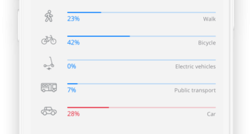
WeCity API Service
The APIs allow for a rigorous calculation of emitted end saved CO2 in…
Find out more...about WeCity API Service
Transcality: PLAN
Self-service traffic simulation platform to evaluate impact of road…
Find out more...about Transcality: PLAN
KINTO FLEX: Flexible Car Subscription Solution
Seamless and Smart Mobility Solutions: Flexible Car Subscription …
Find out more...about KINTO FLEX: Flexible Car Subscription Solution
SL Controller
The highest power output, wide range of setup possibilities and…
Find out more...about SL Controller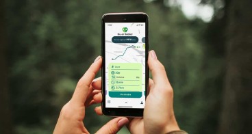
Kobla Moving Lab
Kobla Moving Lab lets citizens in a focus area easily collect their…
Find out more...about Kobla Moving Lab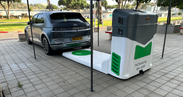
Nano-hub
Eco-friendly urban delivery hubs utilizing cargo bikes to streamline…
Find out more...about Nano-hub
Curb management and smart parking platform
Cut by 30% parking related traffic while improving the attractiveness…
Find out more...about Curb management and smart parking platform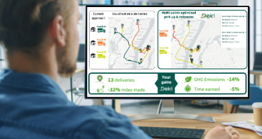
ratioX bicycle CVT gear system
Autonomous & durable gear system that fulfils the missing needs…
Find out more...about ratioX bicycle CVT gear system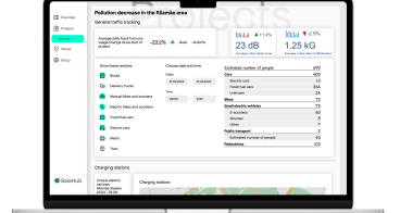
GaiaHub: Mobility Environmental Impact Monitoring Solution
High-precision license plate recognition smart city system that…
Find out more...about GaiaHub: Mobility Environmental Impact Monitoring Solution
1km à Pied: HR Software
Helping multi-site employers reduce their employees' commutes by…
Find out more...about 1km à Pied: HR Software
Ynstant: carpooling service
Enjoy carpooling at the best price to travel responsibly without…
Find out more...about Ynstant: carpooling service
WeRide.Today: Ride or Walk Safely in the City
WeRide.Today is all about users' safety commuting in urban…
Find out more...about WeRide.Today: Ride or Walk Safely in the City
AIPECRA
AI-driven vehicle-based system to automatically detect access to…
Find out more...about AIPECRA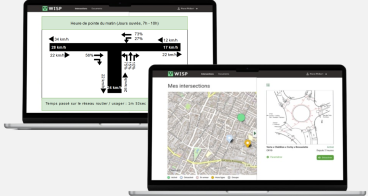
WISP Solutions
Enhance urban mobility with WISP Solutions intelligent traffic light…
Find out more...about WISP Solutions
DLIA for Cities
Optimize public EV charging infrastructure masterplan and accelerate…
Find out more...about DLIA for Cities
LINKA LEO 2 Pro Smart Lock: A Premium Bike Fleet Management Solution
The ultimate micromobility locking solution: guaranteed to increase…
Find out more...about LINKA LEO 2 Pro Smart Lock: A Premium Bike Fleet Management Solution
EASYRAILFREIGHT
EasyRailFreight matches supply and demand in intermodality,…
Find out more...about EASYRAILFREIGHT
Joyride Connected Mobility Platform
Connect, share and track electric vehicles, all on one complete fleet…
Find out more...about Joyride Connected Mobility Platform
HYIPTRAIN
Hydrogen retrofitted kit for diesel train conversion to hydrogen…
Find out more...about HYIPTRAIN
Cargofive
Cargofive transforms freight forwarding with APIs, ML, and RPA,…
Find out more...about Cargofive
Nabogo Carpooling
Platform for daily carpooling integrated with public transport
Find out more...about Nabogo Carpooling
Walking Talking: Team development app shaping healthy habits
Drive sustainable social well-being through Walking Talking's…
Find out more...about Walking Talking: Team development app shaping healthy habits
PANTOhealth: Overhead line predictive maintenance & simulation
Stay on track with PANTOhealth's reliable solutions, enabling…
Find out more...about PANTOhealth: Overhead line predictive maintenance & simulation
RETROLIGHT SYSTEM®
An interactive LED light-emitting road marking system enhancing…
Find out more...about RETROLIGHT SYSTEM®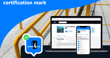
access4you®
International certification mark that certifies and qualifies the…
Find out more...about access4you®
Playground
Turning citizen engagement into actionable insights for smarter, more…
Find out more...about Playground
Cocoon Airbag Protection
Cocoon is a patented airbag protection system for bicycle child seats…
Find out more...about Cocoon Airbag Protection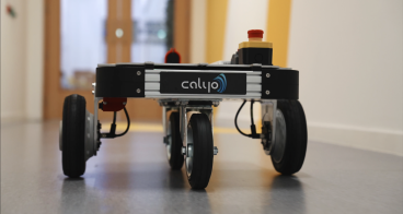
Calyo Pulse
Accurate, real-time, 3D spatial awareness. The most advanced air…
Find out more...about Calyo Pulse
EQHAWK - velomobile, cargo bike
Ecological 4-wheel hybrid bicycle, powered by human muscle and…
Find out more...about EQHAWK - velomobile, cargo bike
Electric Vehicle Fleet Management System - EVMS
Optimize Your EV Fleet Management & Operations with Make My Day…
Find out more...about Electric Vehicle Fleet Management System - EVMS
PLUG&META: Active Road Safety for infrastructure to prevent traffic accidents
Devices integrated into the road infrastructure that detect, signal…
Find out more...about PLUG&META: Active Road Safety for infrastructure to prevent traffic accidents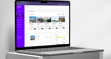
SQUAKE
SQUAKE: Precision carbon calculations and automated compensation for…
Find out more...about SQUAKE
BPARCO Mobility Arch
European first multifunctional micromobility parking solution
Find out more...about BPARCO Mobility Arch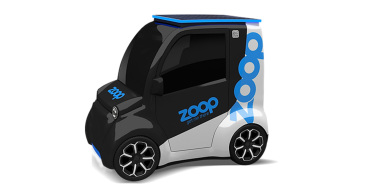
ZOOP - Solar micro car
The Zoop ecosystem of independent shared electric cars will…
Find out more...about ZOOP - Solar micro car
SWITCH: Mobility demand prediction platform
Revolutionise shared fleet distribution, operations and city planning…
Find out more...about SWITCH: Mobility demand prediction platform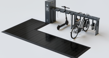
Solum Helios
A new generation of charging stations. Helios is a solar charging …
Find out more...about Solum Helios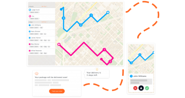
SmartMonkey Planner: Route optimiser for last-mile deliveries
SmartMonkey improves the delivery experience by reducing 90% of…
Find out more...about SmartMonkey Planner: Route optimiser for last-mile deliveries
Skycharge: drone charging infrastructure
Skycharge is building a network of charging stations tailored for…
Find out more...about Skycharge: drone charging infrastructure

SafeMode: Fleet driver engagement & incentive platform
Prevent 30% of accidents, lower fuel consumption and emissions by 5%…
Find out more...about SafeMode: Fleet driver engagement & incentive platform
QOOB Mobility HUB
QOOB provides the ultimate platform to manage micromobility in real…
Find out more...about QOOB Mobility HUB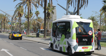
Pendel Mobility: Autonomous MaaS
Pendel Mobility offers autonomous transport solutions as a service…
Find out more...about Pendel Mobility: Autonomous MaaS
eParkio: p2p parking management
eParkio provides seamless parking with its automated parking…
Find out more...about eParkio: p2p parking management
Ottopia: Teleassistance and Teleoperation for AV
Ottopia enables OEM and AV makers to commercialize on their…
Find out more...about Ottopia: Teleassistance and Teleoperation for AV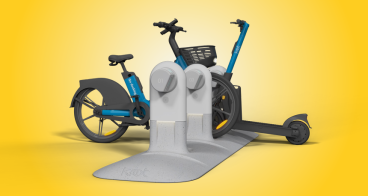
KNOT: Docking & charging stations for bikes and scooters
All-in-one docking and charging solution including stations, vehicles…
Find out more...about KNOT: Docking & charging stations for bikes and scooters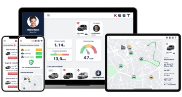
Keet: Digital LCV Fleet Manager
Keet allows SMEs to control their LCV fleet in real-time and…
Find out more...about Keet: Digital LCV Fleet Manager
Isarsoft Perception. Privacy compliant video analytics.
Isarsoft helps customers and partners to utilize the full potential…
Find out more...about Isarsoft Perception. Privacy compliant video analytics.
IMPARGO: Transport Management Platform
The easiest-to-use Transport Management Platform for road freight…
Find out more...about IMPARGO: Transport Management Platform
Hopper Mobility
Hopper is the enviromental friendly car alternative.
Find out more...about Hopper Mobility
Bout's water transport platform - Boat rides & cruises
Bout is a marketplace for boat rides & cruises. The application…
Find out more...about Bout's water transport platform - Boat rides & cruises
BLINK! Lighting Saddles
BLINK! Lighting Saddles awards cyclists & road users with a new…
Find out more...about BLINK! Lighting Saddles
Bia EV Data Services
Bia’s EV data service enables businesses and public bodies to improve…
Find out more...about Bia EV Data Services
Beev: Revolutionizing the electric car experience
Revolutionize the way users experience electric cars with Beev - the…
Find out more...about Beev: Revolutionizing the electric car experience
BAQME
BAQME is the first company globally to offer a free floating shared…
Find out more...about BAQME
Gotikket Booking Platform
The company empowers users to make informed environmental decisions,…
Find out more...about Gotikket Booking Platform
Newky: Digital Key of Mobility and Physical World
Newky converts a user's mobile phone into a digital key,…
Find out more...about Newky: Digital Key of Mobility and Physical World
dataJiro AI: People Counting Systems in Public Transportation
With accurate and instant passenger occupancy data, costumers can set…
Find out more...about dataJiro AI: People Counting Systems in Public Transportation
Jonna Recharged: refurbished e-bikes
Jonna is an end-to-end online marketplace for buying and selling…
Find out more...about Jonna Recharged: refurbished e-bikesCommuteSaver: CO2 emissions tracker for commuting
World’s first automated mobile CO2 emissions tracker for commuting.
Find out more...about CommuteSaver: CO2 emissions tracker for commuting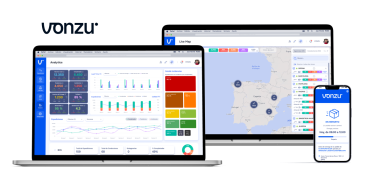
VONZU: Last-mile logistics management platform
Vonzu's purpose is to digitize the logistics sector & gives…
Find out more...about VONZU: Last-mile logistics management platform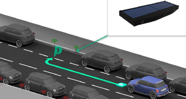
Flash Park: Outdoor IoT parking detection sensors
Flash Park monitors parking in non-delimited areas. The solution…
Find out more...about Flash Park: Outdoor IoT parking detection sensors
Meight: Transport Fleet Management
Meight is the most advanced carrier software to boost profitability,…
Find out more...about Meight: Transport Fleet Management
Urvis Business: Electric cargo bikes
Electric cargo bikes for last-mile logistics.
Find out more...about Urvis Business: Electric cargo bikes
ProperGate: Smart materials delivery for construction sites
ProperGate is a digital supply ecosystem that streamlines…
Find out more...about ProperGate: Smart materials delivery for construction sites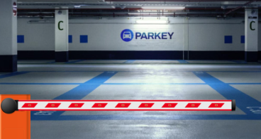
Parkey: B2B platform for flexible parking use
Parkey increases office parking lot utilization by allowing employees…
Find out more...about Parkey: B2B platform for flexible parking use
Whee! Cargobike subscription service
All inclusive cargo-bike subscription service. Costumers ride - Whee!…
Find out more...about Whee! Cargobike subscription service
Asistobe EXPLORE: Get insights about the entire public transport network
A visualisation tool for mobility patterns that helps cities…
Find out more...about Asistobe EXPLORE: Get insights about the entire public transport network
Asistobe OPTIMISE: Sustainable and cost-efficient public transport networks
Make smart mobility decisions with Asistobe: cut OPEX costs by 15-25%…
Find out more...about Asistobe OPTIMISE: Sustainable and cost-efficient public transport networks
DIGAS: Hydrogen locomotive retrofit kit
An instant decarbonization and compliance with ESG targets for rail…
Find out more...about DIGAS: Hydrogen locomotive retrofit kit
SuperWheel
SuperWheel's eco-assistance system enables easier and faster…
Find out more...about SuperWheel
Electric Avenue Bikes Ltd
By pairing sustainable technology with traditional practices -…
Find out more...about Electric Avenue Bikes Ltd
Vianova Curb Manager
Vianova's curbside management tools enable cities to dynamically…
Find out more...about Vianova Curb Manager
Fret Impact by Urban Radar
Key data metrics and visualizations for cities, regions and towns to:…
Find out more...about Fret Impact by Urban Radar
FlexCurb Planning by Urban Radar
Streamline decision making on curb planning. Digitize curb and…
Find out more...about FlexCurb Planning by Urban Radar
FlexCurb Driver by Urban Radar
Equip drivers with better access to loading zones. Reduce emissions…
Find out more...about FlexCurb Driver by Urban Radar
The Good Seat
Transforms users' platform into a global mobility hub with real…
Find out more...about The Good Seat
City Dive by Fluctuo
City Dive offers exclusive metrics on shared mobility data from 250+…
Find out more...about City Dive by Fluctuo
Cezigue: app-builder for connected mobility
Cezigue is a web platform that provides the ability to build easily…
Find out more...about Cezigue: app-builder for connected mobility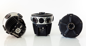
Mosaic 51: durable 360º camera for urban mapping & surveying
Mosaic 51 is a reliable and robust tool with clear, high resolution…
Find out more...about Mosaic 51: durable 360º camera for urban mapping & surveying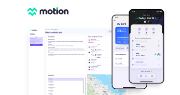
Motion: Sustainable Mobility Platform
Motion helps public and private organizations to integrate and…
Find out more...about Motion: Sustainable Mobility Platform
BLOCK 2P: 2-point locking system
BLOCK 2P fights bicycle and scooter theft for a more sustainable…
Find out more...about BLOCK 2P: 2-point locking systemanet.one: eye-tracking based digital workspace
Eye-tracking-based knowledge management, risk assessment, and quality…
Find out more...about anet.one: eye-tracking based digital workspace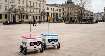
Last-mile food delivery robot
Enhanced food delivery experience thanks to 21st-century robot…
Find out more...about Last-mile food delivery robot
deeptraffic 101: Traffic Management Software
The future of dynamic traffic management for connected and automated…
Find out more...about deeptraffic 101: Traffic Management Software
Vianova Mobility Policy Auto-Tuner
Vianova Mobility Policy Auto-Tuner is a tool that can map carbon…
Find out more...about Vianova Mobility Policy Auto-Tuner
Urban Logistics by Urban Radar
Benefit from a global vision of local delivery activity to implement…
Find out more...about Urban Logistics by Urban Radar
cyclebeeOnRails bike & train information platform
cyclebeeOnRails combines official data of train companies, open…
Find out more...about cyclebeeOnRails bike & train information platform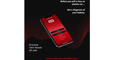
Predictive maintenance application for electrified vehicles' batteries
MyBatteryHealth is a mobile app that allows owners of electrified…
Find out more...about Predictive maintenance application for electrified vehicles' batteries
KINTO Share: Car sharing solution
Seamless and Smart Mobility Solutions: Connecting Drivers to Cars for…
Find out more...about KINTO Share: Car sharing solution
DeepSpeed: electric/hybrid jet marine propulsion
DeepSpeed develops the most efficient naval propulsion ever been…
Find out more...about DeepSpeed: electric/hybrid jet marine propulsion
GoElektrik: One-stop shop for Wallbox installations
GoElektrik offers a seamless, end-to-end solution to rapidly scale…
Find out more...about GoElektrik: One-stop shop for Wallbox installations
MagDock: wireless charging station for micro-mobility
Simple park & charge model for automated wireless charging and…
Find out more...about MagDock: wireless charging station for micro-mobility
TOTT UP: GPS training for bus & coach drivers
Tott up enables drivers to learn routes precisely and be at ease…
Find out more...about TOTT UP: GPS training for bus & coach drivers
Mobile Mapping with Feature Extraction
Visualise roads with pinpoint accuracy to plan infrastructure…
Find out more...about Mobile Mapping with Feature Extraction
Smart Parking System
Smart Lynx Smart Parking is a budget friendly, end-to-end IoT system…
Find out more...about Smart Parking System
stationREV
The stationREV allows bike parking, e-bike and e-cars recharge. It is…
Find out more...about stationREV
RIDERCO : THE BIKE RENTAL APPLICATION
Riderco: the Go-To App for Peer-to-Peer Bike Rentals, Bridging…
Find out more...about RIDERCO : THE BIKE RENTAL APPLICATIONTFT100 - electric mobility and heavy machinery GPS tracker
Easily adaptable and versatile e-mobility GPS tracker – TFT100 has a…
Find out more...about TFT100 - electric mobility and heavy machinery GPS tracker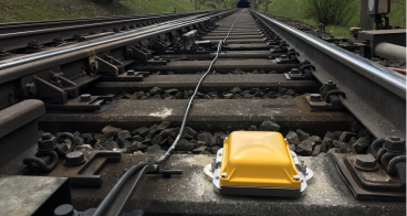
KONUX Switch
KONUX Switch is a predictive maintenance system which helps…
Find out more...about KONUX Switch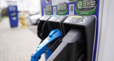
Eco-Movement EV Charging Station Location & Tariffs Data - real-time API
Most complete, highest-quality global EV charging data sourced…
Find out more...about Eco-Movement EV Charging Station Location & Tariffs Data - real-time API
Mobu Smart Mobility Budget
Corporate mobility solution that reduces emissions, cost and is…
Find out more...about Mobu Smart Mobility Budget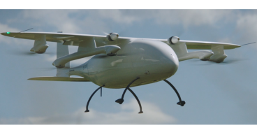
PW.Orca: A heavy-duty cargo drone
PW.Orca allows users to automatically transport cargo through the…
Find out more...about PW.Orca: A heavy-duty cargo drone

WELGO
The cargo bike subscription that meets your needs. Ride, and leave…
Find out more...about WELGO
Parquery Truck Parking - Guide truck drivers to an available parking spot
Parquery guides truck drivers to find available parking spots on…
Find out more...about Parquery Truck Parking - Guide truck drivers to an available parking spot

Reefilla's Fillee: Energy Mobile Storage and EV Charger
Fillee: second-life (used) battery based mobile charger for EV…
Find out more...about Reefilla's Fillee: Energy Mobile Storage and EV Charger
XEV YOYO: Full electric city car with innovative battery swapping system
Making urban mobility a joy for everyone using cutting-edge…
Find out more...about XEV YOYO: Full electric city car with innovative battery swapping system
VertiPlace: Analyse vertiport operability
Analyze the operability of vertiports upfront as well as to optimize…
Find out more...about VertiPlace: Analyse vertiport operability
VertiMonitor: Real-Time Weather Go/NoGo
Automatization of Go / No Go decision making for vertiport operators…
Find out more...about VertiMonitor: Real-Time Weather Go/NoGo
Fleex
Fleex allows you to optimize routes and navigate on these predefined…
Find out more...about Fleex

KEYOU H2 Engine Truck
KEYOU offers its customers emission-free, efficient, and economical…
Find out more...about KEYOU H2 Engine Truck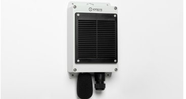
Air Quality and Sound Monitor IoTsens
Evaluates air and noise conditions by monitoring the main…
Find out more...about Air Quality and Sound Monitor IoTsens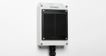
Air Quality Monitor IoTsens
Evaluates air conditions by monitoring the main environmental…
Find out more...about Air Quality Monitor IoTsens
PORTO cargo scooter
Revolts Is Shaping The Future Of Micro Mobility creating high-end,…
Find out more...about PORTO cargo scooter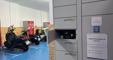
Battery Swapping Station
The solution for the autonomy problems of electric micro-vehicles…
Find out more...about Battery Swapping Station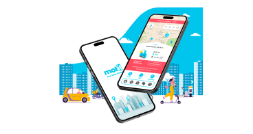
MOTIT_SAAS_MOBILITY PLATFORM
The Smart move to do. Mobility Solutions to move cities towards a…
Find out more...about MOTIT_SAAS_MOBILITY PLATFORM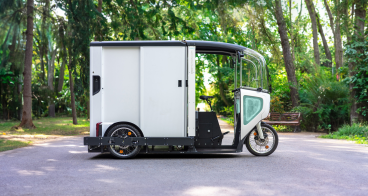
ONO: Sustainable e-cargo bikes
The ONO can replace sprinters, cargo vans and transporters on the …
Find out more...about ONO: Sustainable e-cargo bikes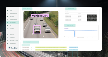
Vision AI Sensor for Smart Cities & Spaces
A plug-n-play, low-power hardware & software solution offering…
Find out more...about Vision AI Sensor for Smart Cities & Spaces
GIZO: Next-Gen AI Tech on Smartphone to Improve Road Safety & Track CO2 Footprint
University Spin-off from Germany Offering Autonomous-driving Level…
Find out more...about GIZO: Next-Gen AI Tech on Smartphone to Improve Road Safety & Track CO2 Footprint
COMPACT hydrogen station
The COMPACT stations are turnkey and all-in-one stations, designed to…
Find out more...about COMPACT hydrogen station
EVOLUTIVE hydrogen station
The EVOLUTIVE hydrogen stations address the heavy and light mobility…
Find out more...about EVOLUTIVE hydrogen station
MOBILE hydrogen station
Hydrogen anytime, anywhere. MOBILE stations are designed for…
Find out more...about MOBILE hydrogen station
Amperfield Connect.Public: Chargin Station with 22 KW charging power
THE CHARGING STATION FOR THE PUBLIC AND SEMI-PUBLIC SPACE
Find out more...about Amperfield Connect.Public: Chargin Station with 22 KW charging power
Amperfied Wallbox connect.solar: Smart charging with solar systems
The KFW-eligible wallbox for solar systems.
Find out more...about Amperfied Wallbox connect.solar: Smart charging with solar systems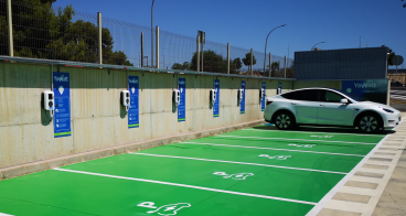
YaWatt: Turn-key EV charging stations
YaWatt offers turn-key EV charging point services powered by ZARIOT&…
Find out more...about YaWatt: Turn-key EV charging stations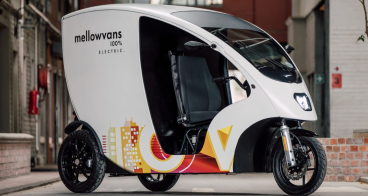
MellowVan
Mellowvans are electric delivery vehicles that provide low-cost,…
Find out more...about MellowVan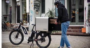
CYCLE: E-Bike and Cargo bikes monthly subscription
Cycle enables your business to transition to sustainable mobility…
Find out more...about CYCLE: E-Bike and Cargo bikes monthly subscription
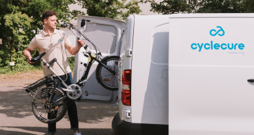
Cyclecure: Repair & Maintenance services for micromobility
Cyclecure provides reliable, convenient and circular after-sales…
Find out more...about Cyclecure: Repair & Maintenance services for micromobility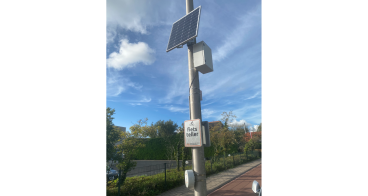
My Cycle Traffic
My Cycle Traffic is a SAAS (Software As A service) platform that…
Find out more...about My Cycle Traffic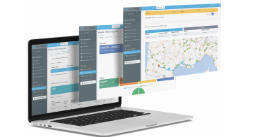
ev-Move Fleet
Accelerate the fleet transition with ev-Move Fleet: powerful…
Find out more...about ev-Move Fleet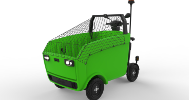
Stint Pickup
Beyond a developed vehicle that's for sale: Stint Pickup focuses…
Find out more...about Stint Pickup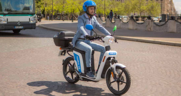
Cooltra - Sharing for employees
Join the two-wheel shared mobility revolution with their sharing…
Find out more...about Cooltra - Sharing for employees
Fleet Electrification Planning tool
Make My Day's Fleet Electrification Planner: Tailored insights…
Find out more...about Fleet Electrification Planning tool
Charging Optimisation (available as an API or White Label)
Make My Day API: Empowering fleets with smarter routes and charging…
Find out more...about Charging Optimisation (available as an API or White Label)
FF DataFactory
FF DataFactory is an universal flexible data platform for police,…
Find out more...about FF DataFactory
KINTO Join
KINTO Join helps communities and organisation lower their CO2…
Find out more...about KINTO Join

CO2e-calculator: Calculate, Compare, Reduce and Contribute for your Travel Impact
A one-stop climate partner to act on users' travel impact.
Find out more...about CO2e-calculator: Calculate, Compare, Reduce and Contribute for your Travel Impact
OBSERVER Live
OBSERVER Live: Transforming cities with real-time traffic insights…
Find out more...about OBSERVER Live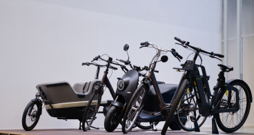
TILER uno
Universal, wireless inductive charging for light electric vehicles…
Find out more...about TILER uno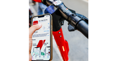
Hop: Micromobility Platform
Hop is a micromobility platform and suite, which lets their own…
Find out more...about Hop: Micromobility Platform
Magway: Zero-emissions transport without batteries or fuels
The zero-emissions, scalable transportation system that…
Find out more...about Magway: Zero-emissions transport without batteries or fuels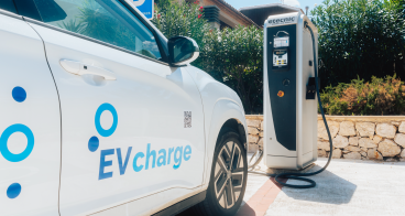
EVcharge - The EV Chargers Management Platform
EVcharge delivers a comprehensive and user-friendly platform for…
Find out more...about EVcharge - The EV Chargers Management Platform
LisNav: Audiodescription for the blind
LisNav is an app that merges Augmented Reality with Artificial…
Find out more...about LisNav: Audiodescription for the blind
e-STANDS
Micromobility parking and charging with unmatched safety and…
Find out more...about e-STANDS
Delphisonic DS-xR
Delphisonic DS-xR offers a value proposition centered around safety,…
Find out more...about Delphisonic DS-xR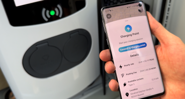
MOBIX Park & Charge
MOBIX Park & Charge solves urban parking and EV charging by…
Find out more...about MOBIX Park & Charge
4screen - the driver interaction platform
4screen has developed the world's first driver interaction…
Find out more...about 4screen - the driver interaction platform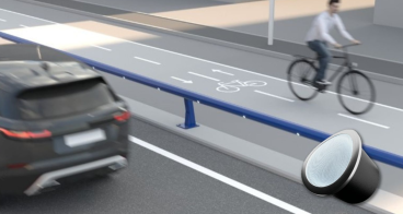
Plug & Meta: Active road safety to transform urban infrastructures
PLUG&META® technology converts any existing infrastructure into…
Find out more...about Plug & Meta: Active road safety to transform urban infrastructures
Metaurban Smart: Urban safety barrier that prevents traffic accidents
Metaurban SMART urban barrier is a containment system with…
Find out more...about Metaurban Smart: Urban safety barrier that prevents traffic accidents
Abel Sensors: Smart Parking for Bikes
The Smart Parking guidance, monitoring & mobile payment solution…
Find out more...about Abel Sensors: Smart Parking for Bikes
bus4.me, the on-demand transport system
bus4.me: a fully customizable tech solution designed to simplify on…
Find out more...about bus4.me, the on-demand transport system
Smart Truck Parking solution
The smartest way to address the lack of truck parking for…
Find out more...about Smart Truck Parking solution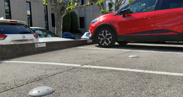
Smart Parking solution
The simplest, cost-effective and reliable way to manage car parks…
Find out more...about Smart Parking solution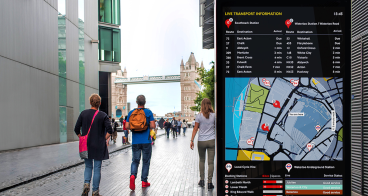
PassageWay RTPI Digital Signs
By providing universal public transport information access to all…
Find out more...about PassageWay RTPI Digital Signs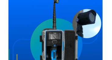
Scout Plus: an innovative multimodal Traffic Surveys Solution
Miovision Scout® Plus accurately collects all data types, operates…
Find out more...about Scout Plus: an innovative multimodal Traffic Surveys Solution
WingLights turning indicators
Universal, patented turning indicators that make riders more visible…
Find out more...about WingLights turning indicators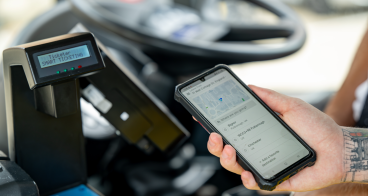
Pingo: Demand Responsive Transport Platform
Pingo is the built for public transport. One platform for all users&…
Find out more...about Pingo: Demand Responsive Transport Platform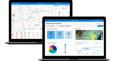
Bus Manager: Manage and share real-time data without the need for new hardware or extra equipment
Bus Manager application enables efficient management of a bus fleet,…
Find out more...about Bus Manager: Manage and share real-time data without the need for new hardware or extra equipment
Bambookoa: bicycles made of bamboo
The new art of making bicycles more sustainable with the environment
Find out more...about Bambookoa: bicycles made of bamboo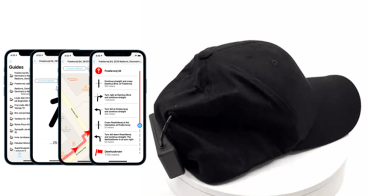
NaviBlind
NaviBlind is an inclusive and accessible GNSS (GPS) navigator that…
Find out more...about NaviBlind
INGA: Solar Electric Cargo Bike
Mobility solution powered by solar energy
Find out more...about INGA: Solar Electric Cargo Bike
MobilityAnalyst
With the interactive mobility scan ‘MobilityAnalyst‘ users gain…
Find out more...about MobilityAnalyst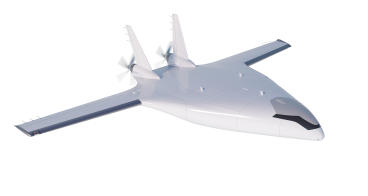
Natilus Kona 3.8T Cargo Drone
Next-generation cargo aircraft Designed for more volume, autonomy,…
Find out more...about Natilus Kona 3.8T Cargo Drone
Mobilize
Cegeka Mobilize is a platform that captures mobility data flows and…
Find out more...about Mobilize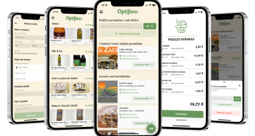
Optifarm: Smart delivery of local food products
Digital platform Optifarm is Etsy for local farmers
Find out more...about Optifarm: Smart delivery of local food products
Custom battery manufacturing service
Get custom production grade batteries in less than 20 working days.
Find out more...about Custom battery manufacturing service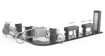
Murwa: Urban parking docks for scooters, bikes & e-bikes.
Murwa is a parking station with an electric charging system -…
Find out more...about Murwa: Urban parking docks for scooters, bikes & e-bikes.
BikeFair: bicycle marketplace
BikeFair is a one-stop-shop bike marketplace: a full-service bike…
Find out more...about BikeFair: bicycle marketplace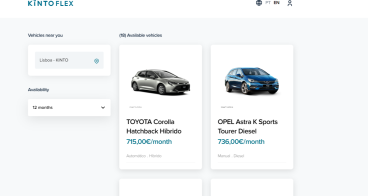
KINTO FLEX: Flexible Car Subscription Solution
Seamless and Smart Mobility Solutions: Flexible Car Subscription …
Find out more...about KINTO FLEX: Flexible Car Subscription Solution
Cube Plus : Smart City bench
Cube Plus revolutionizes urban spaces with smart benches offering…
Find out more...about Cube Plus : Smart City bench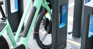
Clean commute and charging system
ACTON offers fleet ebikes and charging station infrastructure for…
Find out more...about Clean commute and charging system
THOR AVAS: Acoustic Vehicle Alerting System
THOR AVAS: Where safety meets style in electric mobility.
Find out more...about THOR AVAS: Acoustic Vehicle Alerting System
Aima+: AI-powered data intelligence platform for shared and connected mobility
AiMA+ by Vulog is a cutting-edge mobility platform leveraging AI and…
Find out more...about Aima+: AI-powered data intelligence platform for shared and connected mobility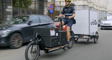
Cycle Logistics: Change management planning
urbike offers a tailor-made support package in urban logistics…
Find out more...about Cycle Logistics: Change management planning
BeTRITON: Fully electric amphibious RV
Fully electric Amphibious RVs for the most sustainable and unique…
Find out more...about BeTRITON: Fully electric amphibious RV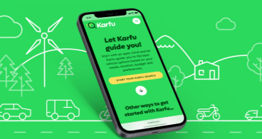
Karfu: Mobility comparison platform
Karfu is developing an impartial vehicle & mobility comparison…
Find out more...about Karfu: Mobility comparison platform
full&fast: Fully-Integrated Energy Storage Solutions
Delivering more than just power & energy. We finance access to…
Find out more...about full&fast: Fully-Integrated Energy Storage Solutions
A4Radar: Smart radar warning sensors
Revolutionise urban safety and efficiency with 5G Smart Radar Warning…
Find out more...about A4Radar: Smart radar warning sensors
Last Mile deliveries with Cargo Bikes
Delivering parcels with cargo bikes is cost efficient and good for…
Find out more...about Last Mile deliveries with Cargo Bikes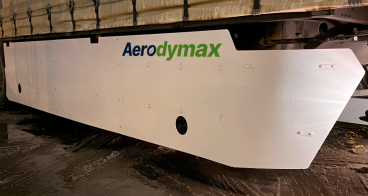
Aerodymax Trailer Skirt
Aerodymax trailer skirt reduces fuel consumption & emissions by…
Find out more...about Aerodymax Trailer Skirt
Rastel.io: Secure bike parking management platform
An access control system that can transform any enclosed space into a…
Find out more...about Rastel.io: Secure bike parking management platform
WeSolve: community engagement platform
Connect with your community, gather insights, and transform feedback…
Find out more...about WeSolve: community engagement platform
ENAIDE
Your intelligent companion for the road. Energy consumption and…
Find out more...about ENAIDE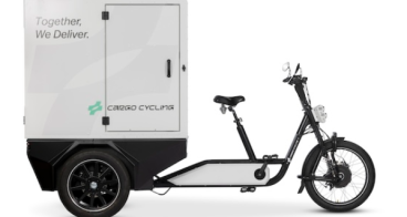
Chariot FS2: Full Suspension E-cargo trike
The next generation e-cargo bikes that helps organizations deliver a…
Find out more...about Chariot FS2: Full Suspension E-cargo trike
ITC: Intelligent Traffic Control
ITC is an innovative software-only solution that improves the usage…
Find out more...about ITC: Intelligent Traffic Control
Mappo: In-vehicle, location-based infotainmaint
Aiming to become the world largest location-based in-vehicle…
Find out more...about Mappo: In-vehicle, location-based infotainmaint
Entroview: Entropy-based technology for battery management
Unlocking precise SOC (state-of-charge) measurement for a brighter…
Find out more...about Entroview: Entropy-based technology for battery management
AUXTAIL: Integrated rear rack
Rear rack stores in bumper, and folds out to provide 2 e-bike…
Find out more...about AUXTAIL: Integrated rear rack
RiDERgy: SaaS for automatic, low cost, greener EV-fleets charging
Provide a scalable, flexible API-first software to EV owners and…
Find out more...about RiDERgy: SaaS for automatic, low cost, greener EV-fleets charging
Mercedes-Benz Data Dashboard
Benefit from our safety, infrastructure, traffic, parking, and micro…
Find out more...about Mercedes-Benz Data Dashboard
Stryker: Compact Urban Vehicle (CUrVe)
'Cargo-bike width and congestion-busting agility, with small van…
Find out more...about Stryker: Compact Urban Vehicle (CUrVe)
King Long: Pure electric city buses
Mini electric city bus with LFP Catl battery and best price/quality…
Find out more...about King Long: Pure electric city buses
INSPECH Insights: Road assets management
INSPECH Insights is a solution tailored for road asset managers and…
Find out more...about INSPECH Insights: Road assets management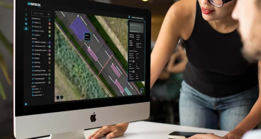
INSPECH Assessment: Digital tool for road conditions assessment and reporting
Designed to improve the inspection process, from data collection to…
Find out more...about INSPECH Assessment: Digital tool for road conditions assessment and reporting
Metapilot: AI launchpad for airtaxis, vertiports, and future mobility
Boeing-backed AI launchpad for air taxis, vertiports, and future…
Find out more...about Metapilot: AI launchpad for airtaxis, vertiports, and future mobility
EP Tender: Smart powerbank trailer for EVs
EP Tender's mission is to accelerate the energy transition with…
Find out more...about EP Tender: Smart powerbank trailer for EVs
Diagonal: Spatial data visualisation
Transforming spatial data into holistic visual narratives
Find out more...about Diagonal: Spatial data visualisation
CyberAutoMatics: In-vehiclecyber security &fleet performance platform
The most comprehensive in-vehicle cyber security & fleet…
Find out more...about CyberAutoMatics: In-vehiclecyber security &fleet performance platform

Buddyp2p: A platform renting private parking spaces and EV chargers
Park, charge & share: Transform your parking and charging…
Find out more...about Buddyp2p: A platform renting private parking spaces and EV chargers
Tarot Routing: Last-mile optimisation and management tool
Enhance last-mile efficiency by reducing both CO2 emissions and…
Find out more...about Tarot Routing: Last-mile optimisation and management tool
Shuttle Planet: On-demand long-distance shared transport platform
Shuttle Planet offers adventure and opportunity through inclusive on…
Find out more...about Shuttle Planet: On-demand long-distance shared transport platform
Smart Kiwi: Fleet rebalancing & optimisation platform
Smart Kiwi optimises fleet distribution by predicting demand through…
Find out more...about Smart Kiwi: Fleet rebalancing & optimisation platform
Gecko Risk: Alternative fuel vehicle data platform
Using data to help businesses in the motor sector evolve understand…
Find out more...about Gecko Risk: Alternative fuel vehicle data platform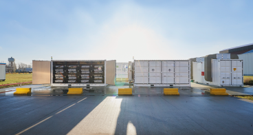
E-STOR: Battery energy storage systems
Battery energy storage systems to provide vital storage for renewable…
Find out more...about E-STOR: Battery energy storage systems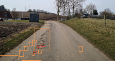
Pluto Technologies: Cost-effective asset management platform
The intelligent asset management solution to help municipalities in…
Find out more...about Pluto Technologies: Cost-effective asset management platform
Bib Batteries: EV Batteries monitoring and management platform
A comprehensive solution to manage electric vehicles batteries,…
Find out more...about Bib Batteries: EV Batteries monitoring and management platform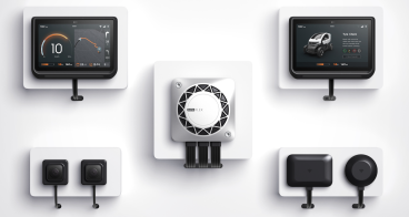
EVware Core FLEX
A plug-and-play Platform-as-a-Service that enables sustainable zero…
Find out more...about EVware Core FLEX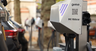
DockChain - Fast charging for fleets and car parks.
DockChain makes rapid DC charging possible for all parking spaces at…
Find out more...about DockChain - Fast charging for fleets and car parks.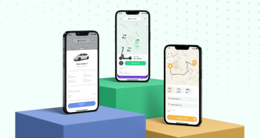
ATOM Mobility - leading software provider for shared mobility industry
All the technology you need to launch and scale your own vehicle…
Find out more...about ATOM Mobility - leading software provider for shared mobility industry
Predictive Maintenance for Critical Equipment
Gelectric's predictive maintenance revolutionises waterway…
Find out more...about Predictive Maintenance for Critical Equipment
3DAI City
Addressing the need for actionable insights in urban environments and…
Find out more...about 3DAI City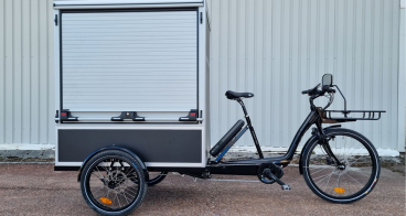
Monark Centro: Cargo bikes for everyone
Monark Centro, a cargo bike range solution for every need.
Find out more...about Monark Centro: Cargo bikes for everyone
ZDbus: ERP solutions for passengers transportation
ZDBus is the leading ERP in Spain with an imminent expansion in Latin…
Find out more...about ZDbus: ERP solutions for passengers transportation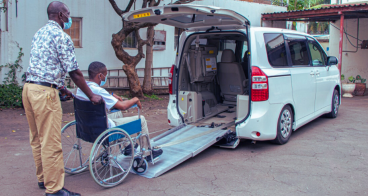
ACE MOBILITY: Ride-hailing service for people with disabilities
Africa's first accessible vehicles ride sharing start-up.
Find out more...about ACE MOBILITY: Ride-hailing service for people with disabilities
KoDelivery: Logistics optimisation platform
Kodelivery is a logistics optimization platform based on an…
Find out more...about KoDelivery: Logistics optimisation platform
Immense: Infrastructure Operations Simulator
Infrastructure Operations simulator that allows costumers to quickly…
Find out more...about Immense: Infrastructure Operations Simulator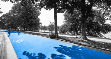
EP-GRIP VELO: Safe cycling paths
Safe cycling paths for vibrant streets.
Find out more...about EP-GRIP VELO: Safe cycling paths
Cityscaper: 3D & Augmented reality visualisations
AR and 3D visualizations enhance citizen participation in…
Find out more...about Cityscaper: 3D & Augmented reality visualisations
AIRLY: Hyperlocal air quality monitoring platform
Airly is the leading cost-effective SaaS solution for hyperlocal air…
Find out more...about AIRLY: Hyperlocal air quality monitoring platform
E-scooter fleet management platform
One dashboard to manage your e-scooter fleet and staff.
Find out more...about E-scooter fleet management platform
MyLock Scooter: Parking structure for electric scooters
By integrating advanced technology and seamless functionality, MyLock…
Find out more...about MyLock Scooter: Parking structure for electric scooters
Phygital Analytics: Mobile devices detection and user behaviour analysis
Awarded phygital solution to know and modify the habits and behaviour…
Find out more...about Phygital Analytics: Mobile devices detection and user behaviour analysis
BelotPay: One app for all transports
One app for every mobility need.
Find out more...about BelotPay: One app for all transports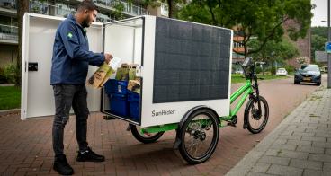
SunRider: The solar-powered cargo e-bike
Pedal into a brighter future with the first solar-powered cargo e…
Find out more...about SunRider: The solar-powered cargo e-bike
Maptionnaire
Maptionnaire is a hassle-free citizen engagement platform that…
Find out more...about Maptionnaire
RoadEO: Road quality monitoring and prediction platform
Data driven road quality monitoring & Predictive road maintenance…
Find out more...about RoadEO: Road quality monitoring and prediction platform

SiWeGO: Smart Eco Transport
SiWeGO is an App that fills & sells the empty space of any…
Find out more...about SiWeGO: Smart Eco Transport
Stanley Robotics: Automated Robotic Valet Parking
Increase parking capacity and offer customers a streamlined, stress…
Find out more...about Stanley Robotics: Automated Robotic Valet Parking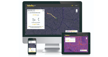
Lobelia Air: Data on street-level
Lobelia Air is an innovative operational service which produces…
Find out more...about Lobelia Air: Data on street-level
DKSR: Open Urban Data Platform
Put urban data into sustainable use for your municipality: With an…
Find out more...about DKSR: Open Urban Data Platform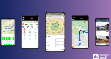
Magic Lane: Map, Location & Navigation platform for developers
An end-to-end Map, Location & Navigation platform for developers…
Find out more...about Magic Lane: Map, Location & Navigation platform for developers
MotionPass: In-car payments platform
MotionPass makes it easy to include commercial services (~parking,…
Find out more...about MotionPass: In-car payments platform
Next Generation Mobility Hubs
The multifunctional mobility hubs promote green mobility while…
Find out more...about Next Generation Mobility Hubs
Street Transformations
We help municipalities, developers, or mobility providers communicate…
Find out more...about Street Transformations
Strategic masterplanning for cities and new urban developments.
JaJa Architects strategic masterplanning for citites and new urban…
Find out more...about Strategic masterplanning for cities and new urban developments.
GalNav Indoor Navigation
GalNav indoor initially enables turn-by-turn navigation for website…
Find out more...about GalNav Indoor Navigation
LUMiCHARGER LP: EV charger sockets
EV charger sockets integrated into public lighting, which can work…
Find out more...about LUMiCHARGER LP: EV charger sockets
Ampliuz: Battery charging station
Making e-bikes accessible to more people, while simplifying the…
Find out more...about Ampliuz: Battery charging station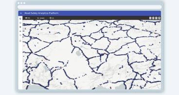
Safely: Road Safety Analytics System
Increase road safety for all transportation modes by making effective…
Find out more...about Safely: Road Safety Analytics System
Cermoni: public transport decision support system
Make public transport the preferred choice by enhancing service…
Find out more...about Cermoni: public transport decision support system
MeePath: Data platform
MeePath is a data platform that tracks, describes and predicts the…
Find out more...about MeePath: Data platform
ASIMOB
Autonomous urban inspector for efficiency in maintenance and road…
Find out more...about ASIMOB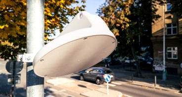
Happy City
Sparkpark keeps pedestrians safe and helps cities meet the United…
Find out more...about Happy City
SmanApp: Mobile App that rewards safe driving
SmanApp is a road safety app based on gamification that rewards…
Find out more...about SmanApp: Mobile App that rewards safe driving
Witick : Mobile ticketing for public transport
Contactless validation with all smartphones thanks to Bluetooth.
Find out more...about Witick : Mobile ticketing for public transport
Hubbel: Mobility Hubs
Hubbel is unique in the world of circular building systems, the…
Find out more...about Hubbel: Mobility Hubs
Road.Travel: Adaptive Travel Guides
Creators of Adaptive Travel Guides, pioneering device-to-car tech…
Find out more...about Road.Travel: Adaptive Travel Guides
Autodrive Solutions: Road Digitisation
Developing the roads of the future. Analog roads will be easily…
Find out more...about Autodrive Solutions: Road Digitisation
Trailer Duck: Electrical powered cargo bike
Transport 300kg/2m³ without any effort by bike or in handcard mode
Find out more...about Trailer Duck: Electrical powered cargo bike
Ciclogreen: Corporate mobile app to quantify and reduce emissions
Ciclogreen supports organisations to calculate and reduce their…
Find out more...about Ciclogreen: Corporate mobile app to quantify and reduce emissions
Cartologica: Asset inventory solution
Using digital techniques, Cartologica inventories every type of asset…
Find out more...about Cartologica: Asset inventory solution
Geolocated images, point clouds and streetviews
Production of geolocated images and streetviews of every kind of…
Find out more...about Geolocated images, point clouds and streetviews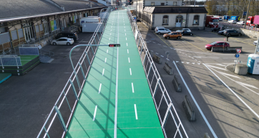
URB-X: Bicycle highways
A modular timber construction system for elevated active mobility…
Find out more...about URB-X: Bicycle highways
StreetMx: Data-based design & decision tool for cities, citizens to score and benchmark streets
Scores based on tangible aspects of sustainability, people - oriented…
Find out more...about StreetMx: Data-based design & decision tool for cities, citizens to score and benchmark streets
Triplesign: Variable Message Sign
Triplesign - The sustainable solution for the future. Solar powered…
Find out more...about Triplesign: Variable Message Sign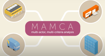
MAMCA Decision Making Software
The MAMCA software enables stakeholders engagement in complex…
Find out more...about MAMCA Decision Making Software
DUMA: Dynamic Urban Mobility Assistant
Creating accessibility by most accurate, local specific and up-to…
Find out more...about DUMA: Dynamic Urban Mobility Assistant
Vianova Mobility Data
Enhanced user experience: data can enable businesses to improve the…
Find out more...about Vianova Mobility Data
Vianova Mobility Manager
Vianova tools aim to make mobility safer and more sustainable…
Find out more...about Vianova Mobility Manager
Cargo-bike Parcels Box
Minimizing the time required to transfer high volumes of parcels at…
Find out more...about Cargo-bike Parcels Box
Belat: Any space locker for orderly micromobility.
Belat is the right choice for orderly indoor and outdoor…
Find out more...about Belat: Any space locker for orderly micromobility.
Soca: Urban parking docks for bikes & e-bikes
Soca is a parking station with an electric charging system - designed…
Find out more...about Soca: Urban parking docks for bikes & e-bikes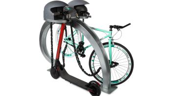
vadeBike
The solution that ensures micromobility is both safe and smart…
Find out more...about vadeBike
DASHTRACK: Urban Platform for Cycling and Infrastructure Data
To make cycling safe and even more attractive in an innovative and…
Find out more...about DASHTRACK: Urban Platform for Cycling and Infrastructure Data
The Pin Bike Kit
Verified movements and rides to incentivise citizens and commuters to…
Find out more...about The Pin Bike Kit
VelSol - Modular cycling infrastructure.
VelSol is a modular system providing climate-enhanced, resilient…
Find out more...about VelSol - Modular cycling infrastructure.
Inbalance grid: smart EV charging solution
The solution allows installing charging stations in locations with…
Find out more...about Inbalance grid: smart EV charging solution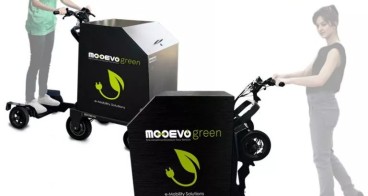
Mooevo Urban
Urban electric delivery cart and scooter combined for use on roads…
Find out more...about Mooevo Urban
PLATIO solar paver
Solar EV changing station by powered PLATIO Solar Pavers for smart…
Find out more...about PLATIO solar paver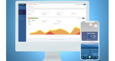
TripShift Platform - Automated carbon tracking.
TripShifts' automated data collection provides organisations …
Find out more...about TripShift Platform - Automated carbon tracking.
TrueSight 1.0
TrueSight 1.0 enables machines to see the world built for humans in…
Find out more...about TrueSight 1.0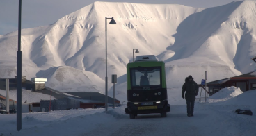
xFlow - Enabling autonomous vehicles
Bringing autonomous processes to life - xFlow®, has a unique value…
Find out more...about xFlow - Enabling autonomous vehicles
Meep: modular and open integration platform
Meep offers a solution for costumers' clients or citizens that…
Find out more...about Meep: modular and open integration platform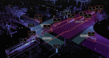
Augmented LiDAR Box for Smart Infrastructures
Outsight Augmented LiDAR Box real-time outputs enable rapid…
Find out more...about Augmented LiDAR Box for Smart Infrastructures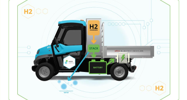
ATX340E H2GO: Electric Vehicle with Hydrogen range extender
Alkè Electric Vehicles is bringing the full power of hydrogen on the…
Find out more...about ATX340E H2GO: Electric Vehicle with Hydrogen range extender
A.S.S.E.S.S. - Autonomous System for Smart Evaluation of Structures and Assets.
Vertliner provides a platform for autonomous assessments of urban…
Find out more...about A.S.S.E.S.S. - Autonomous System for Smart Evaluation of Structures and Assets.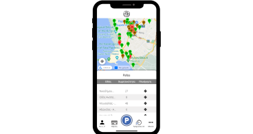
Intercomp Smart Parking Systems for Smart Cities
Smart Parking Systems® is the solution to govern and manage…
Find out more...about Intercomp Smart Parking Systems for Smart Cities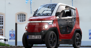
City Transformer
City Transformer developed the world-first born to share urban EVs,…
Find out more...about City Transformer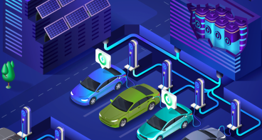
ZenSite: Smart Charging for Sites and Fleets
With ZenSite SMEs and energy communities make optimal use of their…
Find out more...about ZenSite: Smart Charging for Sites and Fleets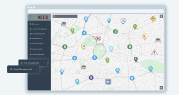
METIS: Interoperable Mobility Analytics and Management Platform
A full control effect on the traffic network to reduce congestion and…
Find out more...about METIS: Interoperable Mobility Analytics and Management Platform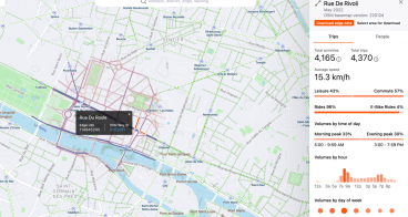
Strava Metro: Data for bicycle and pedestrian planning
Metro is a free tool that aggregates, de-identifies and…
Find out more...about Strava Metro: Data for bicycle and pedestrian planning
Liigu: keyless car rental
Liigu is an app-based mobility service that connects cars to…
Find out more...about Liigu: keyless car rental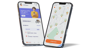
Tripy: Electric Bike Sharing Platform
In order to provide accessible and sustainable transportation for…
Find out more...about Tripy: Electric Bike Sharing Platform
Operatti: Smart public transportation in rural areas.
We improve the public transportation services in rural & peri…
Find out more...about Operatti: Smart public transportation in rural areas.
Usage-based insurance for shared mobility
Connected Insurance helps digital platforms to lower risk, reduce…
Find out more...about Usage-based insurance for shared mobility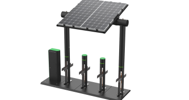
jCharge - Solar charging system for micromobility
Creating a system of jCharge chargers dedicated to operators of…
Find out more...about jCharge - Solar charging system for micromobility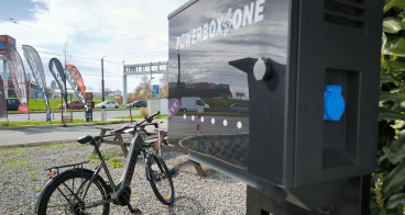
Powerbox.one: universal e-bike charging station
One stop "wallbox" solution for out-of-home charging for…
Find out more...about Powerbox.one: universal e-bike charging station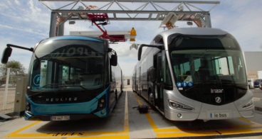
OPTIMOB - Decision support tool for bus line electrification
An accessible web-based tool to help bus operators -public or private…
Find out more...about OPTIMOB - Decision support tool for bus line electrification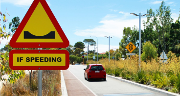
Actibump for safer roads
The friendly solution for safer roads. Actibump reduces speeding by…
Find out more...about Actibump for safer roads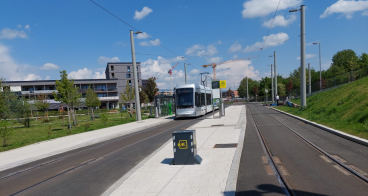
Eliminating curve squealing of tramways and other rail vehicles - CL-E1
Squeal-less tramways are a reality! Health damaging high frequency…
Find out more...about Eliminating curve squealing of tramways and other rail vehicles - CL-E1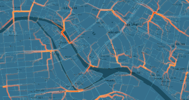
2blox traffic sensor: Accurate mobility data
2blox creates a community of traffic counters. A community which…
Find out more...about 2blox traffic sensor: Accurate mobility dataDynamic Route Optimization, Mobile Driver App & Tracking
Optiyol is a B2B SaaS which helps retailers and carriers for end-to…
Find out more...about Dynamic Route Optimization, Mobile Driver App & Tracking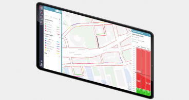
CurbIQ: Understand, manage, analyze and optimize your curbside
Digitise the curb using data automation process which then allows…
Find out more...about CurbIQ: Understand, manage, analyze and optimize your curbside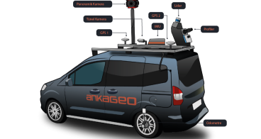
Mobile Mapping Systems.
Urban road inventory production over panoramic images with point…
Find out more...about Mobile Mapping Systems.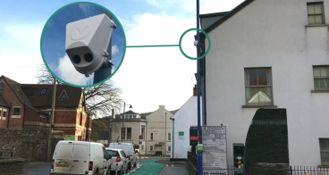
Vivacity AI sensor for traffic flow monitoring.
Our vision is to make cities smarter, safer & more sustainable…
Find out more...about Vivacity AI sensor for traffic flow monitoring.
Etheclobox for thermo sensitive last mile deliveries.
etheclo, the missing link for thermo sensitive monitoring ) - food,…
Find out more...about Etheclobox for thermo sensitive last mile deliveries.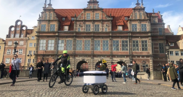
Autonomous Delivery Technology for Online Order Platforms.
We reimagine last-mile delivery process by using autonomous sidewalk…
Find out more...about Autonomous Delivery Technology for Online Order Platforms.
The Intelligent City Performance Platform - Smart and liveable to the city of th
MHP Intelligent City Performance Platform helps cities and companies…
Find out more...about The Intelligent City Performance Platform - Smart and liveable to the city of th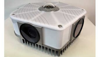
Mosaic Viking: 360º high resolution camera for urban mapping & surveying.
22K resolution captures EVERY last detail, delivering the highest…
Find out more...about Mosaic Viking: 360º high resolution camera for urban mapping & surveying.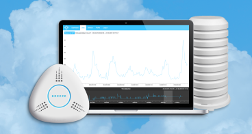
Urban Air Quality Sensors
Breeze Technologies supports organizations to create better clean air…
Find out more...about Urban Air Quality Sensors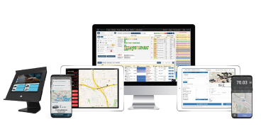
SmartCar Mobility Platform
A universal API platform bridging vehicles and apps, enabling…
Find out more...about SmartCar Mobility Platform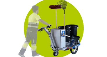
MOOEVO CLEAN: Electrified Sweeper Cart
Mooevo Clean is a sustainable cart with an electric motor designed…
Find out more...about MOOEVO CLEAN: Electrified Sweeper Cart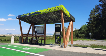
eBIKE PORT solar: Rest and charging station for e-bikes.
Green energy from the sun for your e-bike!
Find out more...about eBIKE PORT solar: Rest and charging station for e-bikes.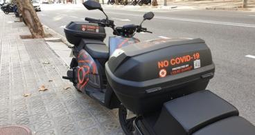
Liquid Guard ®
Liquid Guard® guarantees the disinfection of all treated surfaces…
Find out more...about Liquid Guard ®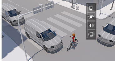
Eye-Net Protect: An all-road users safety solution.
Eye-Net developed a mobile All Road-Users V2X Safety Solution, that…
Find out more...about Eye-Net Protect: An all-road users safety solution.
Pave Commute, the green commuter assistant.
Pave Commute helps employees share rides, build sustainable habits,…
Find out more...about Pave Commute, the green commuter assistant.
Nimbus: Software platform for robotic applications.
Cloud-based ecosystem for robot fleet configuration, testing,…
Find out more...about Nimbus: Software platform for robotic applications.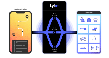
Lyko: APIs for sustainable mobility services
One integration, Countless mobility providers wordlwide - with our…
Find out more...about Lyko: APIs for sustainable mobility services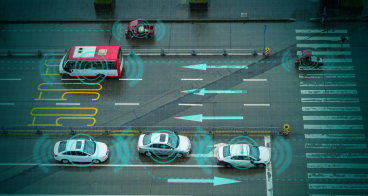
Cyber2Car: the safeguard for connected cars
Cyber2Car prevents attacks from reaching the connected car.
Find out more...about Cyber2Car: the safeguard for connected cars
Watergen On-Board: Creating water from air
Watergen ON-Board is the perfect off grid and on-the-go water-from…
Find out more...about Watergen On-Board: Creating water from air
UMAM: Urban Mobility Assessment Model
The city‘s mobility performance will be analysed according to six…
Find out more...about UMAM: Urban Mobility Assessment Model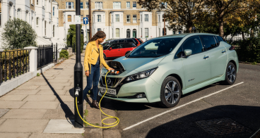
ubitricity: lamppost chargers for urban EV drivers
ubitricity supports cities with a cost-effective and highly scalable…
Find out more...about ubitricity: lamppost chargers for urban EV drivers
See.Sense Data Services for Micromobility
Our granular sensor data insights into the experience of the cyclist…
Find out more...about See.Sense Data Services for Micromobility
Factual DRT monitoring dashboard
Demand responsive transport is a mean to reduce private car ownership…
Find out more...about Factual DRT monitoring dashboard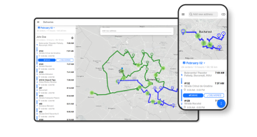
Logistia Route Planner
Logistia Route Planner is a SaaS designed to help businesses plan end…
Find out more...about Logistia Route Planner
Factual Smart Commute: Digital Corporate Mobility Planner
Factual Smart Commute supports corporates to empower their employees…
Find out more...about Factual Smart Commute: Digital Corporate Mobility Planner
Mobilypod: Secure bike shelters
Bike shelters made from recycled shipping containers - Mobilypod is…
Find out more...about Mobilypod: Secure bike shelters
Long Clean Surface
LONG CLEAN SURFACE provides permanent disinfection to public spaces…
Find out more...about Long Clean Surface
N1 Mobility Helmet
The Newton-Rider N1 helmet is like no other: Sleek, Thin, Semi-soft…
Find out more...about N1 Mobility Helmet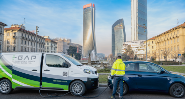
E-GAP: urban, mobile on-demand charging service
E-GAP contributes to the development of a sustainable world thanks to…
Find out more...about E-GAP: urban, mobile on-demand charging service
GoGiro: Micromobility for City Hotels
GoGiro provides everything hotels needs to create an exciting tour to…
Find out more...about GoGiro: Micromobility for City Hotels
Polarity II: Smart Lampposts for Smart Roads
Empowering cities with edge infrastructure devices for smart road…
Find out more...about Polarity II: Smart Lampposts for Smart Roads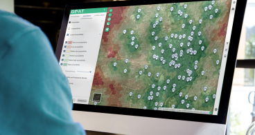
GOAT (Geo Open Accessibility Tool): Planning instrument for the 15-Min-City
GOAT is a cloud-based planning software that enables change-makers in…
Find out more...about GOAT (Geo Open Accessibility Tool): Planning instrument for the 15-Min-City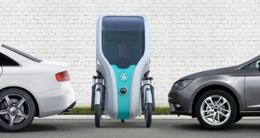
Wello: solar-powered e-cargo bikes
Wello is the perfect mix between the best of an electric bike and van.
Find out more...about Wello: solar-powered e-cargo bikes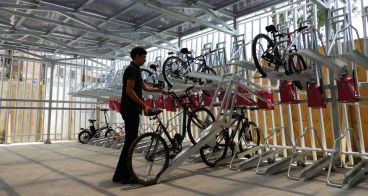
Neko Double Decker Bike Rack
Cycling infrastructure that everyone can use with the space-saving…
Find out more...about Neko Double Decker Bike Rack
Ara SaaS for Real-time Data Management
An innovative solution to manage real-time mobility & transport…
Find out more...about Ara SaaS for Real-time Data Management
Chouette SaaS for Schedule Data Management
Improve your mobility and transport operations without disruption by…
Find out more...about Chouette SaaS for Schedule Data Management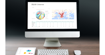
DILAX Citisense
DILAX Citisense combines multiple sources of mobility data and offers…
Find out more...about DILAX Citisense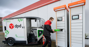
Swobbee: Battery Swapping Station
We offer a decentralised, safe charging solution from a single source…
Find out more...about Swobbee: Battery Swapping Station
DILAX SLS-1000
The new DILAX SLS-1000 uses structured light to see exactly what…
Find out more...about DILAX SLS-1000
Fleet Operations Planning Simulator
Our Simulation as a Service tool allows you to:Easily generate…
Find out more...about Fleet Operations Planning Simulator
Sideline: Mobile & Ecological Car Wash
Sideline provides mobile eco-friendly car wash services anytime,…
Find out more...about Sideline: Mobile & Ecological Car Wash
KERB: Smart Parking Solutions
KERB is a global-from-day-one smart parking and mobility platform…
Find out more...about KERB: Smart Parking Solutions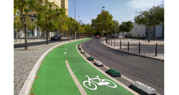
Zipper® cycle lane separators
Zipper® makes it possible to separate traffic flows in cities.
Find out more...about Zipper® cycle lane separators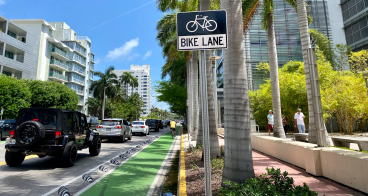
Zebra® Family cycle lane separators
We work to make cycling mobility safer and to make cities more…
Find out more...about Zebra® Family cycle lane separators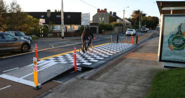
Vectorial® system
We work to make cycling mobility safer and to make cities more…
Find out more...about Vectorial® system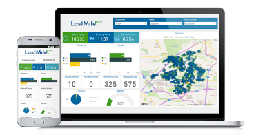
Last Mile Digital Platform
Fairer, smarter and greener urban logistics and last mile delivery…
Find out more...about Last Mile Digital Platform
Trafi for Cities
Our City-led MaaS solution offers:White label business modelSpeed of…
Find out more...about Trafi for Cities
Forfait Mobilité Durable
With RoadMate, reduce your company's carbon footprint.Our…
Find out more...about Forfait Mobilité Durable
ElectricFeel Shared Mobility OS
Launch grow your shared mobility business with an all-in-one…
Find out more...about ElectricFeel Shared Mobility OS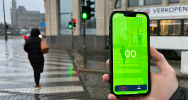
OKO mobile APS
The OKO app provides the ultimate solutions for cities by:Making a…
Find out more...about OKO mobile APS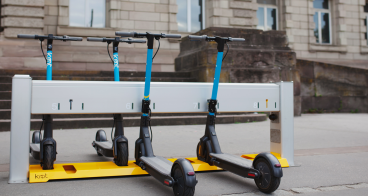
Docking and charging stations for scooters
Universal docking and charging stations for scooter sharing…
Find out more...about Docking and charging stations for scooters190+ handpicked market-ready innovations supported by EIT Urban Mobility