Supporting safe road design in Rome through advanced conflict analysis
The Challenge
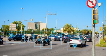
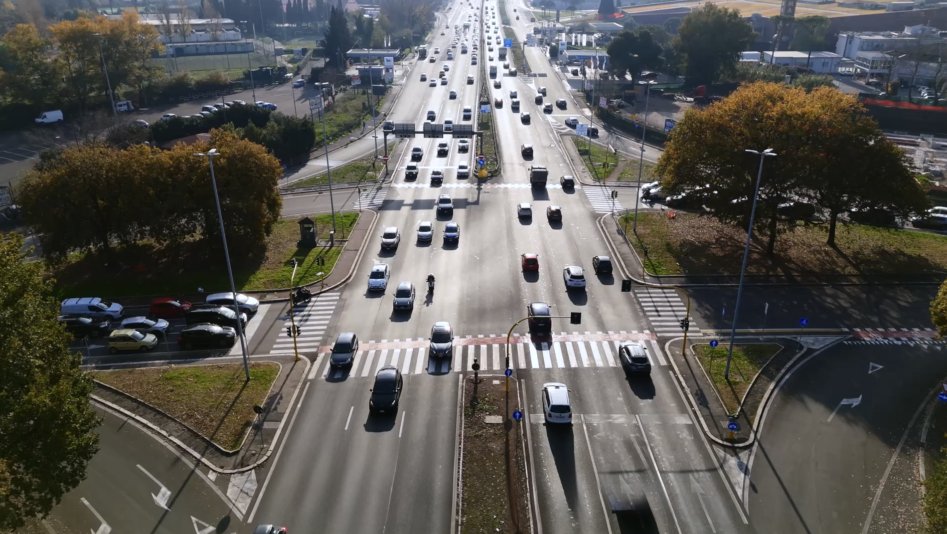
Piazzale Venticinque Marzo 1957 is one of Rome’s most dangerous intersections. Located in the EUR district, it connects major arterial roads carrying high-speed, high-volume commuter flows between residential and business areas. The context is dominated by car dependency, peak-hour congestion, and complex manoeuvres - conditions that amplify collision risks and expose commuters to severe hazards.
Key challenges include:
- Frequent and severe crashes, including fatalities.
- Complex traffic patterns with multiple high-capacity roads and turn-around loops.
- Risky interactions between cars, motorcycles, and pedestrians, compounded by limited granular safety data.
Rome has allocated €2.1 million for redevelopment and developed a redesign to improve safety and traffic flow. However, this investment must be justified: the proposed design needs to be tested and validated for effectiveness before implementation. Unlike small-scale fixes, this high-risk corridor demands a data-driven approach to ensure measurable safety gains and long-term value.
The urgency is clear: without intervention, the intersection remains a critical liability - socially and economically. Every euro spent should translate into fewer crashes, reduced social costs, and improved mobility. Testing the redesign with robust evidence is essential to protect lives, optimize traffic, and deliver a strong return on investment for the city.
The Solution
Roadscor was applied to proactively assess safety risks at Piazzale Venticinque Marzo 1957 using conflict-based analysis rather than relying solely on historical crash data. The platform simulates thousands of interactions between road users and calculates the probability and severity of conflicts, including controllability - the likelihood that an incident can be avoided. This methodology, adapted from Siemens’ ISO 21448 (SOTIF) approach for autonomous vehicles, enables detection of unknown-unsafe scenarios in complex traffic environments.
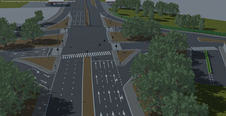
For Rome, a digital twin of the intersection was created using traffic counts, floating car data, and police estimates for pedestrian and cyclist volumes. These inputs allowed scenario modelling across hundreds of routes, including variations in speed and lateral deviations. Each route was simulated against others in time to identify high-risk interactions among cars, motorcycles, and pedestrians, pinpointing critical areas such as turn-around loops where unexpected manoeuvres occur.
Key features include:
- Predictive risk modelling for multimodal flows
- Severity-to-cost conversion, supporting evidence-based decisions
- Scalability for large, complex corridors
- Integration with design, ensuring lane redesign, improved markings, and safer crossings are embedded in the redevelopment
By shifting from reactive crash analysis to proactive simulation, Roadscor enables cities to mitigate risks before implementation.
Making an impact
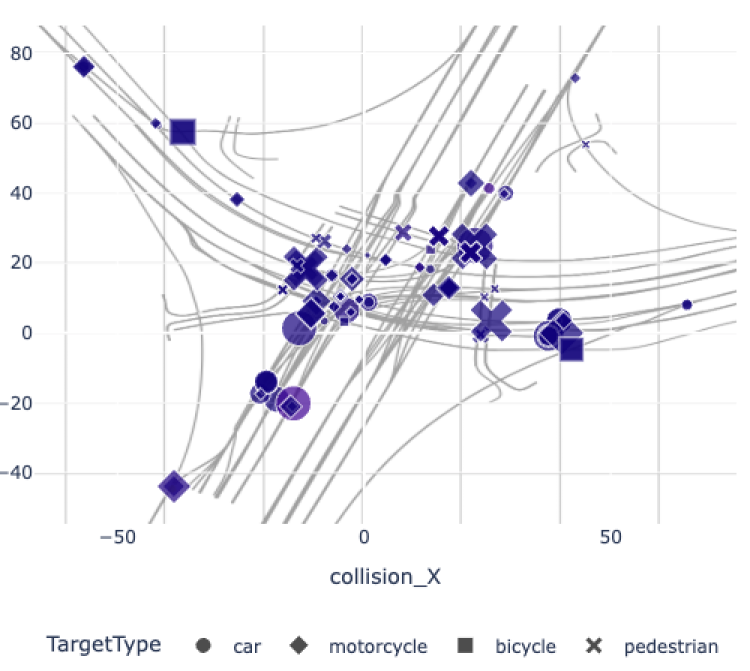
Roadscor’s first iteration of the current intersection layout revealed 374 collisions (208 car-to-car, 147 car-to-motorcycle, 19 car-to-pedestrian) and 439 near-misses, resulting in a total risk score of 28.79. Severity analysis showed 284 minor, 77 moderate, 10 serious and 3 fatal possible conflicts. These findings confirmed the intersection’s high-risk nature and the urgent need for intervention.
The second iteration tested the redesigned layout and demonstrated a significant improvement: 111 collisions (35 car-to-car, 45 car-to-motorcycle, 25 car-to-pedestrian, and 6 car-to-bicycle) and 166 near-misses, reducing the total risk score to 14.50 - a nearly 50% decrease in overall risk exposure. Severity analysis for this iteration showed 64 minor, 25 moderate, 16 serious and 6 fatal possible conflicts, alongside 166 near-miss events. While the redesign substantially lowered overall risk and minor incidents, the increase of serious and fatal conflicts was surprising.
A quick analysis through Roadscor's visualisations showed that the increase is attributable to the traffic signal timing and the increased number of modelled traffic paths. As such, further refinements focus on optimising green phases and clearance times to balance pedestrian safety with traffic efficiency. Adjustments are being evaluated for their impact on flow, with the expectation that these measures will further reduce severe collisions and associated social costs.
Lessons learnt
One key challenge was the limited availability of granular data for such a large, high-volume intersection. While traffic counts and floating car data were available, pedestrian and cyclist volumes relied on police estimates, introducing uncertainty. This highlighted the need for richer behavioural datasets in future projects, such as video analytics or sensor-based monitoring. Another complexity was modelling turn-around loops and signal phases, which required additional iterations to capture unpredictable manoeuvres accurately.
Creating a digital twin and applying probabilistic scenario modelling proved essential for success. While the redesign significantly reduced overall risk, the increase in serious and fatal incidents prompted a deep-dive to identify the source of additional risk. Using conflict-location graphs and video visualisations, the team traced these incidents to new crossing locations and traffic signal timings as likely contributing factors. Further adjustments to signal timing will be assessed in the next iteration to mitigate these risks relative to traffic flow. These insights will enable Rome to embed safety measures into its €2.1 million redevelopment plan, proactively ensuring risk mitigation aligned with Vision Zero objectives.
The approach is highly replicable for other complex intersections: it requires only basic traffic data to start, scales to multimodal environments, and deliver actionable insights without waiting for crash history.