Traffic Inventory, Lines, Defects Detection, Mapping & Analysis
An AI-driven road inspection and digital mapping platform that identifies missing traffic signs, lane line quality and road defects to optimise city maintenance operations.
Supported by: EIT Urban Mobility
Product Details
Traffic Inventory, Lines, Defects Detection, Mapping & Analysis is an AI-powered road inspection and digital mapping solution designed to help cities and road authorities modernise infrastructure monitoring and maintenance planning.
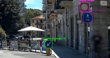
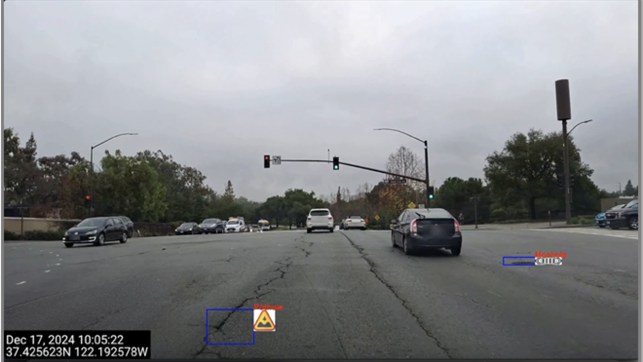
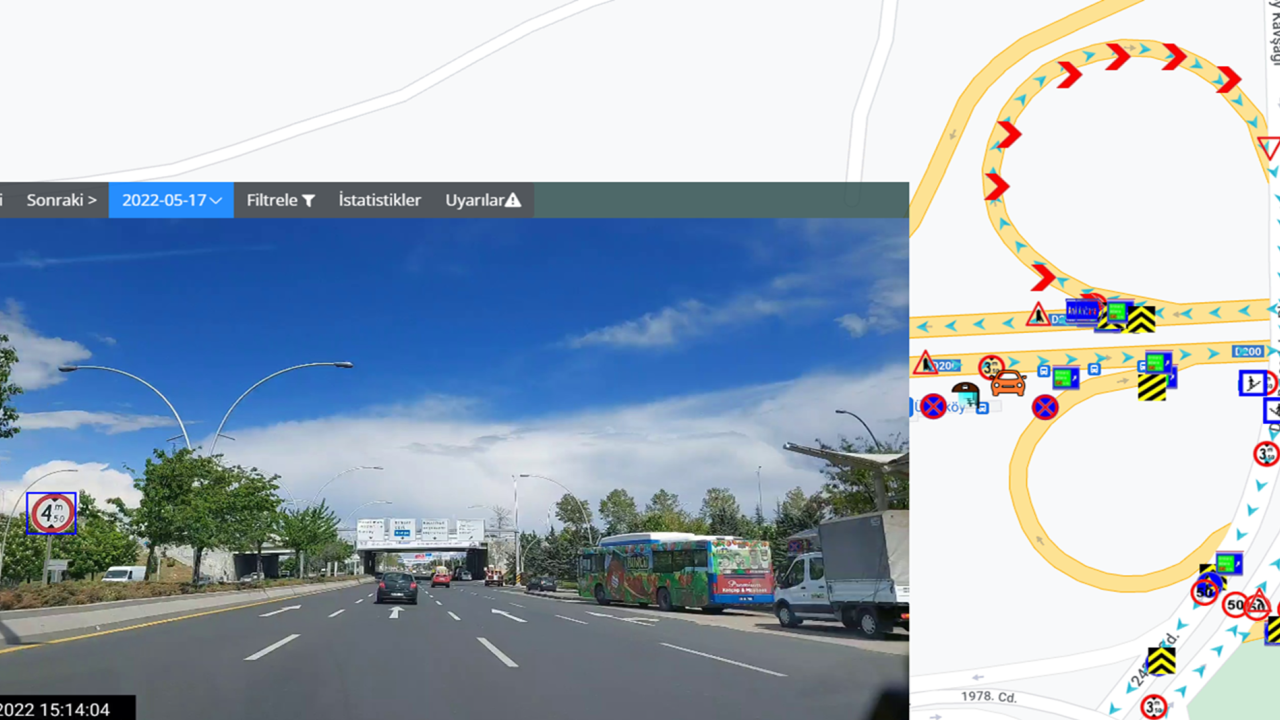
The platform processes road imagery collected from mobile cameras with survey vehicles. Using advanced neural networks and computer-vision algorithms, the system detects and classifies:
• Traffic inventory (existing and missing traffic signs, markings, roadside assets)
• Lane line quality and anomalies
• Pavement defects (potholes, cracks, surface deformations)
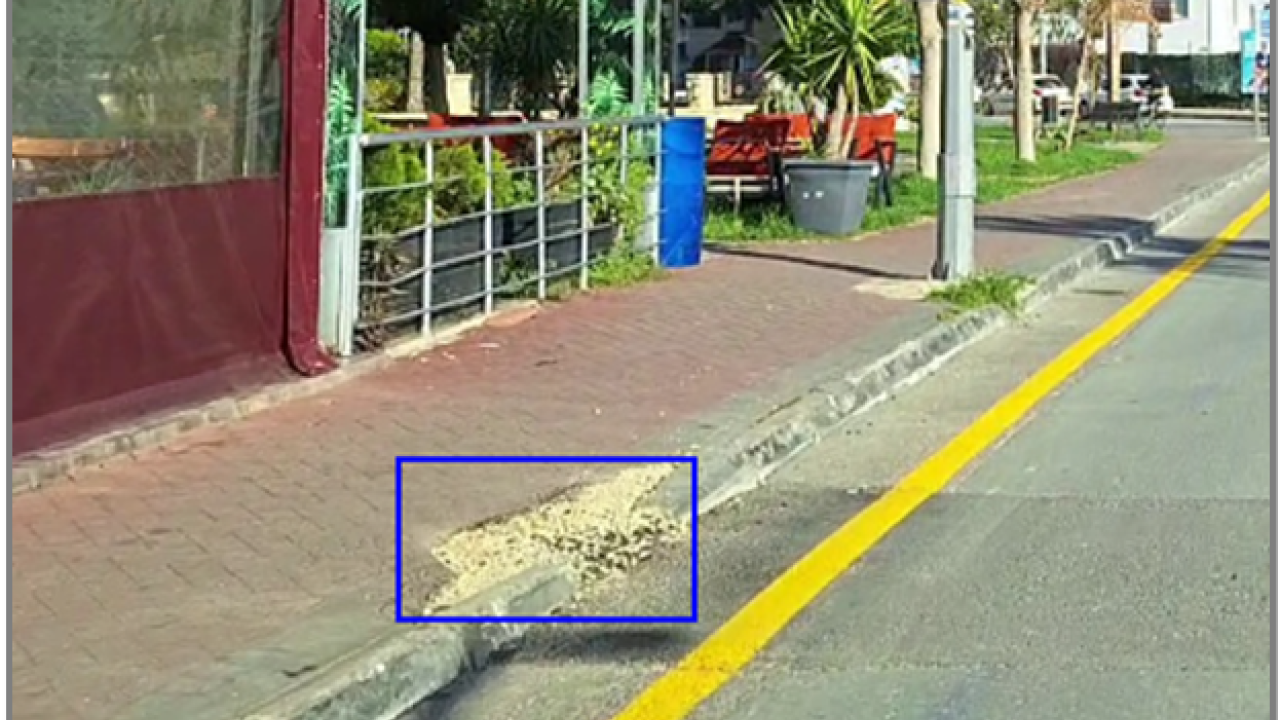
• Sidewalk and curb defects
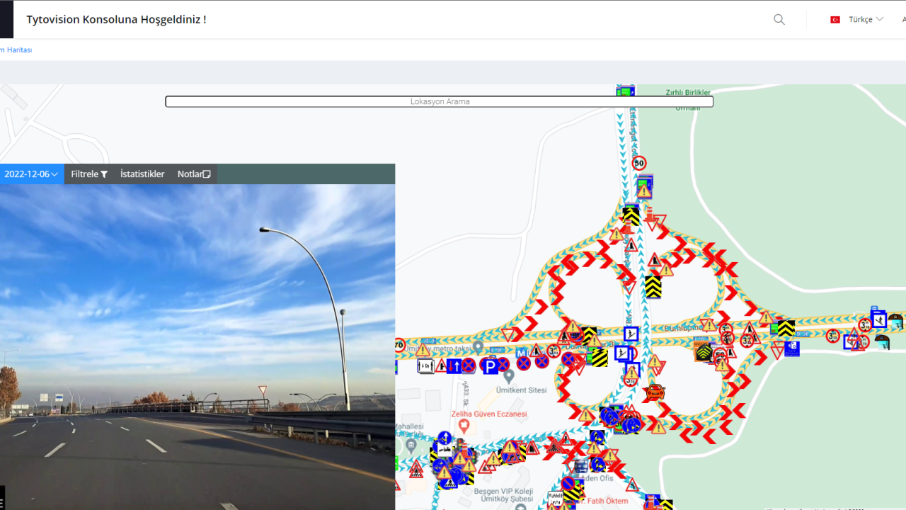
All detected assets and defects are mapped onto an interactive geospatial interface, enabling authorities to visualise infrastructure conditions with precise location data and snapshot-based imagery.
By replacing inefficient manual inspections, the platform enables faster decision-making, optimised maintenance budgets, improved road safety and reduced operational costs.
Availability
Discover cities and markets where the product is available