Data-driven risk assessment for safer walking and cycling in Verona, Italy
The Challenge
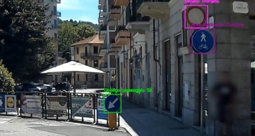
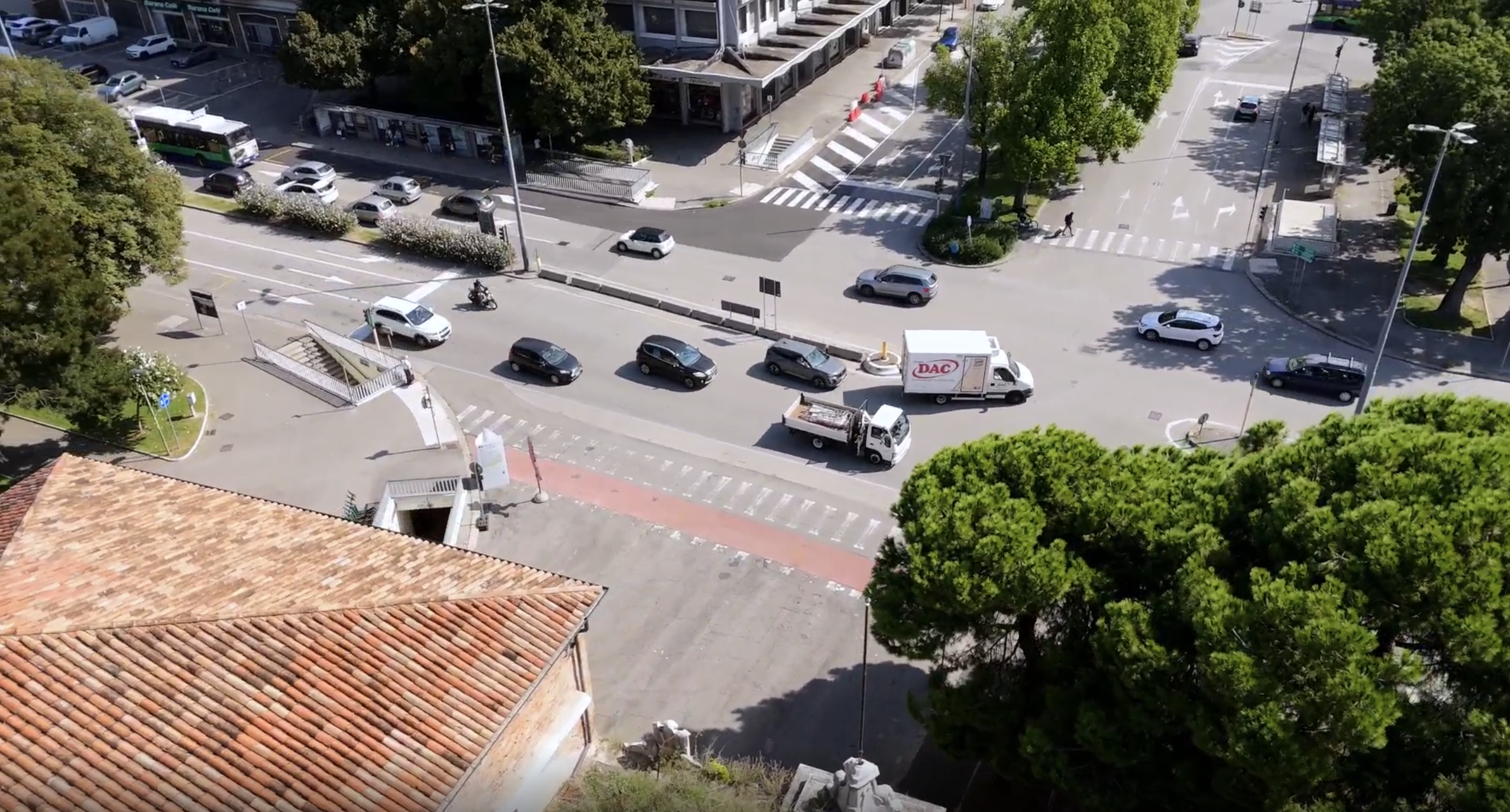
The pre-implementation context at Porta Vescovo (Verona) reveals critical safety and accessibility issues for vulnerable road users (VRUs). The intersection is a dense, historically car-centric node where six major roads converge, generating complex traffic patterns and high vehicular volumes - up to 5,175 vehicles/hour during peak times. Despite underpasses intended for pedestrians, these remain underutilised due to poor design (lack of elevators, bicycle access), creating architectural barriers for the elderly, disabled and cyclists. Observational data show pedestrians avoid these tunnels, opting for at-grade crossings without protection, exposing them to active traffic flows.
Sidewalks are narrow, discontinuous, and waiting areas at signalised crossings are insufficient, forcing pedestrians into hazardous proximity to vehicles. Speed limits of 50 km/h on straight sections amplify risk. Accident data confirm persistent blackspots: Via Torbido/Via Bassetti and Via Barana/Corso Venezia recorded multiple incidents, including pedestrian fatalities (e.g., 2022 hit-and-run). Between 2016–2019, pedestrian deaths rose despite overall accident declines. Behavioural analysis highlights frequent non-compliance (jaywalking), reflecting infrastructure misalignment with user needs. These conditions - fragmented public space, unsafe crossings, and high traffic density - need interventions before implementation to ensure universal accessibility and mitigate severe VRU exposure.
The Solution
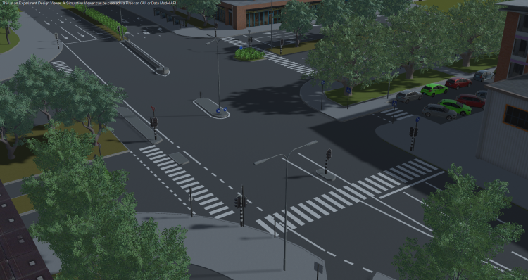
The solution leverages Roadscor, a simulation-based safety assessment tool to proactively identify and mitigate risks for vulnerable road users (VRUs). Unlike traditional crash-based approaches, Roadscor models thousands of plausible multi-actor scenarios using high-resolution traffic data, behavioural variability, and Siemens’ Critical Scenario Creation engine. This enables detection of conflicts before accidents occur, addressing the challenge of fragmented public space and unsafe crossings.
Key features include:
- Probabilistic scenario generation: incorporates observed behaviours (e.g., jaywalking, non-compliance) and traffic signal logic to simulate realistic interactions.
- Conflict scoring framework: evaluates likelihood, severity and controllability, prioritising high-risk scenarios for intervention.
- Data integration: combines micro-simulation inputs (geometry, signal timing, traffic volumes) with drone-derived pedestrian desire lines to reflect actual user patterns.
- Optimisation: runs thousands of simulations to identify critical configurations, such as wide crossings with long exposure times and inadequate waiting areas.
- Decision support outputs: provides risk matrices, conflict maps and numeric safety scores to guide design changes (e.g., reducing crossing widths, expanding active mobility space).
By shifting from reactive to predictive analysis, the solution directly addressed unsafe at-grade crossings and high traffic density, enabling targeted interventions.
Making an impact
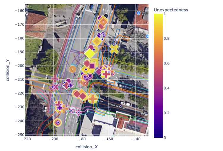
The application of Roadscor at Porta Vescovo delivered measurable social and safety impacts by enabling proactive design interventions. The tool analysed 34,200 sub-simulations, identifying 643 critical scenarios, including 39 pedestrian and 37 cyclist collisions, which represent over 26% of VRU-related conflicts despite their lower traffic share. This evidence guided proposals to reduce crossing widths (currently up to 24m) and expand active mobility space, directly addressing universal accessibility gaps.
Traffic data integration involved 22 cycling sections and 46 pedestrian sections, with drone analysis mapping desire lines that informed realistic behavioural modelling. The city’s accident monitoring system confirms the relevance: Via Torbido and Via Barana recorded 30 and 4 incidents respectively in 2022, reinforcing the need for targeted redesign. By prioritising high-risk configurations, the solution supports Vision Zero objectives, reducing exposure for thousands of daily users near Porta Vescovo FS station and adjacent bus stops.
While full implementation is pending, the methodology has already influenced municipal planning discussions.
Lessons learnt
Where the tool successfully integrated multisource data - including drone footage, traffic counts, and pedestrian desire lines - the initial setup required detailed data preparation and manual video interpretation to ensure precision. Its optimisation engine explored thousands of scenarios, pinpointing critical risk configurations that traditional methods often miss. By embedding ISO 21448 principles, Roadscor provided a structured, forward-looking framework for identifying foreseeable risks, aligning perfectly with Vision Zero objectives.
Behavioural coverage and severity scoring will expand in future iterations, enhancing predictive completeness and prioritisation accuracy. Analyses focused on peak hours, offering a strong baseline for future dynamic modelling. Next steps include automating video analysis, broadening behavioural modelling and integrating injury severity scoring. The methodology - combining micro-simulation, probabilistic scenario generation and conflict scoring - is highly replicable for other complex intersections, paving the way for data-driven, universally accessible, and safer urban spaces.