Assessing accident risks at an unsignalised intersection in Hasselt, Belgium
The Challenge
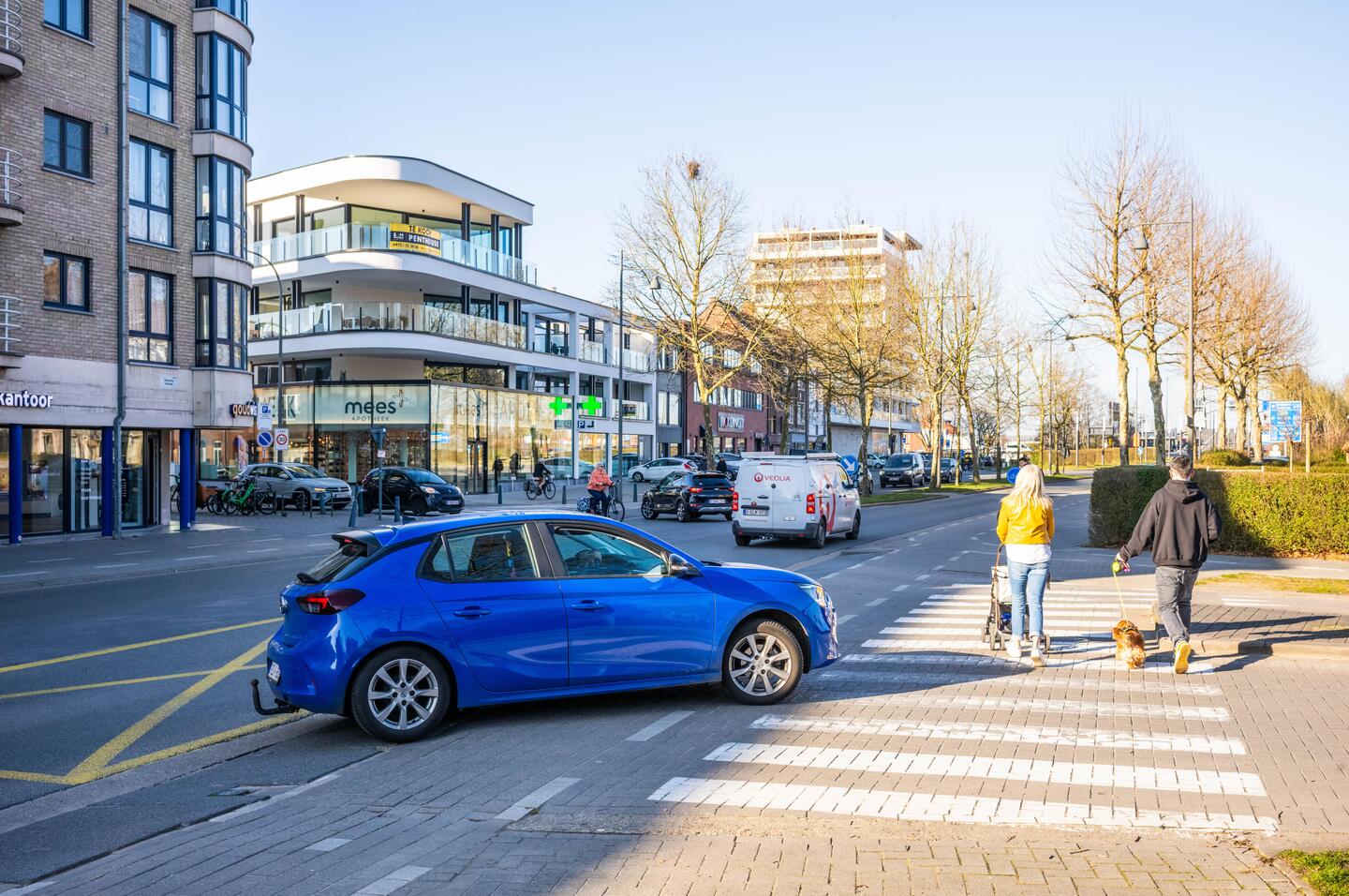
The intersection of Kempische Steenweg and Vilderstraat in Hasselt, Belgium presented growing safety concerns before implementation. Kempische Steenweg is a main access road to the city centre, while Vilderstraat connects to the Elfde Linie campus, an area undergoing transformation into a vibrant, low-traffic zone. This redevelopment was expected to significantly increase multimodal traffic: more pedestrians and cyclists attracted by new educational and recreational facilities and additional car movements as Vilderstraat would serve as a drop-off zone.
The intersection is unsignalised, meaning no traffic lights or priority control, creating unpredictable interactions between modes. Pre-analysis highlighted several critical issues:
- Expected raise in all traffic modes, increasing exposure to conflicts
- Lack of clear priority rules, amplifying risks for vulnerable road users
- Complex approach geometry, making manoeuvres less predictable
Although overall traffic flow was not projected to worsen, the combination of higher pedestrian and cyclist volumes with an unregulated intersection is potentially a significant safety challenge. Without proactive design measures, the evolving urban environment could be a hotspot for (severe) incidents. As such, Roadscor was used to identify where potential issues might arise and how these could be mitigated.
The Solution
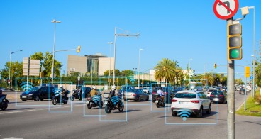
Roadscor tackled Hasselt’s challenge by focusing on the inherent complexity of an unsignalised intersection, where all traffic flows - cars, cyclists, and pedestrians - interact continuously and in any sequence. Unlike signalised junctions with clear phases and priority rules, these intersections create a dynamic environment where every approach can create conflict with every other at any moment. This unpredictability is amplified when multimodal volumes rise, increasing exposure for vulnerable road users.
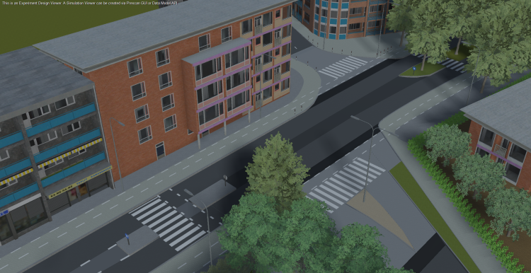
To address this, Roadscor applies predictive conflict analysis instead of relying on historical crash data. The platform builds a digital twin of the intersection and simulates thousands of real-world interaction scenarios, calculating the probability, severity, and controllability of conflicts. This structured approach, adapted from ISO 21448 principles for detecting unknown and unsafe conditions, enables cities to identify risks proactively and test alternative designs before implementation.
Key features were:
- Scenario-based risk modelling for uncontrolled intersections
- Multimodal coverage, prioritising pedestrians and cyclists
- Design comparison capability to evaluate safety trade-offs
- Scalable methodology using existing traffic models
By transforming complex, unregulated intersections into measurable risk landscapes, Roadscor helped the city of Hasselt to anticipate hazards and make evidence-based design decisions.
Making an impact
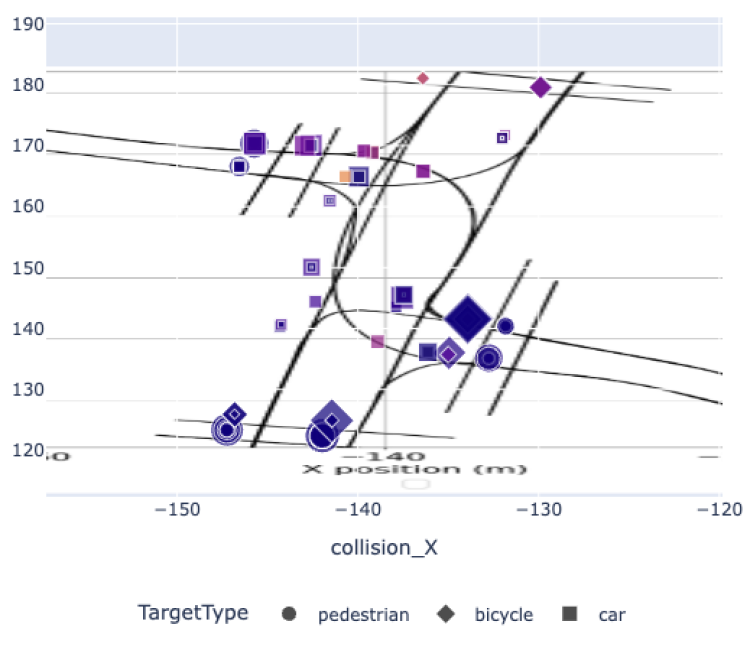
For the original layout of the Kempische Steenweg–Vilderstraat intersection, Roadscor analysed increased multimodal flows and identified 368 potential conflicts, with 145 flagged as possible collisions. The breakdown included 57 car-to-car, 51 car-to-pedestrian, 29 car-to-bicycle, and 8 pedestrian-to-car interactions. These insights were generated using the city’s existing traffic model, without additional data collection, demonstrating the ability to assess safety proactively in complex intersections where all flows interact continuously and in any sequence.
Severity analysis added further depth to the findings. Of the 145 collisions, injuries were calculated for 137 records, and 223 non-collision events were classified as near-misses. The total risk score (Rσ) reached 22.22, highlighting significant exposure. Conflict severity buckets showed 223 near-miss records (risk-score= 7.09), 73 minor (8.96), 32 moderate (3.39), 31 serious (2.78), and 1 fatal conflict. This distribution underscores that while most conflicts were minor or moderate, a notable share involved serious outcomes, emphasising the need for intervention. By combining probabilistic modelling with severity scoring, Roadscor provided a clear, data-driven picture of risk hotspots, enabling proactive design measures to protect vulnerable road users.
Lessons learnt
A key challenge was deploying Roadscor for an unsignalised intersection, as the initial analysis flagged too many scenarios as critical - even when real-world risk was minimal. This revealed the need to refine the algorithm to better handle uncontrolled junctions. Where the adjustment showed improvement, it does require further refinement to ensure trustworthy and reliable results.
Leveraging Hasselt’s existing traffic model was still a major advantage, enabling the creation of a digital twin without costly new data collection. Roadscor’s ability to simulate hundreds of routes with variations in speed and lateral deviations demonstrated the potential of proactive safety assessment. The methodology - combining probabilistic scenario modelling, multimodal conflict scoring, and design comparison - remains highly replicable and scalable, requiring only basic traffic data to start.