Did you know maps could do this? How mobile mapping impacts your life
How many times do you open your maps app on your phone or computer? Daily? Weekly? Let’s explore how mobile mapping and street view data affect your life in ways you couldn’t imagine!
The average person interacts with maps such as Google Maps (including Google Street View), or similar platforms, which provide driving directions and 360º imagery of points of interest (POI). This is primarily used for planning leisure activities, getting to a place of business, or the best route for avoiding daily traffic.
The most advanced and common way to capture such street view data is with mobile mapping systems. Yet, street view imagery, maps, and geospatial data at large are critical across a wide berth of organisations, with far-reaching results that touch more parts of our lives than we could possibly understand.
The hidden uses & Power of street view mobile mapping
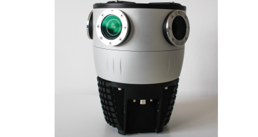
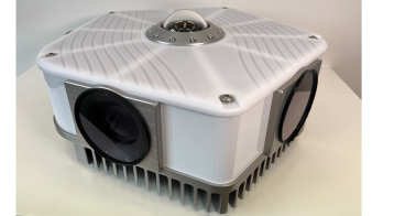
“Mobile mapping” refers to the process of using mobile devices or vehicles equipped with advanced sensors and technology to capture geospatial data of the surrounding environment while in motion. These systems typically include:
- GPS receivers
- LiDAR (Light Detection and Ranging) scanners
- (360º) Cameras
- Inertial Measurement Units (IMUs)
As the vehicle moves, these sensors collect data to create detailed and accurate 3D maps, which can include information about roads, buildings, vegetation, and other features.
Mobile mapping has numerous applications, including navigation and routing, urban planning, infrastructure maintenance, and disaster response. It can also be used for asset management, surveying, and creating immersive experiences in augmented reality (AR) and virtual reality (VR). Mobile mapping technology has advanced significantly in recent years, making it a valuable tool for industries ranging from transportation and construction to archaeology and environmental monitoring.
Towns and cities looking to expand cannot plan for new utility infrastructure without knowing what they have now. Engineering firms need to return the roads to the same state that they were in before the start of massive projects which entail ripping up pavement, sidewalks, and Right-of-Way.
Governmental agencies (tax authority and appraiser's office) and private companies (insurance and real estate firms) need to know how individual properties change over time in order to maintain accurate valuations. Such valuations enable proper taxation and insurance coverage to keep municipalities funded and to keep citizens protected.
Let’s dive in a bit deeper.
Mapping data isn’t all about private profits! How it brings relief
While many surveying and mapping companies are for-profit companies, there are many that provide vital services in emergency situations, including post-disaster data capture. Real-time street view collected in the aftermath of a large storm or other natural disaster can provide emergency response teams with the on-the-ground data they need to react appropriately. This can mean knowing where to send debris removal trucks to communities who are blocked off or provide food and water to those who might not have access to such necessities. Being able to collect, process and visualise the data quickly is of the utmost importance: How this can be done? Find more information here.
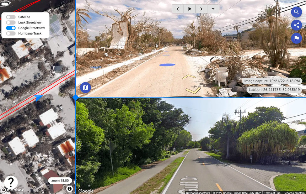
Before and after images of the same roadway in Florida captured after the devastating Hurricane Ian in 2022. Collected and visualised in 24 hours.
Mapping data isn’t all about roads! How it ensures safe rail travel
Did you know railways need to be mapped too? The Norwegian rail authorities require precise track location data, accurate within 10 mm horizontally, to be gathered annually. This monitoring aims to quantify track displacement due to factors like temperature fluctuations and heavy train braking, as excessive movement might lead to derailments. Hence, meticulous tracking of these shifts holds paramount significance. Railway lines need to adhere to such stringent restrictions in order to ensure that passengers and cargo arrive safely at their final destination.
Field, a Norwegian company and leader in surveying utilised a new mobile mapping solution to cut a project from a 6-month long campaign to only 10 days of data capture and about 4 to 5 weeks of data processing and quality control (Learn more about how they did so here).
Mapping data isn’t only about man-made assets! How it greenifies our cities
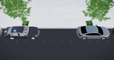
Greehill is an innovative green-minded startup with the goal to “Keep your city’s trees healthy, safe, and resilient and management costs low.” The company offers the world's first Smart Tree Inventory. By capitalising on the power of their mobile mapping system which contains some of the most advanced technologies in the world for street view data capture, Greehill captures data which will later be analysed by a computer algorithm which can determine failure risk, safety factor, leaf area, disease, and more. Based on this information a digital twin was created by Riegl LiDAR which meticulously replicates each tree, while high-resolution photos captured with a Mosaic camera providing different ranges, angles, and altitudes of each tree (find out more here). The efforts are helping clients from Singapore over Texas to Italy:
- Reduce lifetime cost of trees;
- Streamline maintenance and operations;
- Automate data analysis, evidence-based reporting, and real-time intervention management.
In summary, mobile mapping and street view data have evolved beyond just helping us find the nearest café or restaurant. They play a critical role in various use cases, incl. urban planning, emergency response, transportation safety, environmental conservation, and more, ultimately contributing to the betterment of communities and the safety of individuals.
So, the next time you open your map app on your mobile phone to find the nearest 4.6+ rated café or restaurant, think about all of the other ways similar mobile mapping data is saving lives, helping cities develop, and providing insights to better manage our communities.
Lynn Puzzo is the Director of Sales & Marketing at Mosaic, a hardware company specialising in 360º imagery solutions. With nearly a decade of online, content, and digital marketing expertise, she fosters relationships in the geospatial community, and is passionate about empowering people and communities with geospatial insights. As a globetrotter and culture enthusiast who has lived around the world, she weaves her experiences into storytelling.
Published on 4 September 2023.