Products
Explore market-ready mobility solutions across diverse needs and areas. Discover innovations proven to positively impact global smart cities.

Parkly: Modular urban furniture
Parkly's multifunctional and modular urban furniture helps to…
Find out more...about Parkly: Modular urban furniture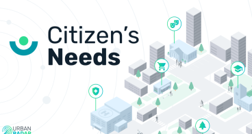
Citizen's Needs by Urban Radar
Proximity based urban planning and 15-min city to meet citizen's…
Find out more...about Citizen's Needs by Urban Radar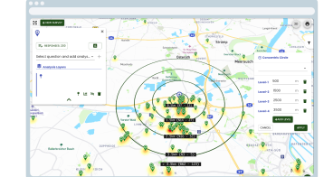
Mapalyse: Public Participation GIS Tool
Increase citizen engagement by collecting public opinions to…
Find out more...about Mapalyse: Public Participation GIS Tool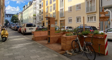
SET: Street Experiments Tool
SET helps to implement street experiments (quick and low-cost…
Find out more...about SET: Street Experiments Tool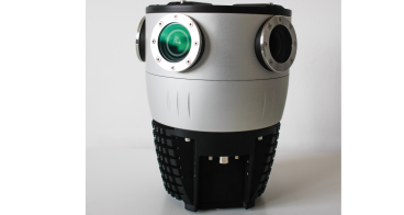
Mosaic X: 360º camera for 3D modelling and mapping
Mosaic X is a purposely-built, top quality mapping camera that allows…
Find out more...about Mosaic X: 360º camera for 3D modelling and mapping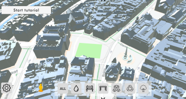
ModelMe3D: Immersive Co-Design of Public Spaces
ModelMe3D is the only co-design platform in the world where costumers…
Find out more...about ModelMe3D: Immersive Co-Design of Public Spaces
The Pin Bike Kit
Verified movements and rides to incentivize citizens and commuters to…
Find out more...about The Pin Bike Kit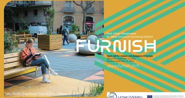
FURNISH
By enabling efficient and effective transformations of outdoor urban…
Find out more...about FURNISH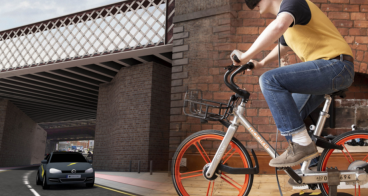
RAPID: 3D Prototyping
Early prototyping of mobility infrastructure changes, along with…
Find out more...about RAPID: 3D Prototyping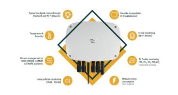
Smart Spot
IoT device for environmental parameter sensoring. The inclusion of…
Find out more...about Smart Spot
HOPU: Environmental data analysis & visualisation
Hopu’s SaaS is an evidence-based air quality solution with high…
Find out more...about HOPU: Environmental data analysis & visualisation
Mosaic: Mobile Street Mapping Service
Mosaic’s Mobile Street Mapping Service gathers large amounts of…
Find out more...about Mosaic: Mobile Street Mapping Service
Karos: Daily Carpooling App
Karos is a daily carpooling solution that connects employees for…
Find out more...about Karos: Daily Carpooling App
MUBE: Carpooling app
Shared short-distance rides for your daily commute
Find out more...about MUBE: Carpooling app
WOW! Urban Utopia: mobility and social hubs
WOW! transforms underutilised urban spaces into vibrant, sustainable,…
Find out more...about WOW! Urban Utopia: mobility and social hubs
Infrared City
AI-powered SaaS platform delivering rapid, high-accuracy…
Find out more...about Infrared City
Kobla Moving Lab
Kobla Moving Lab lets citizens in a focus area easily collect their…
Find out more...about Kobla Moving Lab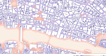
Diagonal: Spatial data visualisation
Transforming spatial data into holistic visual narratives
Find out more...about Diagonal: Spatial data visualisation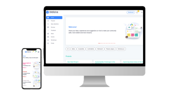
WeSolve: community engagement platform
Connect with your community, gather insights, and transform feedback…
Find out more...about WeSolve: community engagement platform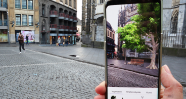
Cityscaper: 3D & Augmented reality visualisations
AR and 3D visualizations enhance citizen participation in…
Find out more...about Cityscaper: 3D & Augmented reality visualisations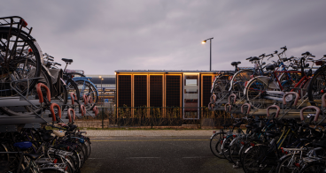
Hubbel: Mobility Hubs
Hubbel is unique in the world of circular building systems, the…
Find out more...about Hubbel: Mobility Hubs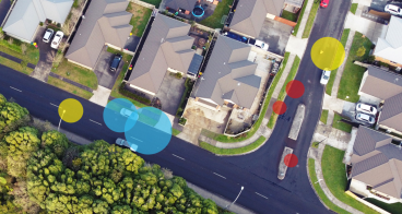
Cartologica: Asset inventory solution
Using digital techniques, Cartologica inventories every type of asset…
Find out more...about Cartologica: Asset inventory solution
Geolocated images, point clouds and streetviews
Production of geolocated images and streetviews of every kind of…
Find out more...about Geolocated images, point clouds and streetviews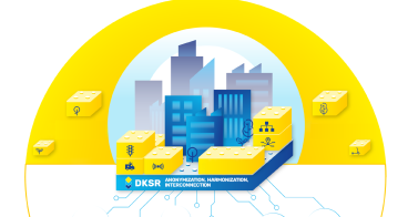
DKSR: Open Urban Data Platform
Put urban data into sustainable use for your municipality: With an…
Find out more...about DKSR: Open Urban Data Platform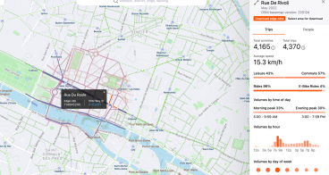
Strava Metro: Data for bicycle and pedestrian planning
Metro is a free tool that aggregates, de-identifies and…
Find out more...about Strava Metro: Data for bicycle and pedestrian planning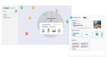
StreetMx: Data-based design & decision tool for cities, citizens to score and benchmark streets
Scores based on tangible aspects of sustainability, people - oriented…
Find out more...about StreetMx: Data-based design & decision tool for cities, citizens to score and benchmark streets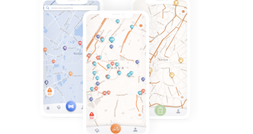
DUMA: Dynamic Urban Mobility Assistant
Creating accessibility by most accurate, local specific and up-to…
Find out more...about DUMA: Dynamic Urban Mobility Assistant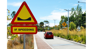
Actibump for safer roads
The friendly solution for safer roads - Actibump reduces speeding by…
Find out more...about Actibump for safer roads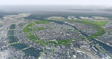
Strategic masterplanning for cities and new urban developments.
JaJa Architects strategic masterplanning for citites and new urban…
Find out more...about Strategic masterplanning for cities and new urban developments.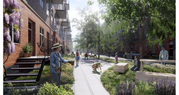
Street Transformations
We help municipalities, developers, or mobility providers communicate…
Find out more...about Street Transformations
The Intelligent City Performance Platform - Smart and liveable to the city of th
MHP Intelligent City Performance Platform helps cities and companies…
Find out more...about The Intelligent City Performance Platform - Smart and liveable to the city of th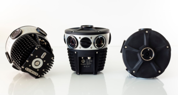
Mosaic 51: durable 360º camera for urban mapping & surveying
Mosaic 51 is a reliable and robust tool with clear, high resolution…
Find out more...about Mosaic 51: durable 360º camera for urban mapping & surveying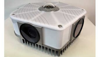
Mosaic Viking: 360º high resolution camera for urban mapping & surveying.
22K resolution captures EVERY last detail, delivering the highest…
Find out more...about Mosaic Viking: 360º high resolution camera for urban mapping & surveying.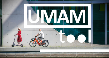
UMAM: Urban Mobility Assessment Model
The city‘s mobility performance will be analysed according to six…
Find out more...about UMAM: Urban Mobility Assessment Model
Watergen On-Board: Creating water from air
Watergen ON-Board is the perfect off grid and on-the-go water-from…
Find out more...about Watergen On-Board: Creating water from air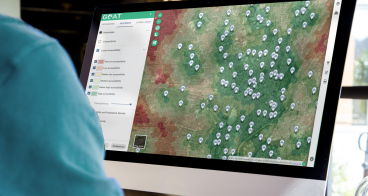
GOAT (Geo Open Accessibility Tool): Planning instrument for the 15-Min-City
GOAT is a cloud-based planning software that enables change-makers in…
Find out more...about GOAT (Geo Open Accessibility Tool): Planning instrument for the 15-Min-City
DASHBIKE: Camera device for cycling and infrastructure data collection
To make cycling safe and even more attractive in an innovative and…
Find out more...about DASHBIKE: Camera device for cycling and infrastructure data collection
FlexCurb Planning by Urban Radar
Streamline decision making on curb planning. Digitize curb and…
Find out more...about FlexCurb Planning by Urban Radar
Vianova Curb Manager
Vianova's curbside management tools enable cities to dynamically…
Find out more...about Vianova Curb Manager
Vianova Mobility Manager
Vianova tools aim to make mobility safer and more sustainable…
Find out more...about Vianova Mobility Manager140+ handpicked market-ready innovations supported by EIT Urban Mobility.