CiiM: Connected Intelligent Infrastructure Monitoring
A GDPR-compliant, 3D LiDAR and AI monitoring platform that measures movement with centimetre-level precision to optimise urban spaces, transport hubs, and buildings in real time.
Supported by: EIT Urban Mobility
Product Details
CiiM (Connected Intelligent Infrastructure Monitoring) is Digiflec’s 3D LiDAR-powered analytics platform that transforms how cities, transport hubs, and buildings are managed.
By capturing centimetre-level movement data in real time—without using cameras—CiiM delivers privacy-safe insights on vehicles, people, and space utilisation.
Cities use it to improve curbside management, reduce congestion, and cut emissions. Airports, councils, and building owners use it to optimise layouts, enhance safety, and reduce energy waste.
With proven deployments across Europe, including Fife Council, Tay Road Bridge, and Trondheim’s smart-loading-bay pilot, CiiM provides accurate, actionable data that turns infrastructure into intelligent systems.
See how your space performs, design it smarter, and manage it sustainably — with CiiM.
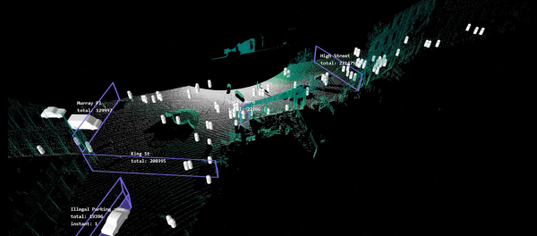
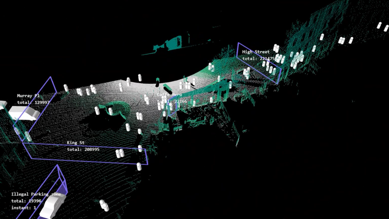
Zone under LiDAR monitoring using CiiM by Digilfec for active travel analysis, desire lines, illegal parking and loading bay analysis.
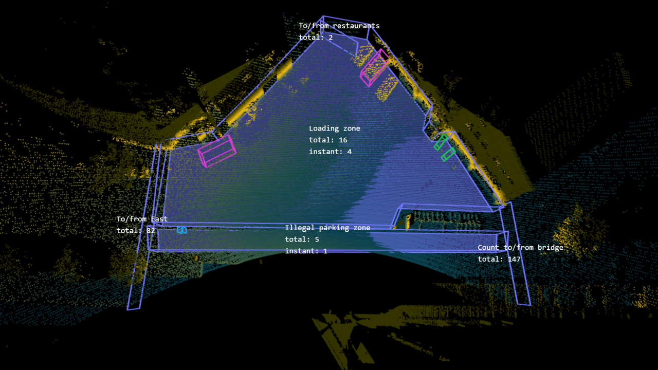
Zone under LiDAR monitoring using CiiM by Digilfec for active travel analysis, desire lines, illegal parking and loading bay analysis.
Availability
Discover cities and markets where the product is available