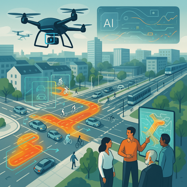
AI-powered traffic monitoring solution via Drones
An innovative approach that enables the simultaneous observation of multiple traffic metrics, all captured using a single advanced observation technique.
Supported by: EIT Urban Mobility
Product Details
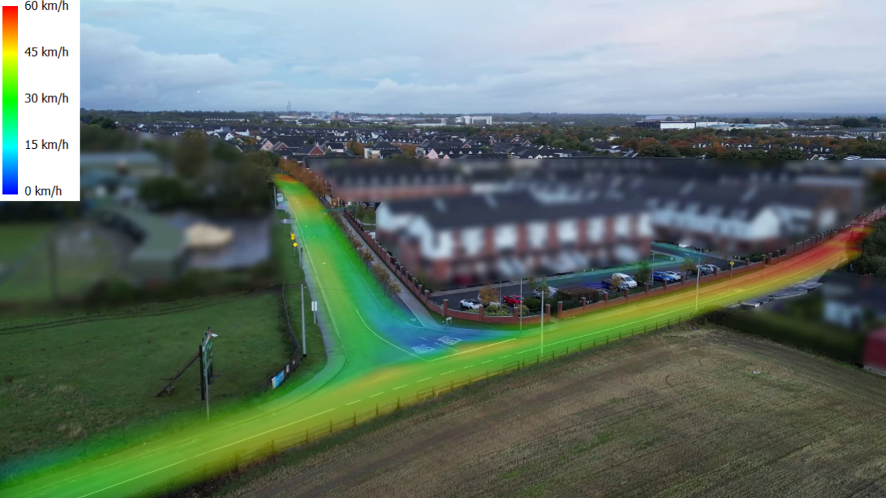
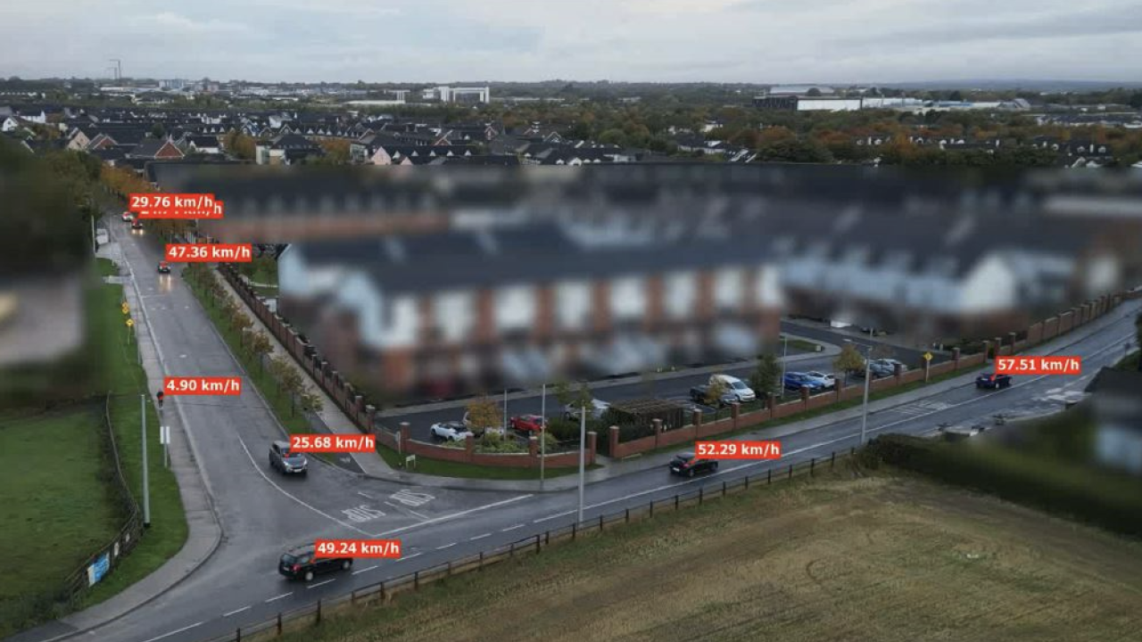
By integrating drone technologies with artificial intelligence, a great deal of data about a specific location is measured in a very efficient way. This objective measurement allows us to measure traffic volume, movement patterns, speed, behavioural trends, interactions between road users, and modal share. It is even possible to measure 'near conflicts', which indicate where potentially unsafe situations can occur. All this data is also visually supported, which makes it very useful in the context of participation, education or even awerness.
We offer customized drone studies (from A to Z), including a complete analysis, which can be used for many purposes and for any location (e.g. school zone, busy intersection, etc.).
Best Practices
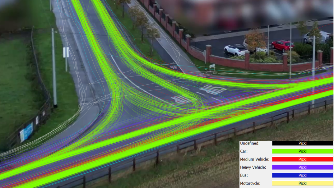
Leveraging drones for smarter safety decisions in Ireland
Availability
Discover cities and markets where the product is available