Leveraging drones for smarter safety decisions in Ireland
The Challenge
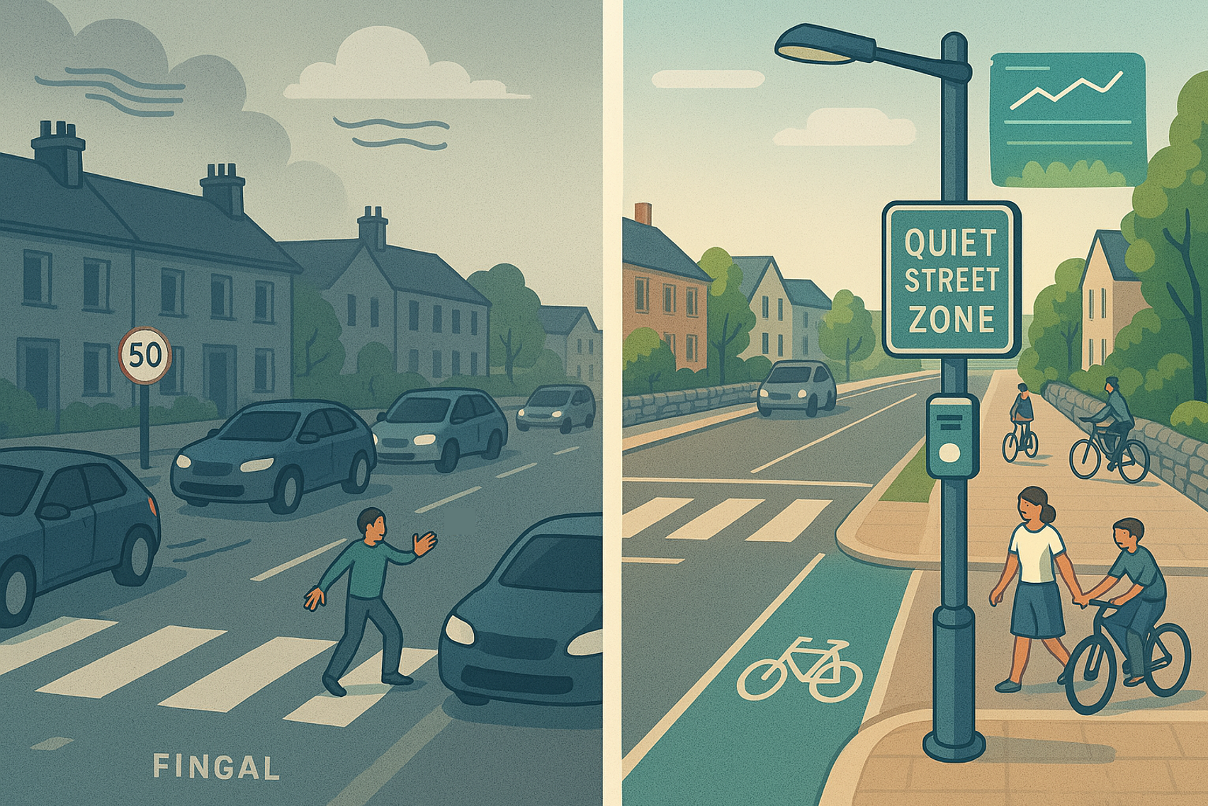
In Fingal County, Ireland, the rise in serious injuries and fatalities from road collisions has become a growing concern. To tackle this challenge, the county is planning to implement the Quiet Streets initiative in select areas.
Quiet Streets is an approach that prioritises safety and sustainability by restricting through-traffic while still allowing access for residents and business owners. This helps create safer, cleaner, and more pedestrian and cyclist-friendly environments,.
To measure the impact of this initiative, Fingal County Council was looking for a solution to collect data on key factors such as traffic volume, movement patterns, speed, parking, driving behaviour, modal share, air quality, and noise pollution in the areas nominated for the Quit Streets initiative.
The Solution
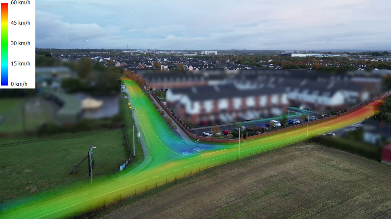
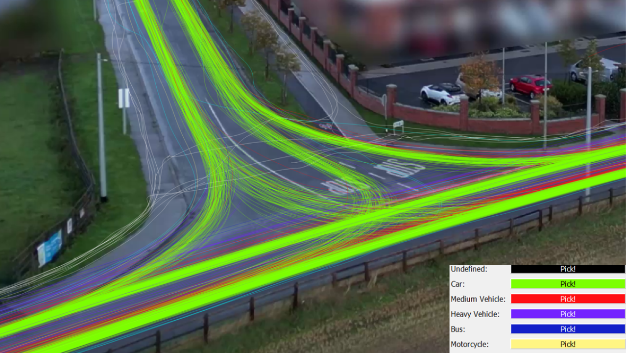
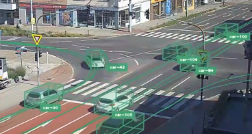
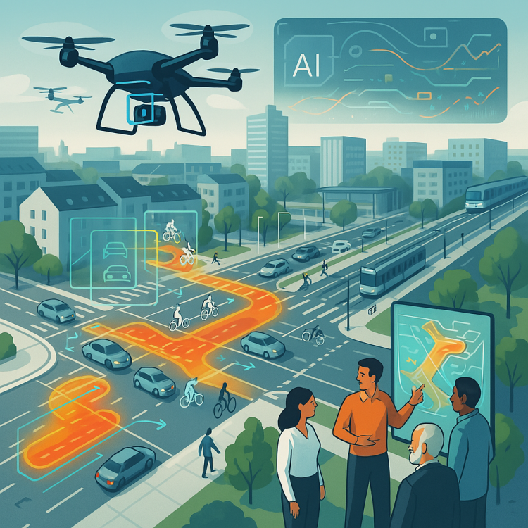
To address the challenge in Fingal County, a drone - and AI-powered traffic monitoring solution was developed by DriveSimSolution. This innovative approach enables the simultaneous observation of multiple traffic metrics, including traffic volume, movement patterns, speed, behavioural trends, interactions between road users, and modal share - all captured using a single advanced observation technique.
By integrating drone technology with artificial intelligence, this solution provided a comprehensive and efficient method for data collection to the city. Additionally, air quality measurements were recorded to assess the environmental impact of the initiative. The technology is highly scalable and replicable, making it ideal for conducting before, during, and after impact evaluations of the Quiet Streets intervention.
As part of the project, a Citizen Engagement study was conducted to ensure community involvement and feedback in the implementation process of the Quiet Streets initiative.
Making an impact
The implementation of the drone and AI-powered monitoring solution provided valuable insights into traffic, safety, and environmental factors. Through advanced video data collection and analysis, the innovation delivered the following results:
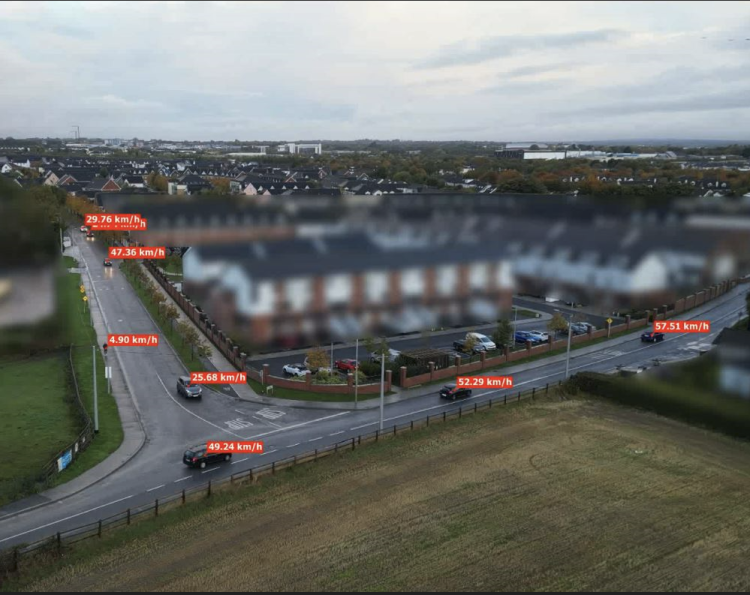
- Accurate traffic volume calculation: precise classification and counting of road users, including pedestrians, cyclists, motorbikes, cars, vans, buses, and trucks. During one measurement, 1115 vehicles were recorded coming from the east.
- Modal share data: conversion of raw traffic volume data into modal share statistics, applying correction factors through specialised algorithms. For example: during the morning rush hour at a busy intersection no less than 854 passenger cars were detected, 46 heavy vehicles and buses, 63 medium vehicles (e.g. vans), 15 pedestrians and 11 cyclists.
- Speed analysis: collection of detailed speed metrics, including average speed, maximum and minimum speeds, and V85 speed (the speed at or below which 85% of vehicles travel). The V85 speed at the above mentioned intersection was 65.77 km/h (max. permitted is 50 km/h).
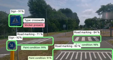
- Traffic violations & behaviour: detection and reporting of illegal or hazardous parking, non-compliance with traffic regulations, and detailed analysis of user presence within the monitored area.
- Air quality monitoring: deployment of street-level sensors to prevent data distortion from diluted emissions, The following aspects were measured: light intensity, sound levels, temperature, humidity.
Lessons learnt
The innovation demonstrated the value of advanced drone and AI technology in improving traffic safety and urban redesign projects. Key takeaways include:
- Potential for further innovation: future development will focus on moving and coordinating drones, a complex scientific challenge that requires further research and technological advancements.
- Scalability and expansion: the success of this innovation highlights the potential to expand the technology to more European cities, providing valuable insights for urban mobility planning.
- Impact on policy and decision-making: the objective and high-quality data collected can serve as a powerful tool for policymakers, supporting data-driven decisions to improve traffic safety and sustainable transportation.
- Citizen engagement as a key component: involving residents in the process can enhance community support and awareness, leading to better adoption and long-term success of mobility initiatives.
These insights reinforce the importance of data-driven urban planning, ensuring that cities can effectively tackle traffic challenges and create safer, more sustainable environments for all road users.