From fragmented data to smarter logistics planning in Las Rozas

The Challenge
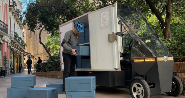
Las Rozas de Madrid is a fast-growing municipality characterised by low-density urban development, strong car dependency and extensive commercial and mixed-use areas. The rapid growth of e-commerce and home deliveries has significantly increased last-mile logistics activity across the city, creating pressure on road capacity, curb space and loading and unloading infrastructure.
Unlike dense historic city centres, logistics activity in Las Rozas is highly dispersed across residential neighbourhoods, shopping centres and major road corridors. Increasing numbers of delivery vehicles contribute to congestion, conflicts over curb use, illegal parking and inefficient occupation of loading and unloading zones, particularly around commercial and mixed-use areas.
Before the pilot, the municipality lacked a consolidated and data-driven understanding of how logistics activity was evolving across the city. Information on delivery routes, stop durations and congestion linked to freight activity was fragmented or unavailable, limiting the ability of municipal teams to identify priority intervention areas or assess the effectiveness of existing infrastructure.
At the same time, Las Rozas was advancing broader mobility and digital twin initiatives, but logistics data was not yet integrated into these planning processes.
The Solution
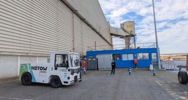
To address these challenges, Las Rozas implemented the LogE-Hubs platform developed by Urban Radar as a strategic decision-support tool for urban logistics planning. The pilot focused on providing the municipality with a consolidated, city-wide overview of last-mile logistics activity, enabling municipal teams to better understand how commercial vehicle flows interact with mobility systems, commercial areas and residential neighbourhoods.
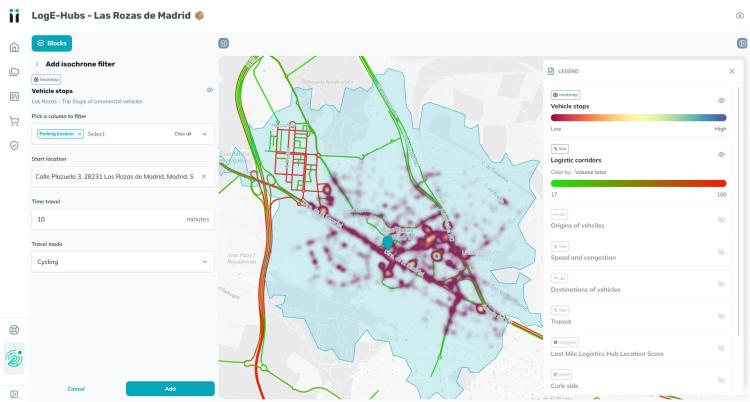
The LogE-Hubs module integrated city datasets such as loading and unloading zones, parking infrastructure, road networks, pick-up and drop-off areas and EV charging infrastructure with aggregated and anonymised floating car data from commercial vehicles. Through geospatial visualisation and analytics, the platform enabled the city to map delivery hotspots, identify congestion areas linked to freight activity and assess the effectiveness of loading and unloading zones.
The pilot also included a multi-criteria logistics hub suitability analysis, helping identify priority locations for future urban logistics hubs and supporting longer-term planning discussions.
The implementation process involved close collaboration between Urban Radar and municipal teams through co-creation workshops, iterative demonstrations and validation sessions.
Making an impact
The implementation of LogE-Hubs provided Las Rozas de Madrid with a consolidated and evidence-based overview of last-mile logistics activity across the municipality. By integrating multiple data sources into a single platform, municipal teams gained improved visibility over commercial vehicle flows, delivery stops, congestion hotspots and the use of loading and unloading infrastructure.
One of the main impacts of the pilot was the identification of logistics corridors and delivery hotspots linked to commercial centres, residential neighbourhoods and major road axes. These insights enabled the municipality to better understand where freight activity generates pressure on road infrastructure and curb space, supporting discussions on targeted interventions and future regulatory measures.
The platform also improved internal coordination between mobility, innovation and digital twin teams by providing a shared evidence base accessible across departments. This strengthened data-driven decision-making and demonstrated how logistics intelligence can become part of a broader urban governance framework.
In addition, the pilot demonstrated the technological readiness of advanced logistics analytics tools for operational use within medium-sized municipalities. The integration of logistics and territorial datasets showed how cities can use aggregated mobility data to support planning processes without requiring complex bespoke infrastructure.

Lessons learnt
One of the main lessons learnt during the pilot was the importance of consolidating heterogeneous datasets into a single, interoperable planning framework. Logistics-related information was originally distributed across different municipal services and external projects, making it difficult to build a coherent understanding of freight activity at city scale. The pilot demonstrated that the value of data increases significantly when mobility, logistics and territorial planning information can be analysed together.
The pilot also highlighted that medium-sized and low-density municipalities require logistics planning approaches adapted to their urban structure. In Las Rozas, logistics challenges were distributed across commercial corridors, residential areas and major road networks rather than concentrated in a historic city centre.
Overall, the experience showed that cities benefit most from data-driven logistics tools when they are integrated into existing planning and decision-making processes. Strong collaboration between municipal teams and technology providers was essential to ensure that analytical outputs matched operational needs and could support future policy and infrastructure discussions.