Mercedes-Benz Data Dashboard
Benefit from our safety, infrastructure, traffic, parking, and micro-weather data to increase your capacity for holistic diagnostics and data-based decision making in urban mobility.
Product Details
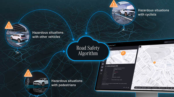
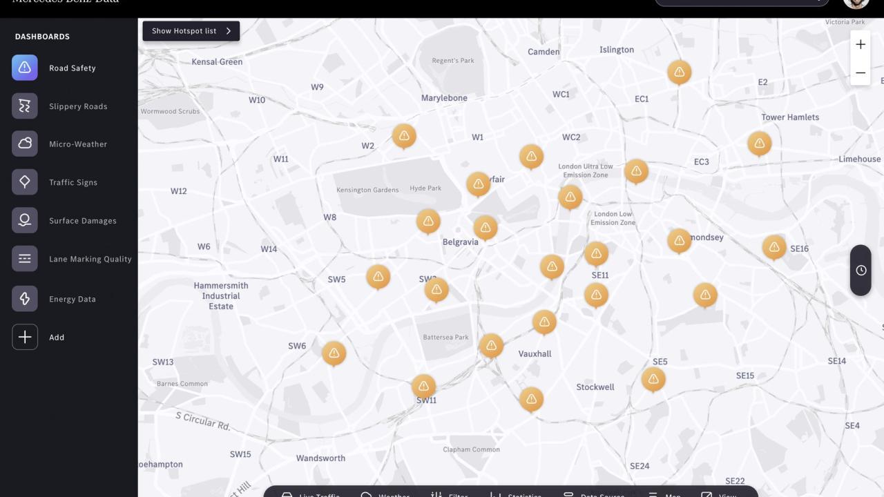
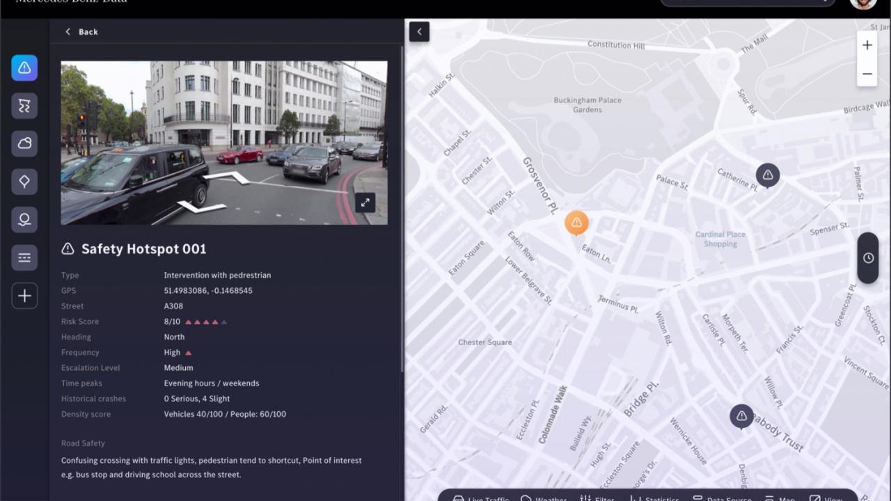
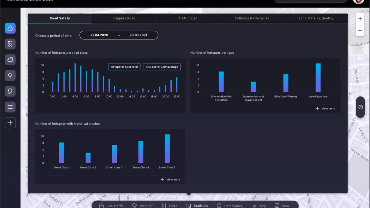
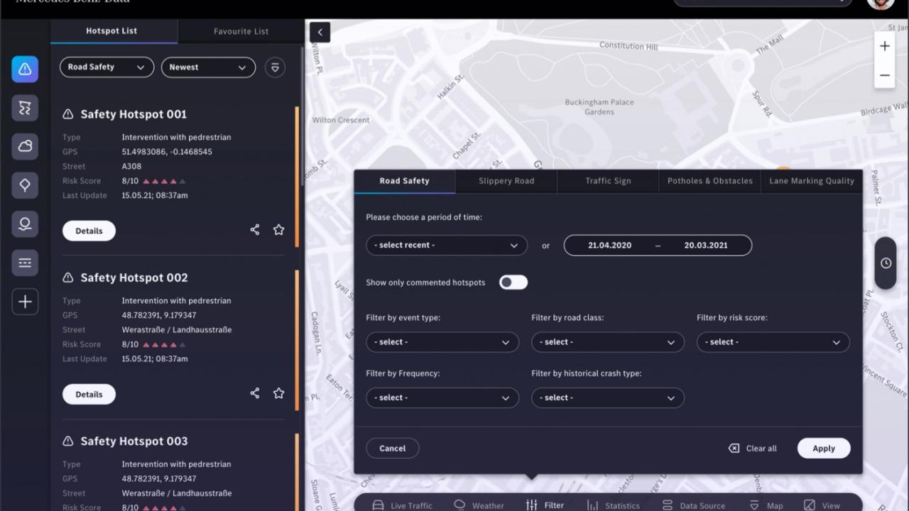
To meet cities’ goals of efficient, safe and clean urban transportation, data-driven decision making will be a key enabler. Our Mercedes-Benz vehicle data can make a significant contribution to improve safety in urban traffic, create transparency and increase efficiency in decision making. Our Data Dashboard combines several of our Mercedes-Benz Data APIs to help cities in their operational and strategic decision-making in the areas of safety, traffic, infrastructure analytics and micro-weather. With our Car-to-X technology, our vehicles communicate between each other and the transport infrastructure. The vehicles continuously scan and evaluate the road infrastructure and their environment to detect potholes and other damages, slippery roads and safety hotspots, existing and missing traffic signs, parking space utilisation and other changes in real-time. The data is analysed in our backend and uses the swarm intelligence of our fleet to track and predict changes over time.
To meet cities’ goals of efficient, safe and clean urban transportation, data-driven decision making will be a key enabler. Our Mercedes-Benz vehicle data can make a significant contribution to improve safety in urban traffic, create transparency and increase efficiency in decision making. Our Data Dashboard combines several of our Mercedes-Benz Data APIs to help cities in their operational and strategic decision-making in the areas of safety, traffic, infrastructure analytics and micro-weather. With our Car-to-X technology, our vehicles communicate between each other and the transport infrastructure. The vehicles continuously scan and evaluate the road infrastructure and their environment to detect potholes and other damages, slippery roads and safety hotspots, existing and missing traffic signs, parking space utilisation and other changes in real-time. The data is analysed in our backend and uses the swarm intelligence of our fleet to track and predict changes over time.
Availability
Discover cities and markets where the product is available