Lobelia Air: Data on street-level
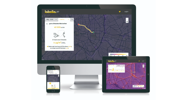
Lobelia Air is an innovative operational service which produces hourly high resolution maps of urban air pollution.
Supported by: EIT Urban Mobility
Product Details
Lobelia Air provides hyperlocal air quality data to fill data gaps due to low coverage of sensors in the field.
Today, Lobelia Air is operational in large cities in Europe, supporting city administrations that promote the European Green Deal and the low emissions zone. Sustainable mobility, health companies, media channels and international research institutions are using our innovative technology.
The Features:
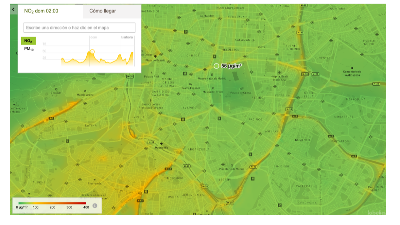
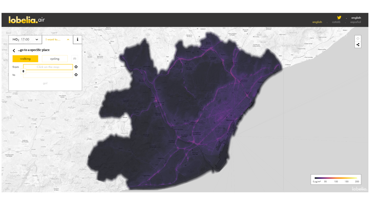
- Hourly updates of PM and NO2 and soon O3
- Automated configuration in any city
- Historical data and 72-hour forecast
- Gamification features
- Lobelia Air is based on a peer-reviewed methodology
- Validated in Madrid, Barcelona and Amsterdam, among others
How does it work?
- Lobelia Air urban dispersion model is driven by meteorology and emission proxy data
- The model assimilates all available local data
- The system is calibrated hourly with the most recent data
- The service predicts air pollution episodes
- Service provided through a dashboard and endpoint API
Lobelia Air provides hyperlocal air quality data to fill data gaps due to low coverage of sensors in the field.
Today, Lobelia Air is operational in large cities in Europe, supporting city administrations that promote the European Green Deal and the low emissions zone. Sustainable mobility, health companies, media channels and international research institutions are using our innovative technology.
The Features:
- Hourly updates of PM and NO2 and soon O3
- Automated configuration in any city
- Historical data and 72-hour forecast
- Gamification features
- Lobelia Air is based on a peer-reviewed methodology
- Validated in Madrid, Barcelona and Amsterdam, among others
How does it work?
- Lobelia Air urban dispersion model is driven by meteorology and emission proxy data
- The model assimilates all available local data
- The system is calibrated hourly with the most recent data
- The service predicts air pollution episodes
- Service provided through a dashboard and endpoint API
Availability
Discover cities and markets where the product is available