GOAT (Geo Open Accessibility Tool): Planning instrument for the 15-Min-City
GOAT is a cloud-based planning software that enables change-makers in implementing the 15-minute-city and creating livable places.
Product Details
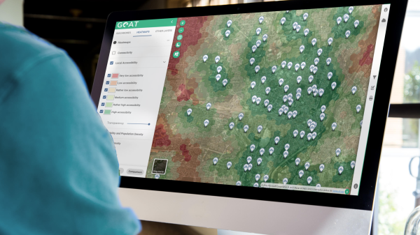
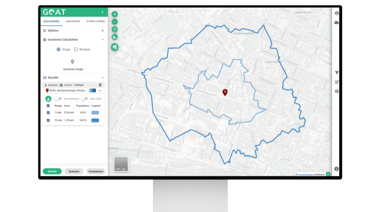
GOAT is a cloud-based planning instrument, which supports planners in implementing the 15-min-city by combining the land use and transport component. GOAT is fully open source and operates via an interactive web map. GOAT allows planners to easily assess the current situation with the help of accessibility analyses and to evaluate new concepts and projects, such as the construction of new infrastructure or facilities (e.g. kindergarten, bike sharing station).
GOAT is equipped with a plethora of complex spatial data. The GOAT subscription includes points of interest, buildings, population data, land use, environmental data and many more. In addition, costumers can easily integrate their own data sets. GOAT not only increases efficiency, but the fact-based analyses also support decision-making and investment processes that have often been subjective up to now.
Plan4better is happy to offer their software as a SaaS solution to municipalities, counties and consultants.
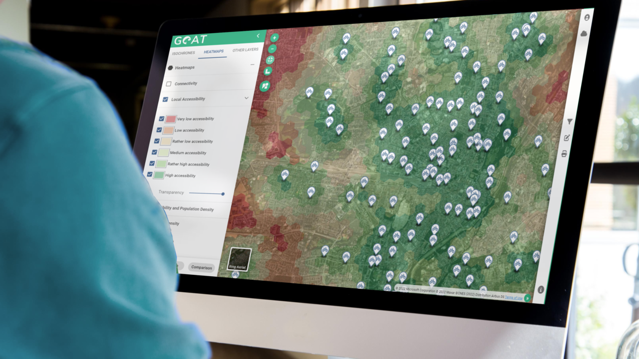
Availability
Discover cities and markets where the product is available