Helsinki, Finland: fleet-based urban data collection
The Challenge
How can Helsinki use professional fleet vehicles as a data collection platform?
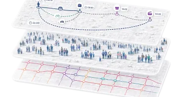
The city seeks a data collection system mounted on fleet vehicles to capture multiple types of urban data while moving through the city. The system should detect different road users to support traffic analysis, parking management, and vulnerable road user safety, while also mapping infrastructure assets such as curbs, markings, and traffic signs. In addition, it should identify changes in street infrastructure over time. To ensure accuracy in areas with GNSS interference, the solution should combine satellite positioning with alternative methods such as visual positioning. The city therefore needs a reliable, mobile, and multi-source urban data collection solution deployed through existing fleet vehicles.
Who can apply?
The RAPTOR Open Call 2026 is open to single small and medium-sized enterprises (SMEs). Proposals must be submitted by one legal entity only; consortia are not permitted.
Applicants must:
- Qualify as an SME under the European Commission definition
- Be legally established in an EU Member State or a Horizon Europe associated country
- Propose a solution addressing one RAPTOR 2026 City Challenge
Applicants may apply to multiple city challenges, but only one project can be funded per applicant.
For full requirements, visit the website.
Background
Currently, urban data collection in Helsinki relies on separate, stand-alone missions that are costly, inefficient, and often limited to a single data type. Existing methods—such as static sensors, manual counts, and occasional large-scale scans—are slow to deploy, expensive to maintain, and difficult to scale. These approaches also generate additional traffic and provide limited flexibility in a complex urban environment. Helsinki sees strong potential in using existing professional fleets as mobile sensing platforms to collect multiple data types simultaneously. This would enable a more dynamic, accurate, and efficient understanding of street-level conditions in the city centre.