Belgium-Ghent: Traffic safety analyses
Background
Challenge
How to improve traffic safety in Ghent through automated and cost-effective video analysis?
Context
Enhancing road safety for all road users, particularly active road users like pedestrians and cyclists, is a crucial objective for the City of Ghent’s Mobility Department. To effectively design safer road infrastructure, comprehensive insights into traffic patterns at accident-prone intersections and intersections that feel unsafe are essential. While the department currently collects data on traffic volumes and registered accidents, it lacks detailed information about traffic flows, desire lines, unauthorised manoeuvres, near accidents, noninjury accidents and other crucial factors influencing safety. On-site observations and camera footage (using AI) can provide insights and additional data, but methods for video processing are expensive and time-consuming, making it impossible for smaller cities to analyse multiple intersections.
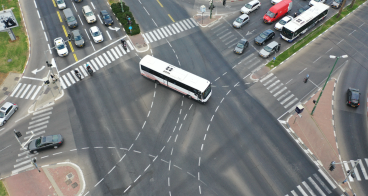
To address this challenge, the City of Ghent seeks cost-effective and automated software solutions capable of analysing aerial video images provided by the city´s sources (captured by drones and/or cameras with bird’s eye view). The solution should provide detailed information on traffic flows, near misses, and other crucial factors influencing road safety. The city of Ghent will collect and provide video images using drones and/or temporarily mounted cameras. Mounted cameras with continuous power supply capture extensive data but may have limited placement options (e.g. not sufficient height). Drones offer wider coverage and higher vantage points but face battery limitations, requiring multiple units or battery swaps, providing multiple shorter videos for the analysis. The city is looking for a solution able to analyse these different visual inputs and provide information on traffic safety on intersections.
The city is mostly looking for software solutions for video analysis, but other solutions that will help to improve the traffic analysis might be considered.
The city's main goal is to make evidence-based decisions to improve traffic safety, making (infrastructure) improvements to the road design and thus reduce the number of fatalities and near accidents on the road network.
The expected solution
The city should have access to video processing software that can transform the gathered footage into customised analyses. Affordable and customisable software with user-friendly tools is essential for effective data extraction and visualisation. The software should provide the city with editable format of the analysis (e.g. the aggregated data and analysis can be reused, visualisations can be edited or reused etc.) to avoid vendor lock-in. The city will need to be sufficiently trained on the use of the solution, to be able to exploit it extensively on its own (no black-box results).
Must-have:
- Produce basic reports on traffic flows and statistics
- Recognise, categorise, and count different transport modes for all possible trajectories on the intersection
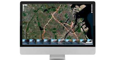
- Generate heatmaps of the trajectories of all road users on the intersection
- Detect accidents and near-accidents, which are instances where different road users' trajectories almost collide
- Comply with GDPR regulations to protect user privacy
Nice-to-have:
Provide detailed analysis of speed and velocity for every trajectory for every transport mode, with different visualisations.
Published on 4 March, 2024.


