Enhancing road safety for vulnerable road users in Konya and Sarajevo
The Challenge
Road safety remains a global challenge with over 50 million injuries and 1.3 million fatalities each year. Vulnerable road users, pedestrians, cyclists and motorcyclists, account for more than half of these deaths.
Current solutions often lack localised insights and fail to identify exactly which parts of the road network are risky and why. Without understanding the cause-effect relations, it is difficult for authorities to take proactive measures.
As a result, investments and interventions are not always targeted effectively, leaving critical high-risk areas unaddressed. Therefore this pilot has deployed advanced road safety analytics tool in Konya and Sarajevo to harness data-driven analytics and participation tools for scalable, replicable urban road safety improvements.
The Solution
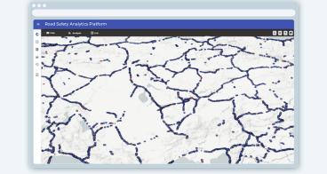
Safely is an advanced Road Safety Analytics System designed to identify high-accident-density areas, assess risks for all road users - including vulnerable ones and uncover cause-effect relationships based on accident data. The system provides:
- Hazardous location detection: identifies areas with high accident density and prioritises them for action.
- Cause-effect analysis: examines accident patterns by type, vehicle and location to answer the critical question: “where and how to improve?”
- Impact measurement: enables comparison of interventions and their effects on traffic safety.
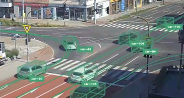
Through pilot demonstrations and field implementations in Konya (Türkiye) and Sarajevo (Bosnia and Herzegovina), the project integrates accident data, geospatial analytics and community feedback via Mapalyse (PPGIS tool).
These insights support the development of practical guidelines for spatial measures, such as enhanced signage, improved pedestrian crossings and upgraded road markings, ensuring inclusive and effective outcomes.
Both cities implemented their selected safety measures in the areas that Safely, Road Safety Analytics System, detected. Finally, we measured the impact of the implemented measures with hazardous location comparison feature of Safely and assess their effectiveness.
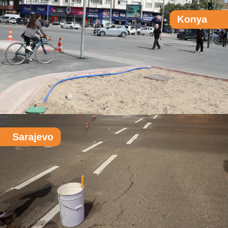
Traffic safety practices implemented in Konya and Sarajevo to enhance the safety of vulnerable road users.
Making an impact
The project was designed to deliver tangible safety improvements while actively involving local communities. Through SAFELY’s data-driven analysis, targeted physical interventions were implemented at two high-risk locations in Sarajevo and three in Konya, directly addressing hazards faced by vulnerable road users.
In parallel, community engagement was a central pillar: leveraging the Mapalyse tool, more than 300 citizens were empowered to identify and report unsafe areas, ensuring that interventions reflect real, lived experiences.
Together, these efforts aimed to significantly improve traffic conditions in the pilot areas, with an ambitious target of achieving a 30% reduction in traffic accidents involving vulnerable road users.

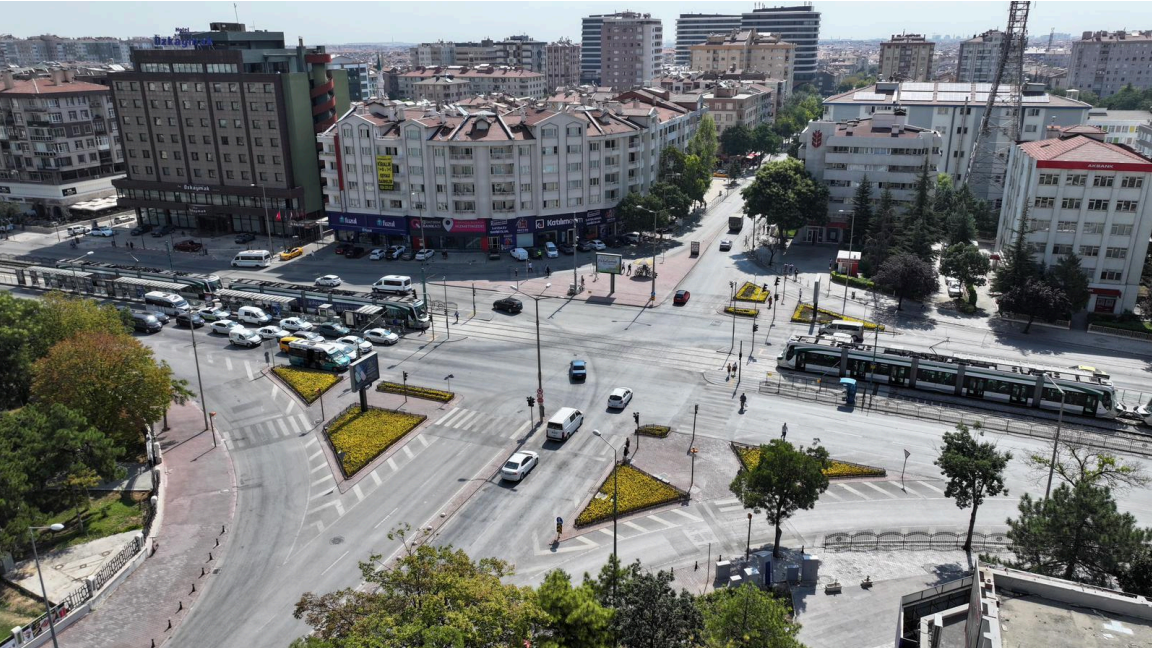
Field implementation pilot for vulnerable road users in Konya
Lessons learnt
Several key lessons have emerged from the project’s implementation. First, accident data only reaches its full potential when it is translated into clear, location-specific and actionable insights that decision-makers can readily use.
Advanced geospatial analysis and the identification of hazardous locations allow for far more precise prioritisation of interventions than traditional approaches.
Moreover, focusing on cause–effect relationships - rather than relying solely on accident counts - enables the design of targeted, user-specific safety measures, particularly for vulnerable road users.
At the same time, data-driven insights must be complemented by local knowledge; integrating community feedback ensures that proposed interventions are both relevant and widely accepted.
Systematically measuring conditions before and after implementation is also critical to assess effectiveness and build a strong case for continued investment. Finally, adopting a replicable and scalable analytical framework makes it possible for cities with varying levels of data capacity to implement evidence-based road safety strategies.