Mosaic: Mobile Street Mapping Service
Mosaic’s Mobile Street Mapping Service gathers large amounts of accurate data on desired areas. Geo-referenced images to create 3D models, digital twins, augmented reality (AR) platforms, and maps.
Supported by: EIT Urban Mobility
Product Details
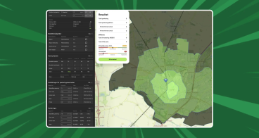
Governments and the private sector are increasingly demanding real-time, highly accurate street-level maps of their cities, spaces, environments, and communities. Mosaic’s mobile street mapping services use the highest resolution 360º cameras, specifically designed and built for mobile mapping.
Mosaic’s mobile street mapping service can be tailored to specific needs. It can include any type of environmental mapping contexts such as streets, facilities, bridges, tunnels, railway, assets, vegetation, etc. This service can include damage assessment, site monitoring or virtual surveying.
It is a fitting solution for organisations conducting asset inspections, inventory collection, or surveyors that need a high level of image detail. Smart city planners urgently requiring data capture can benefit from the quick and efficient delivery of Mosaic’s service.

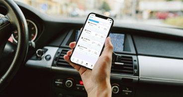
Availability
Discover cities and markets where the product is available