Mobile Mapping Systems.
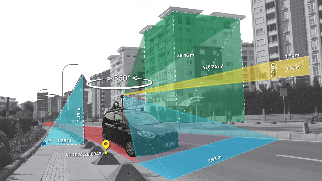
Urban road inventory production over panoramic images with point clouds.
Product Details
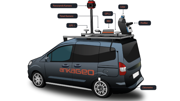
The mobile mapping system consists of Lidar, Profiler, Panoramic Camera, IMU, Odometer and GNSS hardware and data processing software mounted on the vehicle, working synchronously.
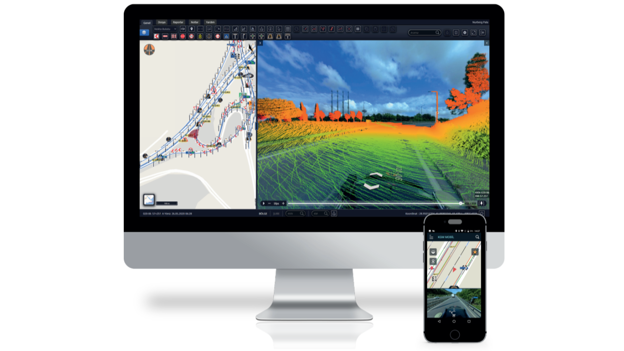
Production of inventories from the desk without going to the field with panoramic image and point cloud data. Dynamically making spatial inquiries and reporting incl.:
- Inventory production over panoramic image and point cloud
- Creating vertical and horizontal road profiles on the road
- Extracting dynamic reports with the reporting module
The mobile mapping system consists of Lidar, Profiler, Panoramic Camera, IMU, Odometer and GNSS hardware and data processing software mounted on the vehicle, working synchronously.
Production of inventories from the desk without going to the field with panoramic image and point cloud data. Dynamically making spatial inquiries and reporting incl.:
- Inventory production over panoramic image and point cloud
- Creating vertical and horizontal road profiles on the road
- Extracting dynamic reports with the reporting module
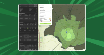
Availability
Discover cities and markets where the product is available