Innovative cycling infrastructure assessment in Barcelona and Sarajevo

The Challenge
Despite growing efforts to promote cycling, many cities continue to struggle with providing safe, well-connected, and inclusive cycling infrastructure. Challenges vary across urban areas and often include network gaps, maintenance issues, and social disparities that hinder cycling from becoming a viable mobility option for all.
For instance, even with infrastructure expansions in cities like the Metropolitan Area of Barcelona, Sarajevo, and Albertslund, cycling still represents a small share of overall mobility. Key barriers include insufficient network coverage, gender disparities, and poor infrastructure maintenance.
To boost cycling rates, cities need interconnected infrastructure that is inclusive and accessible - requiring strategic investment and evidence-based decision-making.
Yet, accurate, up-to-date data is often lacking, and existing studies and data sources are rarely integrated. Traditional methods of evaluating cycling infrastructure tend to be fragmented and reactive, focusing on isolated problems rather than offering a comprehensive view. This makes it difficult to assess the overall scale of challenges or identify specific areas needing improvement.
A more standardised, data-driven approach is essential to guide planning, prioritise investments, and track progress.
The Solution
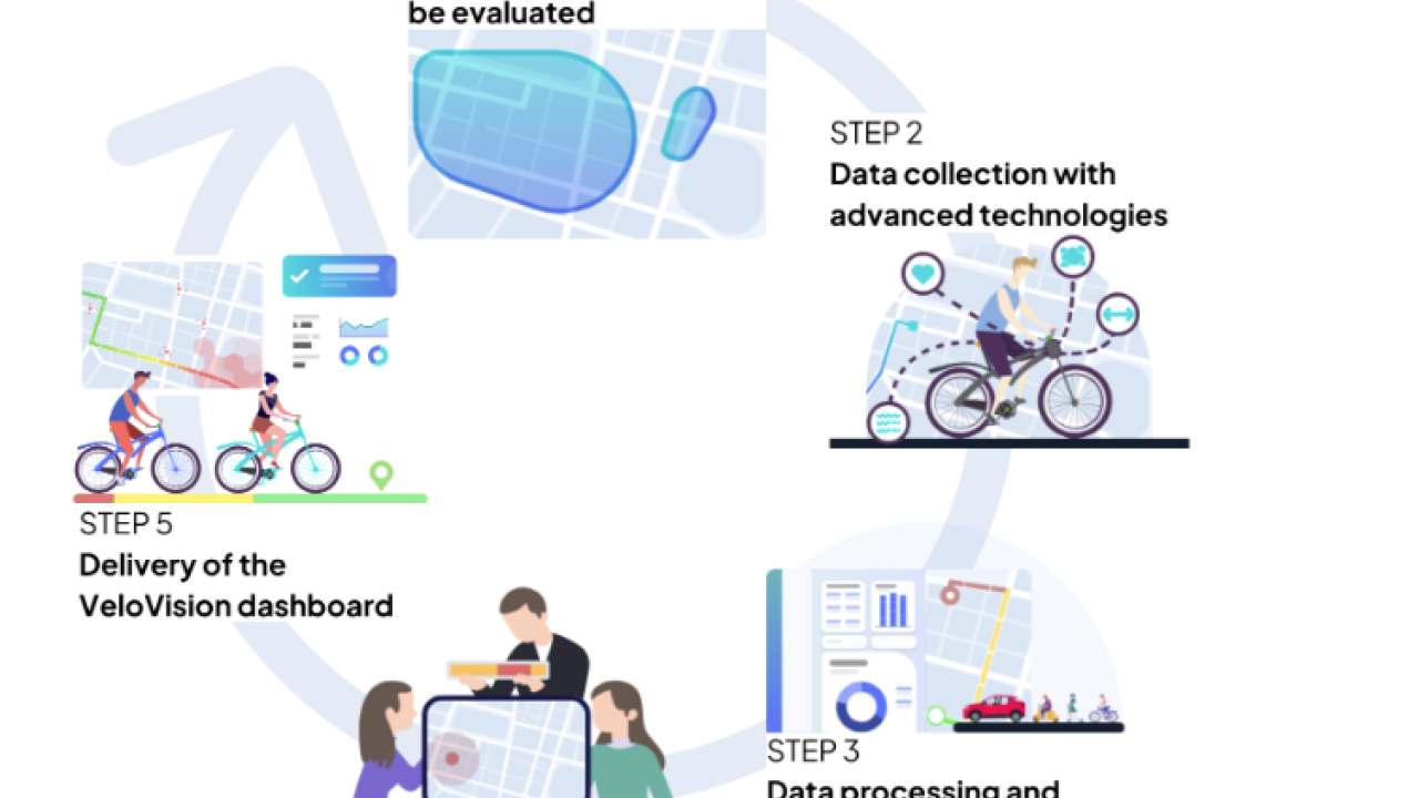
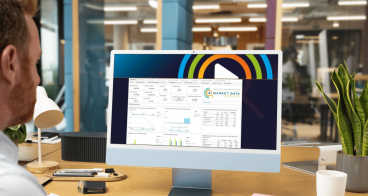
Velovision has been designed to tackle the previously mentioned challenges. It empowered local authorities to create safer, more accessible, and user-friendly networks through advanced assessments and data-driven insights.
Going beyond traditional methods, Velovision delivered automated, scalable, and actionable outputs that support informed decision-making and help cities prioritise investments. By leveraging AI, computer vision, and sensors, it evaluated infrastructure across multiple dimensions - including safety, air quality, accessibility, and connectivity.
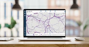
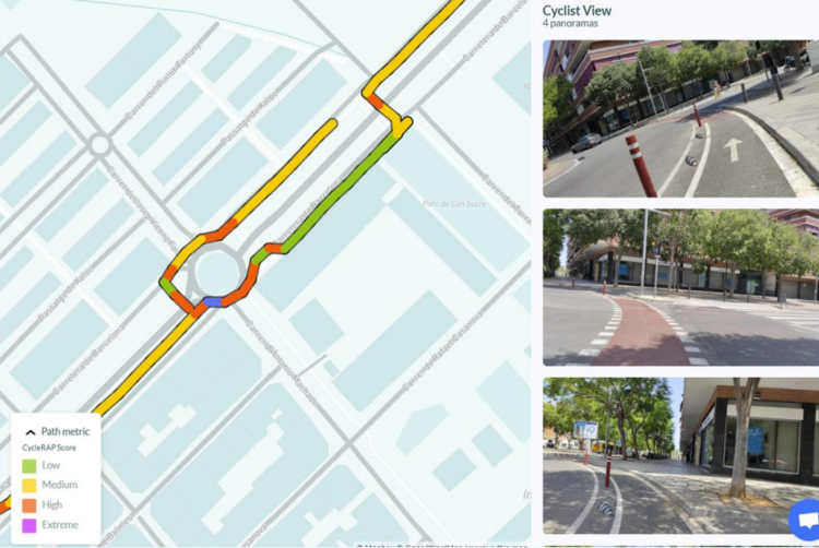
A total of 165 cycling-related attributes have been processed through the tool, with over 50 integrated into the interactive Velovision dashboard. This enables cities to map existing infrastructure, identify gaps, and automatically suggest improvements. Through the combination of three tools - ROAD, City Dive, and Lane Patrol - Velovision provided targeted recommendations to enhance cycling conditions efficiently.
Ultimately, Velovision served as an objective, data-driven platform for advocating infrastructure improvements. In the long term, it aims to become a go-to resource for urban planners and transport authorities, using AI, geospatial analysis, and real-time data to optimise cycling networks and improve the overall cycling experience.
Making an impact
Velovision automated data collection and analysis, improving speed, accuracy, and efficiency while reducing costs and manual input. Advanced technologies have made the assessment process approximately 24.7% faster, with AI handling 25% of the attributes.
During the pilots in AMB, Sarajevo, and the DOLL Living Lab, over 100 km of cycling infrastructure were assessed, demonstrating the tool’s effectiveness for urban cycling planning. Velovision’s dashboard visualised over 50 relevant attributes, enabling data-driven analysis of current conditions. The tool automatically generated 14,000 recommendations to enhance cycling safety, each with specific geospatial localisation.
“Above all, the project provided valuable data on missing infrastructure, such as necessary links to connect our paths. It also highlighted the lack of micromobility parking spots in Sarajevo, and the safety analysis provided solid data on areas needing improvement.”
— Damir Margeta, Bicycle Infrastructure Advocacy Director, City of Sarajevo
“The data allows us to determine the infrastructure length we have developed so far and the infrastructure we want to develop. We also have insights on the usage of the metropolitan cycling infrastructure network, which allows us to quantify and measure the usage of this infrastructure over time.”
— Ruth Lamas, Head of the Metropolitan Bicycle Office, Àrea Metropolitana de Barcelona
Lessons learnt
The pilot projects in AMB, Sarajevo, and the DOLL Living Lab demonstrated Velovision’s adaptability across different urban environments. The tool proved effective in assessing existing infrastructure, supporting future growth, and identifying maintenance needs. A key takeaway was that Velovision can be customised to meet the specific needs of cities and can accommodate different data availability. It can also integrate additional data sources, enabling comprehensive assessments even in cities with diverse data environments.
The use of AI-powered assessments required refining the models to better suit the unique characteristics of each city. Future developments will focus on improving AI algorithms to enhance accuracy and expanding the platform’s predictive capabilities for long-term planning.
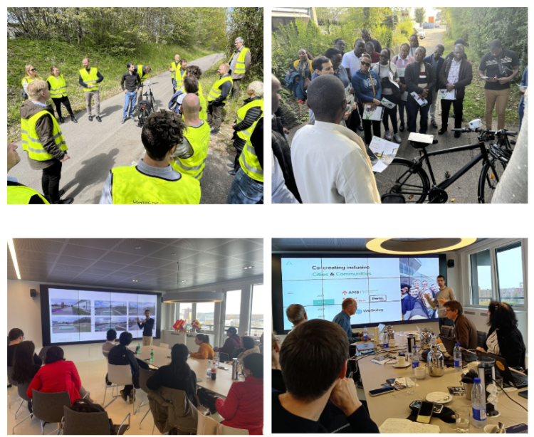
An important lesson was the value of working closely with cities. Workshops and expert surveys were crucial in refining Velovision’s methodology and aligning it with local needs. This ongoing collaboration has been a basis to ensure Velovision meets real challenges and supports meaningful improvements.