Ghent’s smart use of AI and drones for safer streets
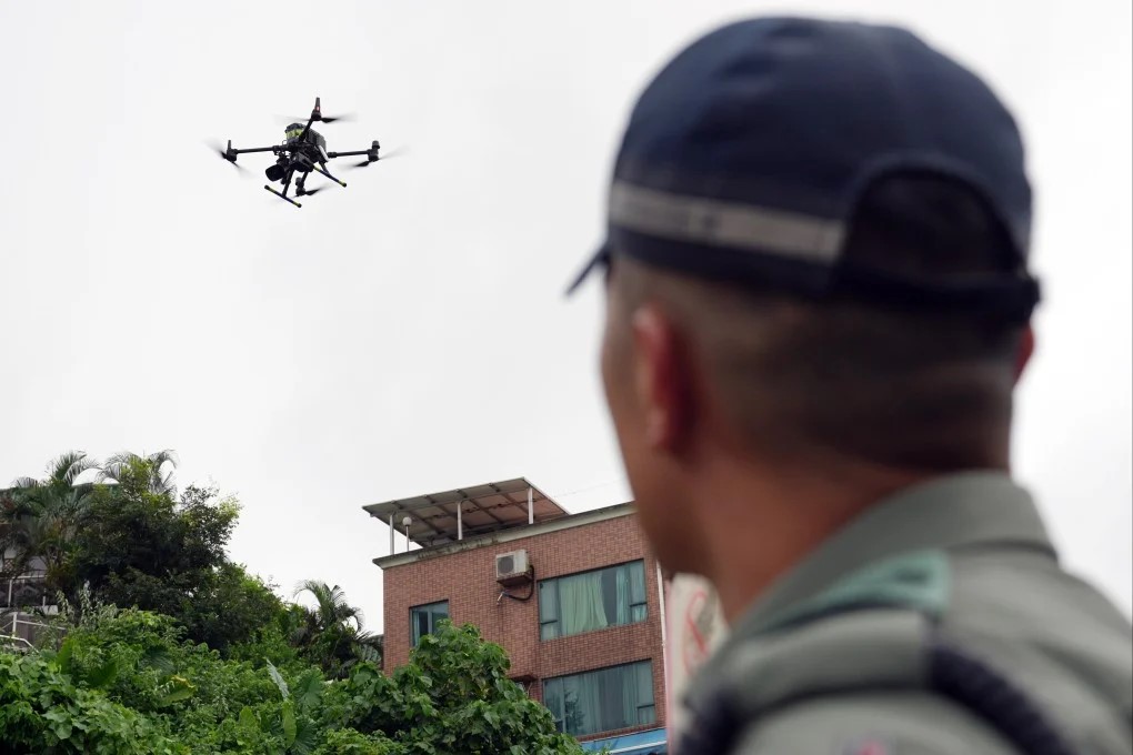
Leveraging Drone Tech
The Challenge
The city of Ghent, Belgium, is navigating a common yet complex urban challenge: improving road safety for all users - cyclists, pedestrians, and drivers - while ensuring accessibility and efficiency in the transport network. Ghent needed an innovative and cost-effective way to gather high-quality traffic data to support better infrastructure decisions.
Traditional methods of collecting and analysing traffic data are often expensive, labour-intensive, and time-consuming, requiring teams on-site and hours of video review. Yet such data is critical. Without it, decisions on where to place a pedestrian crossing or a bike lane remain guesswork. Ghent was looking for a GDPR-compliant, automated, and scalable solution that could unlock the power of data for safer urban mobility.
This challenge reflects a wider trend: cities globally are seeking smarter ways to analyse traffic patterns and make evidence-based decisions to prevent accidents and improve street design.
The Solution
To meet these challenges, Ghent partnered with Greenroads to deploy GreenFlow, a powerful AI video analytics tool designed to work with drone footage. Using a lightweight, off-the-shelf drone flown over one of Ghent’s busiest and most complex intersections, Greenroads collected aerial video data that was later processed using computer vision.
The platform translated the footage into visual analytics, including:
- Heatmaps of traffic flow by mode of transport.
- Origin-Destination (OD) matrices that illustrate movement trajectories.
- Conflict point analysis, detecting areas with high potential for near misses.
- GDPR-compliant processing from footage captured at high altitude.
These outputs were accessible via a user-friendly dashboard, providing planners and traffic engineers with the clarity needed to make informed decisions.
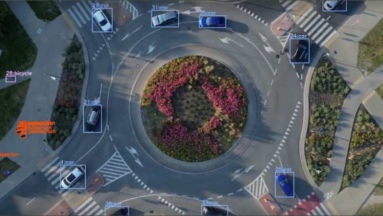
Information gathering at key junctions
Making an impact
The results were immediate and impactful:
- Data-rich visuals inspired planners: over 30 transport professionals from Ghent’s mobility department attended the demonstration, eager to incorporate the insights into ongoing design work.
- 27 conflict points identified in just one hour of footage - data that’s now informing signal timing and junction redesign.
- Significant time and cost savings: studying a junction with nearly 30 traffic paths and up to 2,500 cars and 800 cyclists per hour would have been unfeasible with manual methods.
- Tool adapted in real-time: Greenroads tailored and trained its model specifically for Ghent's footage - delivering beyond expectations.
- Interest in scaling: The city is considering extending the pilot and has already initiated internal knowledge transfer to continue exploring the tool’s use.
As Xan Albrecht, Traffic Researcher at the city of Ghent, noted:
“If you have a junction with 2,500 cars and 700 to 800 cyclists in one hour, then you just know that freeing up this intersection and lowering the traffic intensities will have a beneficial effect.”
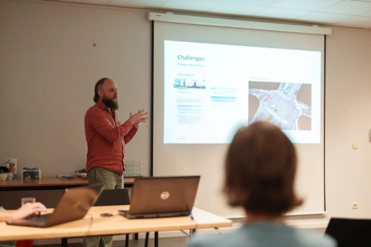
Xan Albrecht presenting at an event for the City of Ghent
Lessons learnt
- AI + drones - data power: computer vision applied to drone footage can rapidly provide deep insights, enabling smarter urban planning.
- Scalable, affordable, compliant: using standard drones and ensuring GDPR compliance makes this method accessible for other cities with limited budgets.
- Engagement matters: transparent communication and inclusive workshops with city staff generated enthusiasm and a sense of ownership over the results.
- Adaptability wins: Greenroads’ ability to tailor its tool in real-time maximised relevance and usability.
- Timing is everything: Piloting the tool just before a planned junction redesign allowed Ghent to maximise the pilot’s value.
Future-ready cities embrace the sky: As Blair Rogers, GIS Consultant, put it:
“Within a few years, drones will be another tool in the toolbox, as relevant as a telephone.”