Cunit: Piloting a smart inventory of its road infrastructure

The Challenge
Cunit is a coastal city 50 km southwest of Barcelona home to around 8,000 inhabitants. During the peak holiday season, however, the population can increase up to 50,000. Cunit has a network of over 1,200 kilometres of roads. Currently, the Municipality of Cunit is using an outdated geographic information system (GIS), a web map comprised of different data layers, developed by a third party. It is necessary to modernise the GIS so that it incorporates the inventory of road elements such as pedestrian crossings, traffic signs, traffic lights, etc. and is easily updatable. A solution was sought to meet the following objective: Optimization of data collection, analysis, and maintenance of road elements.
The Solution
ASIMOB uses lightweight, low-cost devices on-board of commercial fleet vehicles (i.e. municipal maintenance vehicles) that are programmed to automatically collect video and data from the streets with the established frequency (i.e. bi-weekly for the whole city, daily for road works areas) and send them to the cloud.
The solution builds on three key elements:
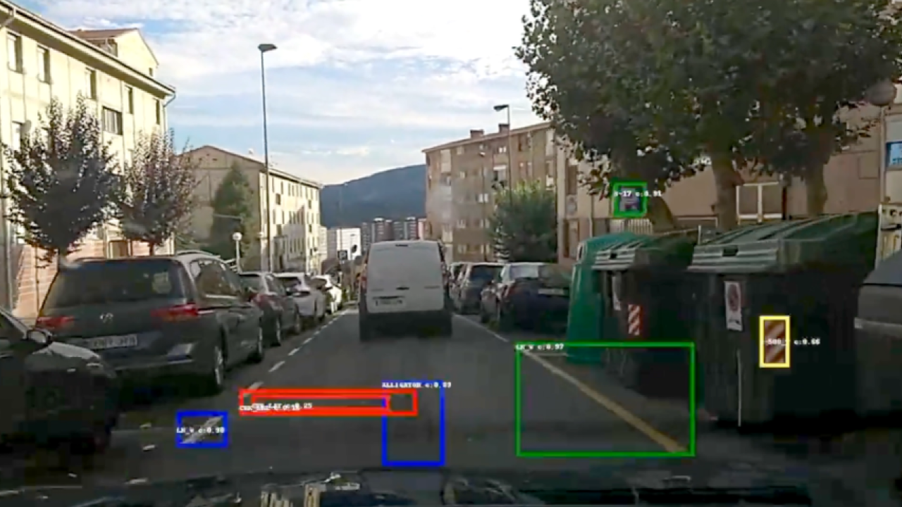
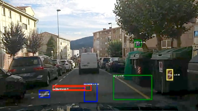
- On-board equipment, with sensors and cameras, are installed in vehicles that circulate normally on streets and highways, to collect data and video of the places to be monitored.
- Cloud services that automatically detect, classify and analyse traffic signs, road markings, pavement irregularities and protections, applying Artificial Vision and Data Analytics.
- Web application that displays information with high added value for end users. Our application can be connected through an API to Smart City platforms or traffic platforms and the information can be mixed with other sources of information.
Making an impact
Demo length: 3 months (01 March - 25 May 2022)
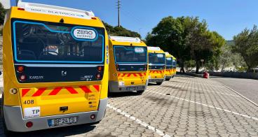
Vehicles involved: 4 police patrol vehicles
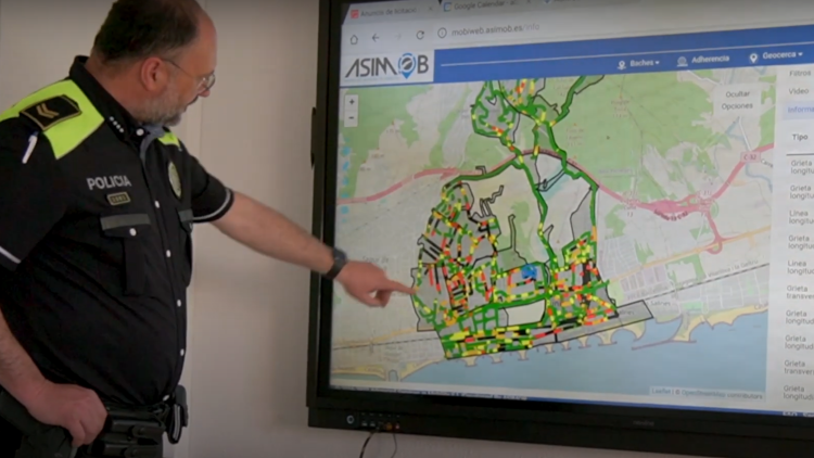
Monitored road length: 144 km
Detections made:
- 20.502 irregularities in the pavement (with different degradation levels)
- 3.636 signs in total: 2.835 of them were vertical signs and 801 horizontal (painted on the road)
Lessons learnt
This section will be added shortly.